
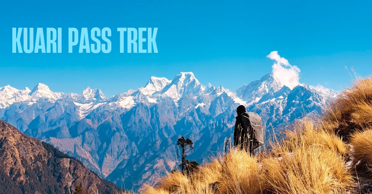
Some treks give you a glimpse of the Himalayas. Kuari Pass gives you the whole thing.
From the very first day, the mountains are with you. Dronagiri rising above the base village. Hathi-Gauri peaks appearing through the oak canopy. And then, on summit day, standing at Kuari Top – a 270-degree sweep of the greatest peaks in the Garhwal Himalayas laid out right in front of you. Nanda Devi. Chaukhamba. Kamet. Dronagiri. Trishul. Nilgiri. Changabang. Nearly 22 peaks visible at once.
There is no other trek in Uttarakhand that offers mountain views on this scale, this close, this consistently throughout the journey.
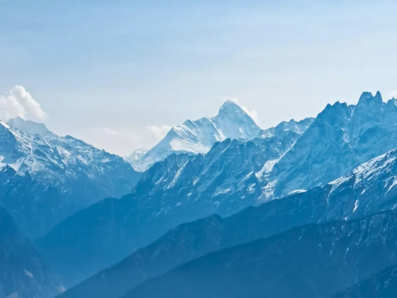
But Kuari Pass is not just about the view from the top. The walk there is just as beautiful. Ancient oak and rhododendron forests. Wide alpine meadows that change completely with the seasons. A historic ridge trail that Lord Curzon once walked – which is why this route is still called the Curzon Trail. A magical forest campsite at Tali. And Gorson Bugyal – a high alpine meadow where Nanda Devi appears so close it makes people stop walking.
Kuari Pass sits at 12,516 ft. The total trek distance is 22 km over 6 days. It is a moderate trek – one of the finest introductions to Himalayan trekking for beginners who are reasonably fit.
Two main itinerary routes are commonly taken to Kuari Pass. The Karchi route starts from Dhak/Karchi village and is the classic trail. The Tugasi-Pipalkoti route approaches from a different direction via Tugasi village and offers a slightly different experience of the same landscape. Both end at Auli and are covered in detail below.
What Makes Kuari Pass Special
1. The Greatest Mountain Views in Uttarakhand
This is not an exaggeration.
Kuari Pass offers a 270-degree panorama of the Garhwal Himalayas from a single vantage point. You see Chaukhamba, Neelkanth, Dronagiri, Kamet, Nilgiri, Hathi-Gauri peaks, Trishul, Nanda Devi, Changabang, Mana-Mandir peaks, Pangarchulla – nearly 22 peaks in one view.
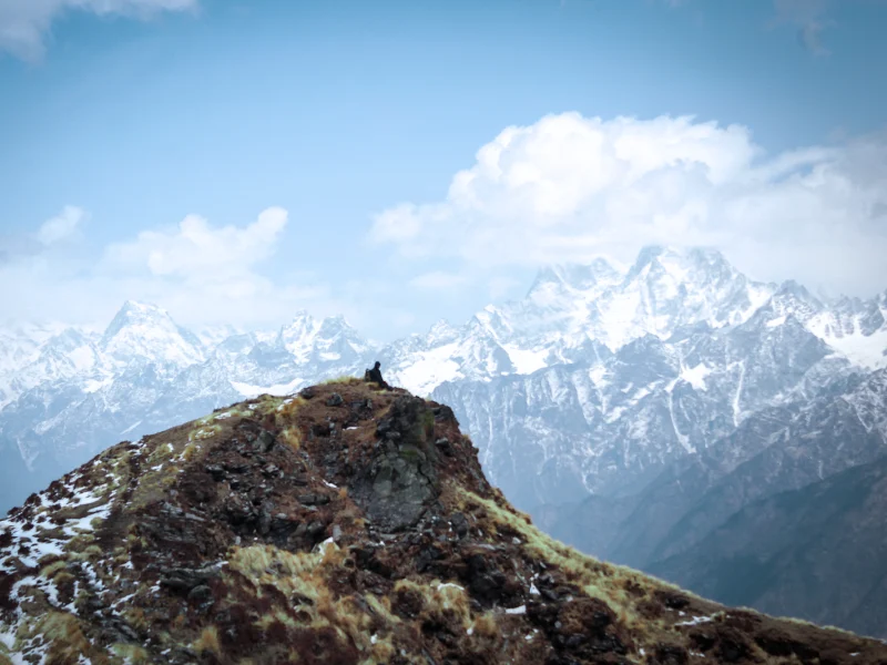
And what makes it truly rare is Nanda Devi. At 25,643 ft, Nanda Devi is Uttarakhand’s highest peak and one of the most beautiful mountains in the world. Most treks give you a distant view of it. From Gorson Bugyal on Day 5, Nanda Devi stands right in front of you – its entire face visible, towering over the meadow.
Trekkers have been known to stand in silence for long minutes when they first see it. Some with tears in their eyes.
2. The Historic Curzon Trail
This trek carries a piece of history with it.
In the early 1900s, Lord Curzon – then Viceroy of India – explored this very route through the Garhwal Himalayas. His journey made the trail famous and it has carried the name “Lord Curzon Trail” ever since. Walking this path means walking a route that has been celebrated by explorers for over a century.
That history adds a special layer of meaning to every step.
3. Ancient Oak and Rhododendron Forests
The forests on this trek are some of the oldest and most beautiful in the region.
From Karchi to Akhrotghetta, you walk through a mix of pine, oak, and maple. By Day 3, the oaks have turned golden and the trail through them is extraordinary. In winter, these forests fill with snow and become an entirely different world – silent, white, magical.
On Day 4, the trail from Chitrakantha down to Tali dives into a dense forest of golden oaks, pines, and dwarf rhododendrons. Sunlight cuts through the canopy at angles that make it look like the forest is lit from inside. This section alone is worth the entire trek.
4. Gorson Bugyal and Tali – Two Unmissable Places
Gorson Bugyal is a wide alpine meadow where mountain views open up in every direction. In winter, it is a blanket of white. In autumn, it is deep green with hints of gold. Walking the full length of Gorson Bugyal with Nanda Devi ahead of you is one of the finest walks on any Himalayan trek.
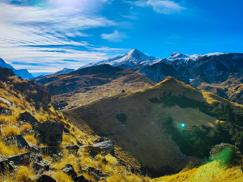
Tali is the campsite in the middle of the forest. A calm, cool, golden-oak forest with a stream running nearby. After the long summit day, arriving at Tali feels like stepping into a sanctuary. It is one of the most beautiful campsites in Uttarakhand.
5. The Summit Day Ridge Walk
The climb on Day 4 is the heart of this trek.
You ascend steeply from the treeline to a ridge that is part of the original Curzon Trail. From this ridge, 360-degree views of the Himalayas open up instantly. Then a gradual climb to Kuari Top. Then the actual ridge walk – long, windy, breathtaking – past Jhandi Top and down to Chitrakantha meadows.
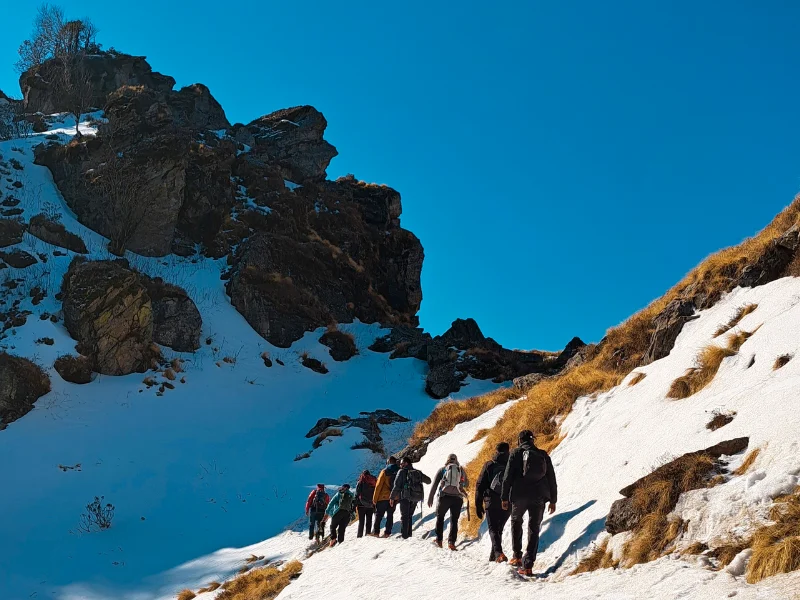
This is not just a summit. It is a full day of walking on top of the Himalayas.
Two Routes to Kuari Pass
There are two main approaches to Kuari Pass. Both are beautiful. Both end at Auli. The Karchi route is the classic trail and is more commonly done. The Tugasi-Pipalkoti route approaches from Tugasi village and adds the experience of Garhwal villages and a slightly longer approach.
Route 1: The Karchi Route (Classic Trail)
Quick Itinerary
| Day | Route | Distance | Duration | Altitude |
|---|---|---|---|---|
| Day 1 | Drive Rishikesh to Dhak/Karchi | 255 km | 9-10 hrs | 7,785 ft |
| Day 2 | Trek Karchi to Akhrotghetta | 2.75 km | 3 hrs | 7,785 ft to 9,264 ft |
| Day 3 | Trek Akhrotghetta to Khullara | 2.5 km | 4 hrs | 9,264 ft to 11,014 ft |
| Day 4 | Trek Khullara to Tali via Kuari Pass | 7.65 km | 8-9 hrs | 11,014 ft to 10,990 ft via 12,516 ft |
| Day 5 | Trek Tali to Auli + Drive to Karchi | 8.1 km + 21 km | 7-8 hrs + 1 hr | 10,990 ft to 9,390 ft |
| Day 6 | Drive Karchi to Rishikesh | 255 km | 9-10 hrs | – |
Day by Day Guide – Karchi Route
Day 1: Drive from Rishikesh to Dhak/Karchi
Distance: 255 km
Duration: 9-10 hours
Altitude: 7,785 ft
The drive from Rishikesh to Karchi is one of the most scenic approaches to any Himalayan trek in Uttarakhand.
The road follows the tributaries of the Ganga all the way up. You pass through all five of the famous Panch Prayag – the five sacred confluences along the Alaknanda river.
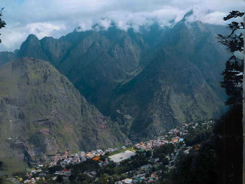
You pass through all five of the famous Panch Prayag – the five sacred confluences along the Alaknanda river. Devprayag, where the Bhagirathi and Alaknanda merge to form the Ganga. Rudraprayag, where the Mandakini joins. Karnaprayag, where the Pindar meets the Alaknanda. Nandaprayag, with the Nandakini. Vishnuprayag, deep in the mountains. Every one of these is worth seeing.
After Pipalkoti, the landscape shifts. The mountains close in. The valley narrows. The air changes. You are entering the Greater Himalayan range now.
Watch the left side of the road as you approach Karchi. Mt. Dronagiri will appear above the village – a massive peak with glaciers running down its flanks. This mountain will be your constant companion for the entire trek.
Karchi is a small village with a few interesting things to explore if you arrive with time. There are hot springs nearby. The nearby Lata-Reini village is where the famous Chipko movement began in India – one of the earliest environmental conservation movements in the world.
Rest well. Day 2 is a steep climbing day.
Day 2: Trek from Karchi to Akhrotghetta
Distance: 2.75 km
Duration: 3 hours
Altitude Gain: 7,785 ft to 9,264 ft
Difficulty: Easy to Moderate
A short but meaningful day. The trek starts directly from Karchi village. You can either walk through the village or take the trail above it.
Cross the water bridge early on – fill your water bottles here. It is the last reliable water source for a stretch.
The trail climbs steeply for the first 20 minutes until it reaches a clearing. Stop here and turn left. Behind you is Karchi village. Above and beyond it, Dronagiri rises in a wall of glaciers and rock. The mythological story attached to this mountain is one of the most famous in Hindu tradition – it is said that Hanuman Ji carried a piece of this very mountain on his quest for the Sanjeevni herb for Lakshmana.
After the clearing, the trail enters the forest. Pine, oak, and maple trees crowd the path on both sides. The trail winds in switchbacks through the forest, gradually and then more steeply.
After a long forest climb, a lone walnut tree marks your arrival at the campsite. This is Akhrotghetta – named after the walnut tree that stands at its edge. It is a clearing with a stream flowing nearby. The Hathi-Gauri peaks and Dronagiri are clearly visible from here.
Watch the sunset from this campsite. And wake up early to catch the first rays of sunlight hitting the peaks – the alpenglow here is extraordinary.
Day 3: Trek from Akhrotghetta to Khullara
Distance: 2.5 km
Duration: 4 hours
Altitude Gain: 9,264 ft to 11,014 ft
Difficulty: Easy to Moderate
Another shorter day. But the forest walk today is one of the finest on the entire trek.
The trail is surrounded by oak trees for most of the day. By this altitude, the oaks have turned golden. The trail passes through section after section of these glowing trees with mountains peeking through every gap in the canopy.
About 40 minutes from camp, you reach the first clearing. Then back into the forest. The mountains play peek-a-boo – visible for a moment through the trees, then hidden again. It is an enchanting section.
Important in winter: The streams here freeze overnight. Verglas – hard ice formed from frozen snow – can make stream crossings extremely slippery. Walk carefully on any hard, shiny surface.
As you climb, the treeline begins to thin. Dwarf rhododendrons appear. The section ahead is a lovely walk to Khullara.
Along with Dronagiri and Hathi-Gauri peaks, new mountains start appearing. Kamet and Neelkanth come into view on clear days. The mountain range keeps getting bigger the higher you go.
Khullara campsite is a clearing at 11,014 ft. Open sky. Big views. Tonight’s sunset from here has an alpenglow that will stay in your memory.
Day 4: Trek from Khullara to Tali via Kuari Pass
Distance: 7.65 km
Duration: 8-9 hours
Altitude: 11,014 ft to 12,516 ft and back to 10,990 ft
Difficulty: Moderate
The biggest day of the trek. Start early.
From Khullara, the trail climbs steeply out of the treeline. In 1 to 1.5 hours, you reach the main ridge. This is Lord Curzon’s historic trail. The moment you step onto this ridge, 360 degrees of the Himalayas opens up around you.
On one side – Chaukhamba, Neelkanth, Dronagiri, Nilgiri, and the Hathi-Gauri peaks. Straight ahead – Trishul and parts of Nanda Devi. You are on a ridge between two worlds of mountain views.
Continue along the ridge to reach the upper grasslands of Kuari Pass. At a ridge marked by a small shrine, Pangarchulla peak suddenly appears in front of you. This is one of the most adventurous summit climbs in the Garhwal region and it stands right ahead of you.
From this point, a 40-minute moderate climb takes you to Kuari Top at 12,516 ft. The actual Kuari Pass is slightly lower at a depression about 30 minutes further, but most trekkers stop at Kuari Top – the views here are grander and more panoramic.
Stand here and turn slowly. Almost 22 peaks are visible in a 270-degree sweep. Nanda Devi. Chaukhamba. Kamet. Mana-Mandir peaks. Dronagiri. Nilgiri. Changabang. Pangarchulla. Take your time. You have earned every bit of this.
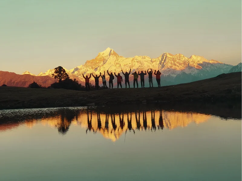
After the summit, retrace back to the ridge. Instead of turning back towards Khullara, continue forward along the ridge. An hour’s walk brings you to Jhandi Top at the highest point of the ridge.
Note: The ridge can be cold and windy. Keep your outer jacket and gloves accessible.
From Jhandi Top, descend towards Chitrakantha meadows through a forest trail – 1 to 1.5 hours of walking. Then the trail from Chitrakantha dives into the forest section towards Tali.
This is the section people remember for years. Dense golden oaks, tall pines, dwarf rhododendrons. The forest is thick and the silence inside it is complete. Sunlight cuts through the canopy at angles that make the whole forest glow. It is one of the most beautiful forest walks in Uttarakhand.
Tali campsite is about 40 minutes through this forest. It sits right in the middle of the trees. A stream runs nearby. After a 9-hour day, arriving here feels like stepping into a painting.
Day 5: Trek from Tali to Auli. Drive to Karchi.
Distance: 8.1 km trek + 21 km drive
Duration: 7-8 hours + 1 hour
Altitude Loss: 10,990 ft to 9,390 ft
Difficulty: Moderate
The final trekking day. And it is a beautiful one.
Start with a 30 to 40-minute climb to Tali Lake. The lake sits above the treeline at around 11,500 ft. In winter, it freezes completely. Its surface reflects the surrounding peaks – Nanda Devi and Dronagiri visible in the mirror of the ice.
From Tali Lake, a steep 20-minute climb brings you to an overhanging ledge trail that cuts through a cliff face. Below you are the Lower and Upper Tugasi villages in the valley. Above you, Himalayan Griffons often circle on the thermals – watch for these enormous birds soaring overhead.
After about 40 minutes on the overhanging trail, it ends abruptly and you make a U-turn into Gorson Bugyal.
Gorson Bugyal opens up in front of you. Wide, open, beautiful. Mountain views in every direction. Nanda Devi is at her most dramatic here – a towering wall of ice and rock rising directly above the meadow. Take your time on this bugyal. Walk it slowly. This is what the whole trek has been leading to.
Note: Gorson Bugyal sees more tourist traffic near Auli. Carry your waste out. Contribute to keeping this place clean.
From the bugyal, the trail descends through the Padiyar forest section – oak trees, a gentle gradient, a final taste of the Himalayan forest. You reach Padiyar temple about 15 minutes into the forest. From there, the trail continues descending to Upper Auli and finally to Auli itself.
Auli sits at about 9,500 ft and is one of India’s most famous ski destinations. The slopes here are stunning – wide, open, with big mountain views. If you have time, Auli is worth a short walk around before the drive.
From Auli, drive 21 km back to Karchi. Overnight at Karchi.
Day 6: Drive from Karchi to Rishikesh
Distance: 255 km
Duration: 9-10 hours
Start before 6 am. The drive is long. The Panch Prayag confluences are visible again on the way back. The same mountains that appeared in the distance when you drove up are now familiar landmarks.
You reach Rishikesh by early evening.
Route 2: The Tugasi-Pipalkoti Route
This route starts from Tugasi village, reached after a drive to Pipalkoti and then a further 50 km to Tugasi. It approaches Kuari Pass from a different direction and adds the experience of trekking through remote Garhwal villages and agricultural terraces.
The summit day on this route goes up from Tali Forest camp to Kuari Pass and back – a longer out-and-back day. The descent happens the next day through Gorson Bugyal to Auli.
Quick Itinerary
| Day | Route | Distance | Duration | Altitude |
|---|---|---|---|---|
| Day 1 | Drive Rishikesh to Pipalkoti | 220 km | 9-10 hrs | 4,400 ft |
| Day 2 | Drive Pipalkoti to Tugasi + Trek to Gulling Top | 3 km | 2-3 hrs | 8,000 ft to 9,400 ft |
| Day 3 | Trek Gulling Top to Tali Forest Camp | 5 km | 4-5 hrs | 9,400 ft to 11,100 ft |
| Day 4 | Trek Tali to Kuari Pass + Back to Tali via Khullara Top | 10-11 km | 8-9 hrs | 11,100 ft to 12,750 ft and back |
| Day 5 | Trek Tali to Auli via Gorson Bugyal + Drive to Pipalkoti | 9 km + 45 km | 6-7 hrs + 1.5 hrs | 11,500 ft to 9,500 ft |
| Day 6 | Drive Pipalkoti to Rishikesh | 220 km | 9 hrs | – |
Day by Day Guide – Tugasi-Pipalkoti Route
Day 1: Drive from Rishikesh to Pipalkoti
Distance: 220 km
Duration: 9-10 hours
Altitude: 4,400 ft
The drive follows the Badrinath Road from Rishikesh. The Alaknanda river runs alongside the road for most of the journey – starting as a calm, wide flow near Rishikesh and becoming wilder and more powerful as you climb into the mountains.
Watch for the four Prayags on this drive. Devprayag is where the Bhagirathi and Alaknanda merge to form the Ganga – a sacred and beautiful confluence. Rudraprayag, Karnaprayag, and Nandaprayag follow as you go higher. Each one sits at a dramatic bend in the river.
You reach Pipalkoti by evening. This small town at 4,400 ft is your base for the night. The mountains are already visible from here.
Day 2: Drive from Pipalkoti to Tugasi. Trek to Gulling Top.
Drive: 50 km, 2-3 hours
Trek Distance: 3 km
Duration: 2-3 hours
Altitude: 8,000 ft to 9,400 ft
Difficulty: Moderate
The drive from Pipalkoti to Tugasi is winding and scenic. The Dhauli-Ganga river glints in the valley below. The road climbs steadily through the Garhwal landscape.
Tugasi village at 8,000 ft is where the trek begins. The trail starts through terraced farmland – the step-farming typical of these mountain communities. The fields are carefully carved into the hillside. The views across the valley are already impressive.
As you climb beyond the farms, the trail opens to views of Dronagiri. This mountain has an almost haunting quality – it appears and disappears with the cloud cover, revealing itself fully only on clear moments.
The terrain opens into a meadow as you approach Gulling Top at 9,400 ft. The campsite here looks out at Dronagiri, Hathi Parvat, Gauri Parbat, and Brahmal Peak. As the sun drops behind the mountains, the alpenglow on these peaks is extraordinary.
Day 3: Trek from Gulling Top to Tali Forest Camp
Distance: 5 km
Duration: 4-5 hours
Altitude Gain: 9,400 ft to 11,100 ft
Difficulty: Easy to Moderate
A more relaxed day after yesterday’s initial push. The trail climbs gently through dense forest – oak, rhododendron, and walnut trees.
About 20 minutes into the walk, a beautiful green clearing opens up. Stop here. On a clear morning, Nanda Devi, Kalanka, Changabang, Hathi Parvat, and Gauri Parbat are all visible in a single view. This is one of the finest mountain panoramas on this entire route.
In late March and April, the rhododendrons are in full bloom along this section – pink and white flowers against the deep green forest. In winter, the same forest is draped in snow with light filtering through the conifers at magical angles.
The trail crosses a stream that marks the entrance to the thicker forest section. Dronagiri continues to appear at different angles as you gain altitude – a mountain that seems to change shape as you move around it.
Tali Forest Camp at 11,100 ft is tucked inside the ancient woodland. Tall trees surround the campsite on every side. It is a quiet, deeply peaceful place. Sleep well – summit day is tomorrow.
Day 4: Summit Day – Tali Forest Camp to Kuari Pass via Khullara Top and Back
Distance: 10-11 km
Duration: 8-9 hours
Altitude: 11,100 ft to 12,750 ft and back
Difficulty: Moderate to Difficult
Start early. This is the longest and most demanding day.
The trail from Tali climbs for 2 km to reach Jhandi Top – a well-earned rest point with panoramic views and stunning surroundings. Many trekkers who are tired or unwell turn back from here. It is a perfectly good decision if needed.
From Jhandi Top, another 1 km of moderate ascent takes you to Khullara Top. The landscape here is wide open – snow-clad peaks appearing in every direction. Rest here, take in the view, and have some food.
The next section is a challenging 1.5 km traverse to a frozen stream near a broken bridge at about 12,300 ft. This section is technically demanding when covered in snow – walk slowly and carefully. After the stream, the final 1 km push to Kuari Pass itself begins. This is the hardest stretch.
Important: Carry microspikes or crampons for this day if there is snow. The frozen stream section and the final push to the pass require proper traction.
Kuari Pass at 12,750 ft is the highest point of this route. The panorama here is complete. Kedarnath Peak, Chaukhamba, Neelkanth, Nanda Devi – the entire Garhwal Himalayan range stretches from horizon to horizon.
After the pass, retrace back to Tali for the night.
Day 5: Trek from Tali to Auli via Gorson Bugyal. Drive to Pipalkoti.
Trek: 9 km
Duration: 6-7 hours
Drive: 45 km
Duration: 1.5 hours
Altitude: 11,500 ft to 9,500 ft
Difficulty: Moderate
Start with the climb to Tali Lake – a high alpine lake at 11,500 ft, often frozen in winter. Its surface perfectly reflects the surrounding peaks. Nanda Devi and Dronagiri are both visible here on clear mornings.
A steep 20-minute climb from the lake brings you to the overhanging ledge trail. Below you, the Tugasi villages are visible in the valley. Above, Himalayan Griffons circle on the thermals. After the ledge section, a U-turn takes you into Gorson Bugyal.
Walk the full length of Gorson Bugyal slowly. This is where Nanda Devi appears most dramatically – towering directly above the open meadow. It is the finest view of Nanda Devi you will see on this trek.
From the bugyal, descend through the Padiyar forest to Upper Auli and then Auli. The descent through the oak forest is pleasant and gradual. A gentle end to a big trek.
From Auli, a 45-minute drive takes you back to Pipalkoti.
Day 6: Drive from Pipalkoti to Rishikesh
Distance: 220 km
Duration: 9 hours
Start early. The same beautiful road takes you back along the Alaknanda river. You reach Rishikesh by evening.
How Difficult Is the Kuari Pass Trek?
This is a moderate trek. Suitable for beginners who are fit and well-prepared.
Total trek distance is 22 km on the Karchi route and about 27 km on the Tugasi route. Both cover 6 days including drives.
The most challenging section on the Karchi route is Day 4 – a 9-hour day that includes the steep climb to the ridge, the walk to Kuari Top, a long ridge traverse, and a descent through forest to Tali.
On the Tugasi route, the summit day is an out-and-back to Kuari Pass – longer and more demanding, especially on the frozen section near the pass.
A few specific challenges to be aware of:
- A steep 3,000 ft ascent on Day 2 of the Karchi route
- The narrow overhanging ledge trail near Gorson Bugyal – requires steady footing and no fear of exposure
- Navigation can be difficult in fog or heavy cloud cover – always trek with a local guide
Is the Kuari Pass Trek Safe?
Yes – with the right preparation.
Terrain Safety
The trails on both routes are well-defined for most sections. The overhanging ledge trail on Day 5 (Karchi) or Day 5 (Tugasi) is the most technically demanding section – it cuts along a cliff face. Walk carefully and stay on the mountain side.
In winter, verglas (hard ice on frozen streams) is a genuine hazard. Never step on shiny ice without testing it first. Carry microspikes for any winter trek to Kuari Pass.
The summit day on the Tugasi route requires crampons or microspikes for the frozen stream section near the pass. Do not attempt this section without proper traction.
A local guide is strongly recommended on both routes. The Tugasi route in particular has sections where the trail is less obvious.
Altitude Safety
Kuari Pass at 12,516 to 12,750 ft is high enough for Acute Mountain Sickness (AMS) to be a real concern.
AMS does not care about fitness or experience. Anyone climbing too high too fast can be affected.
Watch for these symptoms:
- Persistent headache
- Nausea
- Dizziness
- Loss of appetite
- Weakness
- Disturbed sleep
If any of these appear, descend immediately. Do not wait to see if they improve at altitude.
Stay hydrated throughout the trek. Drink at least 3 litres of water on all trekking days. Take half a tablet of Diamox (125 mg) every 12 hours from Rishikesh as prevention.
Weather Safety
Weather above 10,000 ft changes fast. Gorson Bugyal and the ridge near Kuari Pass are fully exposed to wind. The ridge walk on Day 4 (Karchi route) can be cold and windy even in autumn. Carry your wind layer where you can reach it quickly.
Snowfall can make the sections above the treeline difficult to navigate. If visibility drops or snowfall is heavy, turn back. The ridge section is not safe in zero visibility.
On the Tugasi route, the Gorson Bugyal approach can become inaccessible in very bad weather – the descent via Auli would then need to be rerouted back through Tugasi.
Emergency Exits
On the Karchi route, the safest exit from anywhere before the summit is to descend back to Karchi via Akhrotghetta.
If you are at Tali or beyond, descend towards Auli and then drive to the nearest town.
On the Tugasi route, exit towards Tugasi village and drive to Pipalkoti from there.
The nearest hospital with reasonable facilities is at Joshimath, about 1 to 1.5 hours from Karchi/Auli. For serious emergencies, Dehradun or Rishikesh are the destinations – 9 to 10 hours away.
Best Time to Do the Kuari Pass Trek
Autumn (October to November)
The most popular and highly recommended time. Skies are clear and crisp after the monsoon. Mountain views are at their sharpest. Nanda Devi looks stunning against blue skies. The meadows are still green or turning golden. Temperatures are cool but manageable. The trails are dry and well-defined.
Winter (December to February)
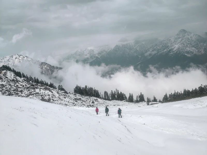
A completely different and extraordinary experience. Snow covers the forests and meadows. Tali Lake freezes. The forests look magical with snow on every branch. The ridge near Kuari Pass is dramatic in winter snow. Nights are very cold. You need proper winter gear including microspikes and thermals. Strongly recommended for experienced trekkers who are well-equipped.
Spring (March to April)
Rhododendrons bloom in reds and pinks along the entire trail. Snow melts slowly from the upper sections. The forest comes alive with colour and birdsong. Tali Lake may still be partially frozen. A beautiful season for trekkers who want colour and life on the trail.
Summer (May to June)
The meadows are green and the weather is warm. Views are good on clear days, though afternoon clouds are common. The forest sections are bright and full. A good option for those who want pleasant temperatures and do not mind some cloud cover.
Temperature Guide
| Season | Karchi / Pipalkoti | Akhrotghetta / Gulling Top | Khullara / Tali | Kuari Pass | Night Temp |
|---|---|---|---|---|---|
| Oct-Nov | 12-20°C | 6-14°C | 2-8°C | -2 to 4°C | -5 to 2°C |
| Dec-Feb | 2-8°C | -5 to 2°C | -10 to -3°C | -15 to -8°C | -15 to -10°C |
| March-April | 12-20°C | 5-12°C | 0-7°C | -4 to 2°C | -5 to 2°C |
| May-June | 18-26°C | 12-18°C | 6-12°C | 2-7°C | 2-6°C |
Temperature drops sharply above the treeline. The ridge near Kuari Pass is always colder than campsite temperatures suggest. Layer up before you reach the exposed sections.
How to Reach the Base Camp
For the Karchi Route: Dhak/Karchi is 255 km from Rishikesh, about 9 to 10 hours by road.
For the Tugasi Route: Pipalkoti is 220 km from Rishikesh, about 9 hours by road. Tugasi is a further 50 km from Pipalkoti.
By Air
Fly to Dehradun (Jolly Grant Airport), 28 km from Dehradun city. From Dehradun, take a vehicle to Rishikesh and then onwards to the base camp.
By Train
Take the Kota Express (Train No. 12401) from Hazrat Nizamuddin, Delhi to Haridwar. From Haridwar, take a bus or shared taxi to Rishikesh (30 km). Then hire a vehicle to the base camp.
Tip: Arrive in Rishikesh the evening before Day 1. The 9 to 10 hour drive to the base camp means an early morning departure is essential.
Things to Know About Auli
The trek ends at Auli – one of India’s most famous skiing destinations.
Auli sits at about 9,500 ft in the Chamoli district. It looks out at Nanda Devi, Kamet, and Mana Parbat. The ski slopes here are among the finest in India. In winter, the entire hillside is covered in snow.
If you arrive with some time before your drive back, Auli is worth a short walk around. The views are magnificent even from the cable car station. The ropeway from Auli to Joshimath is one of the longest in Asia – the ride itself offers panoramic mountain views.
Frequently Asked Questions
How long is the Kuari Pass trek?
The Karchi route covers 22 km of trekking over 4 days. The Tugasi route covers about 27 km over 4 trekking days. Both include drives on Day 1 and Day 6.
Which route is better – Karchi or Tugasi?
The Karchi route is the more classic and popular approach. It is better suited for first-time trekkers. The Tugasi route adds the experience of village walks and terraced farmland and offers a slightly longer summit day. Both are beautiful.
Is this suitable for beginners?
Yes, with reasonable fitness. The moderate grade means a fit beginner can do this trek. The steepest challenge is the Day 2 ascent on the Karchi route and the frozen section near the pass on the Tugasi route. Train specifically for sustained uphill effort.
Do you need a permit?
The trek passes through the Nanda Devi Biosphere Reserve, a UNESCO World Heritage Site. Entry fees and registration may be required at the forest checkpost near the starting villages. Carry a government-issued photo ID.
Is Nanda Devi actually visible?
Yes – and clearly. Especially from Gorson Bugyal on Day 5. This is one of the few treks in Uttarakhand that offers a close, unobstructed view of Nanda Devi. On clear days, it is a view that stays with you for a long time.
What is the Curzon Trail?
The Curzon Trail refers to the historic route that Lord Curzon, Viceroy of India, explored in the early 1900s. The ridge section near Kuari Pass is part of this original route. Walking it adds a layer of history to the trekking experience.
Can you extend the trek with Pangarchulla?
Pangarchulla Peak at around 15,000 ft is visible from the Kuari Pass ridge and is a popular summit climb done in spring (March to April). It is a separate, more difficult trek that shares the approach with Kuari Pass. Experienced trekkers sometimes combine the two.
Kuari Pass is the kind of trek that redefines what you think is possible from a Himalayan trail.
The forests are older than you expect. The meadows are wider than you imagined. And the mountains – Nanda Devi, Chaukhamba, Kamet, all of them – are closer than you believed possible.
Train well. Come prepared. And let the Himalayas do the rest.