
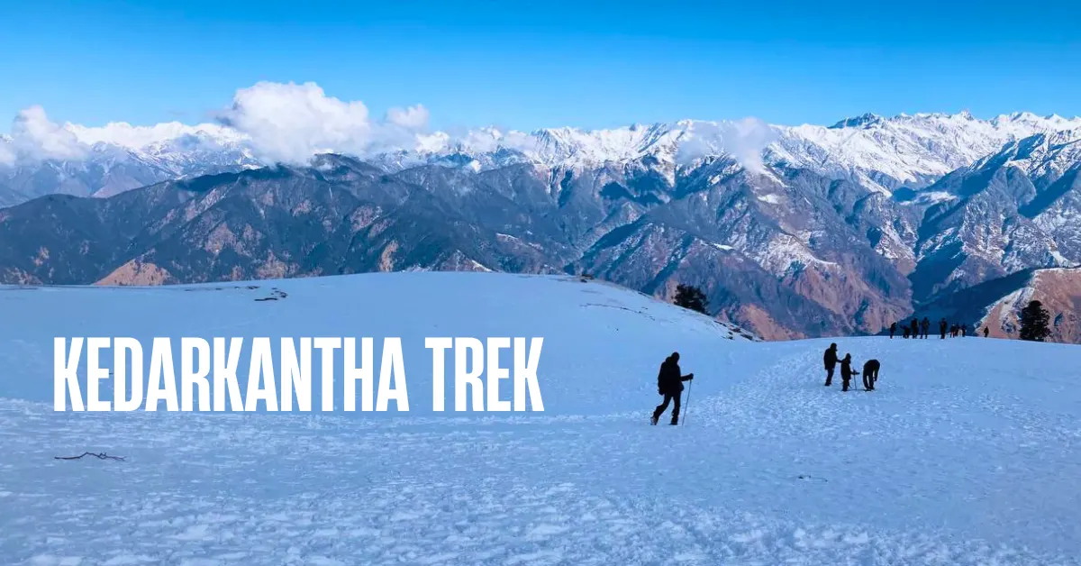
Most Himalayan summits shut down in winter. Snow piles up. Trails disappear. The mountains become inaccessible.
Kedarkantha does the opposite.
In winter, when the rest of the Himalayas closes its doors, Kedarkantha opens up in all its glory. Snow-covered trails. Frozen alpine lakes. Ice-draped forests. A 360-degree summit view with every major peak wearing a thick coat of white.
This is why trekkers from across India call it the queen of winter treks.
But Kedarkantha is not just a winter story. In spring, rhododendrons explode in colour along the trail. In summer, the clearings turn lush green and wildflowers appear everywhere. In autumn, the forests go golden and the skies become impossibly clear. Every season brings a completely different version of this trek. And every version is beautiful.
Kedarkantha sits at 12,500 ft in the Govind Wildlife Sanctuary of Uttarkashi district, Uttarakhand. The summit gives you a 360-degree panorama of the Garhwal Himalayas – Swargarohini, Bandarpoonch, Kalanag, Gangotri range, Jaonli, Draupadi Ka Danda, and the Har Ki Dun and Rupin valleys far below.
The total trek distance is about 20 km over 4 to 5 trekking days. It is an easy to moderate trek – one of the best summit climbs for beginners in the country.
There are three main routes to Kedarkantha summit. The Sankri route is the most popular and the most well-known. The Kotgaon route is a quieter and equally beautiful alternative. And the Gaichawan route is a newer, less-travelled path through apple orchards and untouched forest that is fast gaining attention. All three lead to the same summit. Each one gets there differently.
We cover all three in detail below.
What Makes Kedarkantha Special
1. A Full Summit Climb – Beginner Friendly
The Kedarkantha summit at 12,500 ft is a proper Himalayan peak. The final push to the top is steep and challenging. You earn the summit.
But the trail getting there is forgiving enough for a first-time trekker who is fit and well-prepared. The gradients are manageable. The campsites are well-placed. The itinerary is designed to give your body time to adjust.
You get the full summit experience – the climb, the effort, the views from the top – without the extreme difficulty of a more advanced trek. That is rare. That is what makes Kedarkantha special.
2. Winter Trekking at Its Best
From December to February, Kedarkantha transforms completely.
The trails fill with fresh snow. The oak and cedar forests are draped in white. Juda Ka Talab – the alpine lake you camp beside on Day 2 – freezes over. Walking on a snow-covered trail through a silent, frosted forest is one of the most extraordinary experiences you can have in the Indian Himalayas.
And the summit views in winter are unmatched. Every peak on the horizon carries a thick cap of snow. The sky is sharp and clear. The morning light on the snow is golden.
This is the version of Kedarkantha that has made it India’s most popular winter trek.
3. Juda Ka Talab – The Frozen Alpine Lake
On Day 2 of the main route, you arrive at Juda Ka Talab. It sits at 9,100 ft, surrounded by dense forests of cedar, maple, oak, and pine.
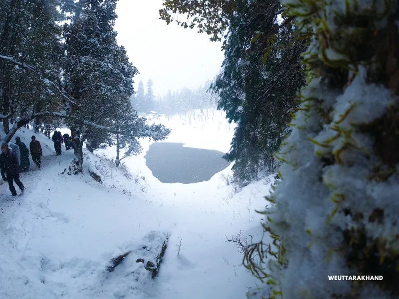
In winter, the lake freezes completely. A sheet of ice forms on the surface. The forest around it is snow-covered. The whole scene feels like it belongs in a different world.
The lake also carries a beautiful piece of local legend. It is said that Lord Shiva once removed a lock of his hair and cast it into this area – and the pond was born from it. That is why the lake is called Juda Ka Talab – the lake of Shiva’s hair.
Even beyond the mythology, this is simply one of the most beautiful campsites on any Himalayan trek.
4. Beautiful Forests, Clearings, and Campsites
The Kedarkantha trail is full of variety. Dense forests of pine, oak, cedar, and maple. Wide open clearings that appear suddenly in the middle of the trees. High-altitude meadows. Rocky ridges.
The sunsets from the higher campsites – especially from Bhoja Dhadi on the Kotgaon route and Pukhrola on the Gaichawan route – are extraordinary. The alpenglow on the snow-capped peaks as the sun sets is one of those things you do not forget easily.
5. The Village of Sankri
Sankri is not just the base camp for this trek. It is a place worth spending time in.
It sits in the Uttarkashi district, at the confluence of mountain trails. This small village is the jumping-off point for multiple Himalayan treks – Har Ki Dun, Phulara Ridge, Bali Pass. The people here are warm and welcoming. Traditional wooden houses line the lanes. Life moves slowly and quietly.
Arrive a day early if you can. Walk around the village in the evening. It sets the mood for everything that follows.
Quick Itinerary Overview
Route 1: Sankri Route (Most Popular)
| Day | Route | Distance | Duration | Altitude |
|---|---|---|---|---|
| Day 1 | Drive Dehradun to Sankri | 220 km | 10 hrs | 6,400 ft |
| Day 2 | Sankri to Juda Ka Talab | 4-5 km | 5 hrs | 6,400 ft to 9,100 ft |
| Day 3 | Juda Ka Talab to Kedarkantha Base | 4 km | 2.5 hrs | 9,100 ft to 10,100 ft |
| Day 4 | Base to Summit + Descend to Hargaon | 6-7 km | 7 hrs | 10,100 ft to 12,500 ft to 8,900 ft |
| Day 5 | Hargaon to Sankri | 4 km | 3-4 hrs | 8,900 ft to 6,400 ft |
| Day 6 | Drive Sankri to Dehradun | 220 km | 10 hrs | – |
Route 2: Kotgaon Route (Good Alternative)
| Day | Route | Distance | Duration | Altitude |
|---|---|---|---|---|
| Day 1 | Drive Dehradun to Kotgaon | 195 km | 10-11 hrs | 6,520 ft |
| Day 2 | Kotgaon to Khujai | 5.5 km | 5 hrs | 6,520 ft to 9,460 ft |
| Day 3 | Khujai to Bhoja Dhadi | 3.5 km | 3.5 hrs | 9,460 ft to 10,700 ft |
| Day 4 | Bhoja Dhadi to Summit + Descend to Khujai | 9 km | 7-8 hrs | 10,700 ft to 12,500 ft to 9,460 ft |
| Day 5 | Khujai to Kotgaon | 5.3 km | 5 hrs | 9,460 ft to 6,520 ft |
| Day 6 | Drive Kotgaon to Dehradun | 195 km | 9-10 hrs | – |
Route 3: Gaichawan Route (Emerging Alternative)
| Day | Route | Distance | Duration | Altitude |
|---|---|---|---|---|
| Day 1 | Drive Dehradun to Gaichawan | 195 km | 10-11 hrs | 5,570 ft |
| Day 2 | Gaichawan to Julota | 5.2 km | 5.5 hrs | 5,570 ft to 8,920 ft |
| Day 3 | Julota to Pukhrola | 3.5 km | 3.5 hrs | 8,920 ft to 10,870 ft |
| Day 4 | Pukhrola to Summit + Descend to Akhoti Thatch | 9 km | 7-8 hrs | 10,870 ft to 12,500 ft to 8,270 ft |
| Day 5 | Akhoti Thatch to Gaichawan | 4 km | 4-5 hrs | 8,270 ft to 5,570 ft |
| Day 6 | Drive Gaichawan to Dehradun | 195 km | 10-11 hrs | – |
Three Routes to the Summit
Route 1: The Sankri Route
The Classic. The Most Popular. The One Everyone Knows.
If you are doing Kedarkantha for the first time, this is the route to take.
The Sankri route is the most well-trodden path to the summit. The trail is clearly defined. There are tea stalls and dhabas at key points along the way. Guides familiar with every section are easy to find. And the campsites – Juda Ka Talab/Jainola, Kedarkantha Base, Hargaon – are among the most beautiful in the Garhwal Himalayas.
This route also gives you the Juda Ka Talab experience, which alone is worth the trek.
Day 1: Drive from Dehradun to Sankri
Drive Distance: 220 km | Duration: 10 hours | Altitude: 6,400 ft
The drive from Dehradun to Sankri is a journey in itself. You pass through Mussoorie, then follow the Yamuna and Tons rivers deep into the mountains. The road winds through Mori, Naitwar, and Purola. Pine trees line the road. The valleys drop sharply on one side.
The last 22 kilometres before Sankri pass through the Govind Wildlife Sanctuary. This is when the mountains close in around you and the forest becomes thick and wild.
Sankri sits at 6,400 ft. It is a small, friendly village. Traditional wooden houses, terraced fields, a mountain pace of life. If you arrive with daylight left, walk around the village. The surrounding mountains are visible from here. The Swargarohini peaks appear in the distance.
Rest well. The trek begins tomorrow.
Day 2: Trek from Sankri to Juda Ka Talab
Distance: 4-5 km | Duration: 5 hours | Altitude Gain: 6,400 ft to 9,100 ft | Difficulty: Moderate
The trek begins from Sankri village. You walk through the village extension of Saur, then along a stream, and then straight into the forest.
The forest takes over quickly. Pine, cedar, oak, and maple trees crowd the trail. The path is broad and gradual for the first 2 to 3 hours. Watch carefully – Himalayan langurs are often spotted here. They move fast and are shy, but if you walk quietly, you may catch a proper glimpse. Wild boars, hares, and martens are also seen on this stretch.
In winter, the trail is covered in snow from early on. The forest turns silent and white. The crunching of snow under your feet is one of those sounds that stays with you.
After 4 to 5 hours of walking, the forest opens and Juda Ka Talab appears.
The lake is surrounded on all sides by cedar, maple, oak, and pine. In winter, it freezes completely. The ice catches the morning light and turns the whole scene a soft, luminous white. Even in summer, the lake is beautiful – its deep blue water reflecting the sky and the trees around it.
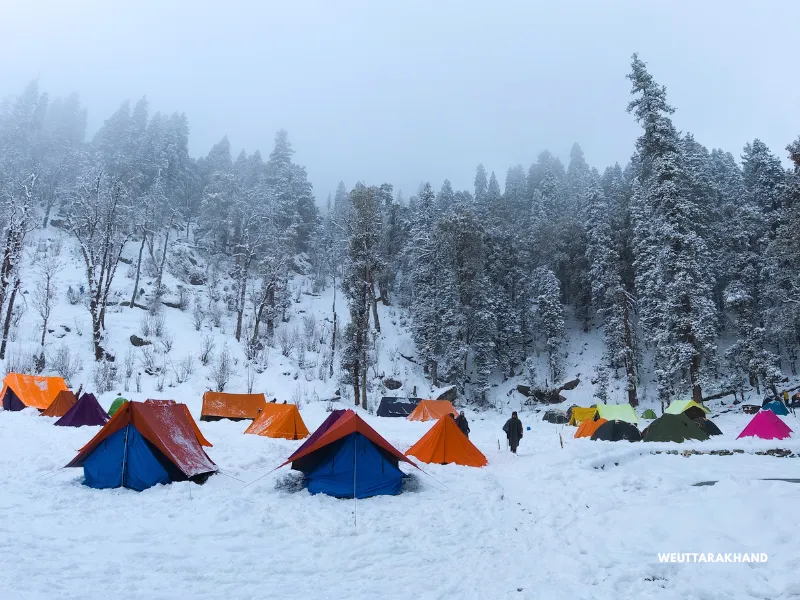
This is your campsite for the night. Set up camp. Watch the stars come out. In the mountains, far from any city, the night sky here is extraordinary.
Day 3: Trek from Juda Ka Talab to Kedarkantha Base
Distance: 4 km | Duration: 2.5 hours | Altitude Gain: 9,100 ft to 10,100 ft | Difficulty: Easy to Moderate
A short and rewarding day. The trail continues through cedar, maple, and oak forests before breaking out into expansive meadows. As you gain height, the Himalayan range begins to reveal itself.
The Kedarkantha peak comes into view early on this day and stays visible for most of the walk. That first clear sighting of the summit ahead of you is a special moment. It builds anticipation for tomorrow.
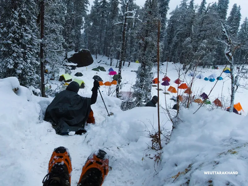
The trail is well-marked and easy to follow. Even in winter snow, the route is clear.
Kedarkantha Base is a wide, open campsite. No trees blocking the view. No walls on any side. Just open sky and mountains in every direction.
This is the best stargazing spot on the entire trek. After dinner, step outside your tent. The absence of artificial light at 10,100 ft means the stars here are the brightest you will ever see.
Rest well. Tomorrow is summit day.
Day 4: Summit Day – Kedarkantha Base to Summit. Descend to Hargaon
Distance: 6-7 km | Duration: 7 hours | Altitude: 10,100 ft to 12,500 ft to 8,900 ft | Difficulty: Moderate
Start before dawn. You want to reach the summit at sunrise.
The trail begins through oak and pine forest. In winter, the snow is deep and fresh here. You can hear streams beneath the snow, still moving under the ice. The forest slowly opens as you gain altitude.
The gradient increases steadily. And then, near the top, the final push comes. A sharp, steep incline for the last stretch. This is the part that tests you. It is hard. But keep moving.
And then you are at the top.
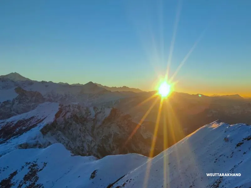
The summit of Kedarkantha at 12,500 ft gives you a 360-degree view of the Himalayas. Swargarohini. Bandarpoonch. Kalanag. The Gangotri range. Jaonli. Draupadi Ka Danda. The Har Ki Dun and Rupin valleys below.
At sunrise, the sky turns orange and red before the sun clears the horizon. The light falls on the snow-capped peaks in a warm, golden sweep. It is one of the most beautiful mornings you will ever witness.
There is a small temple at the summit dedicated to Lord Shiva, Goddess Parvati, and Lord Ganesha. Take a moment here.
After the summit, descend back to Kedarkantha Base for lunch. Then continue down to Hargaon camp – a beautiful clearing surrounded by alpine trees with distant views of the snowy peaks.
Day 5: Hargaon to Sankri
Distance: 4 km | Duration: 3-4 hours | Altitude Loss: 8,900 ft to 6,400 ft | Difficulty: Easy
A leisurely final day. The descent from Hargaon passes through dense forest all the way to Sankri. When the trees open up briefly, you get a bird’s-eye view of the Har Ki Dun valley stretching out below.
Back in Sankri, you have the rest of the day. Explore the village. Buy a wooden handicraft from one of the small shops. Talk to the locals. The pace of life here is slow and easy. Let it settle in.
Day 6: Drive from Sankri to Dehradun
Distance: 220 km | Duration: 10 hours
The same scenic road takes you back. Tons river, pine forests, mountain villages. You reach Dehradun by evening.
Route 2: The Kotgaon Route
Quieter Trails. Older Forests. Just as Beautiful.
The Kotgaon route starts from Kotgaon village at 6,520 ft – a slightly higher starting point than Sankri. This route sees far fewer trekkers. The forests are older and denser. The clearings are wider and more dramatic. And the sunsets from the higher campsites are among the best on any Kedarkantha route.
If you have already done the Sankri route and want a new experience – or if you simply prefer a quieter trail – this is a great choice.
Day 1: Drive from Dehradun to Kotgaon
Drive Distance: 195 km | Duration: 10-11 hours | Altitude: 6,520 ft
The drive follows the same route as Sankri until the Naitwar Barrier. Here you need a government-issued ID for permission. After the barrier, the road turns right towards Kotgaon instead of going straight to Sankri.
Kotgaon is a cluster of small hamlets – Shialdi, Paisar, Guradi, Suchan Gaon, Dargar Gaon, Dewara. Each one has its own quiet character. The Tons river runs nearby. Its sound follows you all evening.
There is a Someshwar temple right at the heart of the village. The wooden carvings on the temple are beautiful. And behind it, the Swargarohini peaks rise in a wall of mountains.
Walk through the village in the evening. The traditional Koti Banal architecture homes – built with alternating layers of stone and wood to resist earthquakes – are unlike anything you see in the plains. The villagers are welcoming and unhurried.
Day 2: Trek from Kotgaon to Khujai
Distance: 5.5 km | Duration: 5 hours | Altitude Gain: 6,520 ft to 9,460 ft | Difficulty: Easy to Moderate
The trek starts from the road going right from Kotgaon. About 1 km of road walking leads to a small suspension bridge over a stream. Just before the bridge, the trail forks right into the forest.
The forest here is predominantly oak. Old, dense, and beautiful. The canopy is thick enough to filter the sunlight into long, golden beams. The trail ascends gradually. You hear birds everywhere – warblers, thrushes, flycatchers calling from branch to branch.
After about an hour, you reach the first clearing. Rest here. The forest continues around you in every direction.
Another hour of forest walking brings you to Mohlani meadow – a huge clearing that opens up on one side to wide views of the surrounding hills. Tall pine trees border the other three sides. There is a small Matrishakti Mandir here. There is also a water source. Fill your bottles.
After Mohlani meadow, the trail continues through forest, then crosses a small wooden bridge over a stream, then climbs gradually to Khujai campsite.
Khujai is a large clearing in the middle of dense forest. To your right, you can see tomorrow’s trail. To your left, shepherd huts and cattle space. A little further ahead, big boulders where you can sit and take in the view. This is a beautiful place to spend an evening.
Day 3: Trek from Khujai to Bhoja Dhadi
Distance: 3.5 km | Duration: 3.5 hours | Altitude Gain: 9,460 ft to 10,700 ft | Difficulty: Easy
Start from the trail heading south-west from Khujai. A kilometre of ascent through forest brings you to Tatalona meadow – a beautiful clearing. Rest here.
From Tatalona, descend about 600 metres to a water stream. The stream, the boulders, and the dense forest all around make for a striking setting. Cross the stream and climb back into the forest.
The trail ascends through forest for another stretch, then turns steeply right through boulders. Another short descent leads to a second stream crossing. After that, a final 700-metre ascent through forest brings you to Dhoka.
Dhoka, in the local Garhwali language, means “meadow with a big boulder.” Apt description. It is exactly that – a wide meadow with one enormous boulder at one end. From here, snow-capped mountains begin to appear on the horizon for the first time on this route.
Just ahead of Dhoka is Bhoja Dhadi. This is your campsite for the night.
Do not miss the sunset from here. The alpenglow on the snow peaks as the sun drops behind the mountains is extraordinary. And the Kedarkantha summit is clearly visible ahead of you – close enough to feel real, far enough to build anticipation.
Day 4: Summit Day – Bhoja Dhadi to Summit. Descend to Khujai.
Distance: 9 km| Duration: 7-8 hours | Altitude: 10,700 ft to 12,500 ft to 9,460 ft | Difficulty: Moderate
Start early. The trail heads right from the Bhoja Dhadi campsite and immediately passes through a beautiful section of rhododendron trees. In spring, this stretch is a riot of colour.
Beyond the rhododendrons, the treeline begins to thin. The trail transitions from forested to open grassy terrain. Then from grass to rock and mud. The ascent gets steep. Climb in a zigzag pattern on the steepest sections.
At one point, the trail from the Sankri route merges with yours. From this junction, the final steep push to the summit begins. It takes 2.5 to 3 hours from Bhoja Dhadi to reach the top.
The summit views are the same regardless of which route brought you here. Swargarohini. Bandarpoonch. Kalanag. Gangotri. Draupadi Ka Danda. Jorkanden. Rupin and Har Ki Dun valleys below. A full 360 degrees of the Himalayas.
After the summit, retrace the route to Bhoja Dhadi and descend all the way to Khujai for the night.
Day 5: Trek from Khujai to Kotgaon
Distance: 5.3 km | Duration: 5 hours | Altitude Loss: 9,460 ft to 6,520 ft | Difficulty: Easy to Moderate
A narrow, beautiful descent through dense oak forest all the way back to Kotgaon. The last trekking day always has a quiet, reflective quality to it. Take your time. Notice things you missed on the way up.
Back at Kotgaon, rest for the evening.
Day 6: Drive from Kotgaon to Dehradun
Distance: 195 km | Duration: 9-10 hours
Start early – before 7 am if possible. The drive takes at least 9 to 10 hours. Plan to arrive in Dehradun by early evening.
Route 3: The Gaichawan Route
Apple Orchards. Untouched Forests. The Road Less Taken.
The Gaichawan route is the newest and least-travelled path to Kedarkantha. Very few trekkers know about it. The trail passes through working apple orchards, unique Koti Banal architecture villages, and forest sections so untouched that the trail itself is barely formed in places.
This is not a route for someone who wants a comfortable, well-serviced trail. But if you want solitude, raw natural beauty, and an authentic experience of the mountains – this is it.
Gaichawan village is known locally as the Apple Valley of the Mori block. You will see sprawling apple plantations around the village. The Tons river runs nearby. The grain bank here – called Kothar – is almost a hundred years old, with underground levels for different types of grain.
Day 1: Drive from Dehradun to Gaichawan
Drive Distance: 195 km | Duration: 10-11 hours | Altitude: 5,570 ft
The drive follows the same route as Kotgaon past the Netwar Barrier. After the barrier, take a right turn towards Gaichawan village. The road straight ahead leads to Sankri.
Gaichawan is tucked in the Tons Valley. Quiet, self-contained, unhurried. Explore the village and the apple orchards in the evening. The grain bank is worth a look – it is a piece of living history.
Day 2: Trek from Gaichawan to Julota
Distance: 5.2 km | Duration: 5.5 hours | Altitude Gain: 5,570 ft to 8,920 ft | Difficulty: Moderate
The trail starts through apple orchards and farmland. You pass through the villages of Suchan Gaon and Dargar Gaon – both notable for their traditional Koti Banal homes and unhurried way of life. These villages feel completely untouched by tourism.
Haltwar village is the first major landmark, about 3 km from Gaichawan through the villages. If you are hungry, stop at a local dhaba here and try siddu – a local steamed bread that is filling and delicious.
From Haltwar, the trail enters a light forest that gradually ascends. A wooden bridge over a stream marks the transition into denser forest. From here, the trail turns into a staircase of rock slabs, climbing steadily.
The forest deepens. Maples and rhododendrons line the trail. You move in and out of clearings, each one slightly higher than the last. After the second clearing, the campsite is near.
Julota is a stunning clearing in the middle of the forest. The sunset from here – if you arrive on time – is worth the effort of the entire day.
Day 3: Trek from Julota to Pukhrola
Distance: 3.5 km | Duration: 3.5 hours | Altitude Gain: 8,920 ft to 10,870 ft | Difficulty: Easy to Moderate
A short day but with nearly 2,000 ft of altitude gain. Stay well hydrated. The trail is steep in stretches.
The trek starts through golden oak trees. Within 400 metres, you hit the first clearing. Then another 400 metres to Shiun Ka Thatch.
Continue through thick oak forest to a bigger clearing – Moru Ka Thatch. There is a small dhaba here. Try the local siddu or pua. Sit and enjoy the quiet. This is one of those spots where you do not want to leave.
After Moru Ka Thatch, the forest gets steep and the tree cover thins. Rhododendrons appear, then dwarf rhododendrons near the top. Streams cross the trail at several points. In spring, this entire section is carpeted in colour.
About 45 minutes from Moru Ka Thatch, the trail opens into an amphitheatre-shaped meadow surrounded by mountain ridges on all sides. You can see the Kedarkantha summit ahead of you.
This is Pukhrola. Your campsite for the night.
The sunset here is spectacular. And the night sky – cold, clear, and full of stars – is one of the best you will find on any route to Kedarkantha.
Note: It gets windy and very cold at Pukhrola after sunset. Layer up immediately when you stop walking. Do not wait until you are cold – by then it is too late.
Day 4: Summit Day – Pukhrola to Summit. Descend to Akhoti Thatch.
Distance: 9 km | Duration: 7-8 hours | Altitude: 10,870 ft to 12,500 ft to 8,270 ft | Difficulty: Moderate
Start at 4 am.
This route approaches the summit from the western ridge. It is steep at multiple points. Climb in a zigzag pattern wherever the gradient becomes aggressive. The summit takes 2 to 3 hours from Pukhrola.
From the top, the view is the same one that has been drawing trekkers to Kedarkantha for decades. The Chainsheel Pass is visible from this western approach – a unique feature of this route. Rupin valley and Har Ki Dun valley spread out below. Swargarohini, Bandarpoonch, Kalanag, Gangotri, Draupadi Ka Danda, Jorkanden – all present and accounted for.
After the summit, descend back to Pukhrola and have lunch there. Then continue down to Akhoti Thatch – 2 km further, about 2.5 to 3 hours through the forest.
Akhoti Thatch is named after the walnut trees that surround it. Akhoti means walnut in the local language. It is a big, beautiful clearing – a fitting last campsite for this route.
Day 5: Trek from Akhoti Thatch to Gaichawan
Distance: 4 km | Duration: 4-5 hours | Altitude Loss: 8,270 ft to 5,570 ft | Difficulty: Easy
After breakfast, start down towards Gaichawan. The trail after Akhoti Thatch is narrow and barely formed in places. It has not been worn smooth by trekker traffic. That is part of its appeal.
The forest is thick with oak and rhododendron. Small clearings and river streams interrupt the descent every now and then. After about 2 km, you reach a shepherd hut in a small opening. Take a break here.
The next section has a small waterfall that you need to cross carefully – the trail narrows to single-person width here. Keep your footing slow and deliberate. In the early morning, martens and red foxes are sometimes spotted nearby.
The descent continues towards Haltwar village, about 1.5 hours from the shepherd huts. From Haltwar, another 1.5 hours brings you back to Gaichawan.
Day 6: Drive from Gaichawan to Dehradun
Distance: 195 km | Duration: 10-11 hours
Start before 7 am. The drive is long. Plan your onward travel from Dehradun after 7 pm.
Which Route Should You Choose?
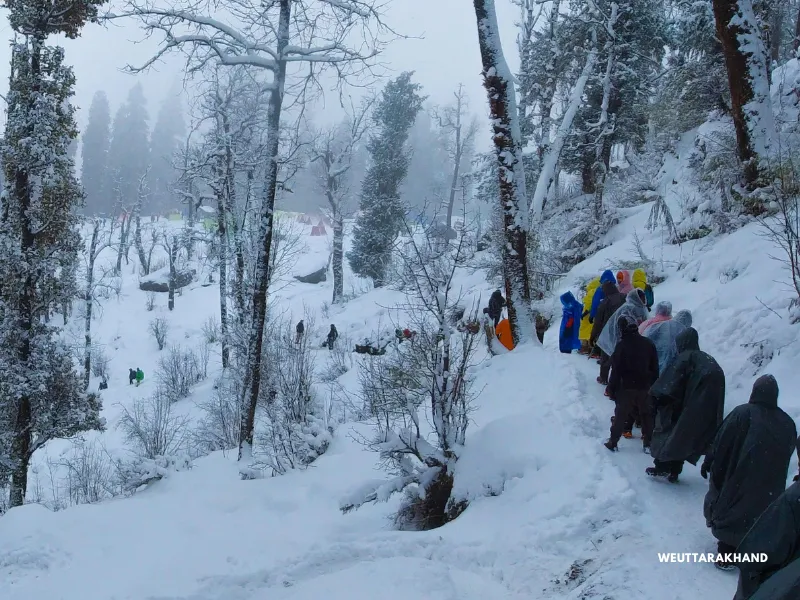
Sankri Route
Choose this if you are doing Kedarkantha for the first time. It is the most popular route for a reason. Well-defined trail, iconic campsites, the best-known trekking experience on this mountain. Juda Ka Talab alone makes this route worth taking. But the trail is overcrowded compared to the other two trails.
Kotgaon Route
Choose this if you want a quieter trail with older forests, wider clearings, and sunsets from Bhoja Dhadi that rival anything in the Himalayas. Good for second-timers or anyone who wants to avoid the crowds.
Gaichawan Route
Choose this if you want something raw and off-the-beaten-path. Apple orchards, ancient architecture villages, untouched forest sections, and solitude most of the way. Best for experienced trekkers or those looking for something genuinely different.
All three routes converge near the summit. The top is the same. What changes is the journey there.
How Difficult Is the Kedarkantha Trek?
This is an easy to moderate trek. It is the recommended starting point for anyone new to Himalayan trekking.
Total trekking distance on the Sankri route is about 20 km over 4 days. You gain approximately 6,100 ft in total. The summit day involves 6 to 7 km of trekking with a steep final ascent.
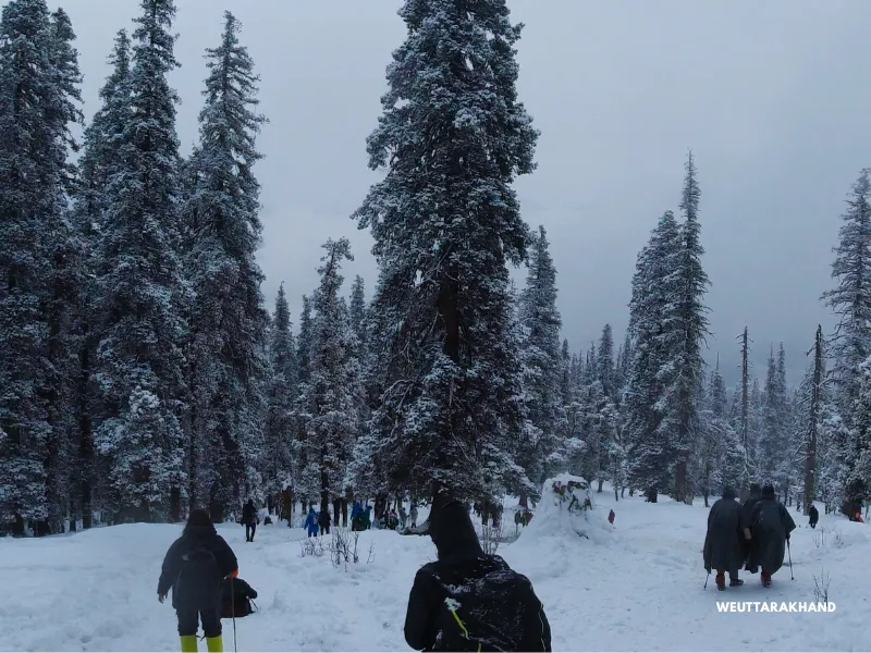
The Kotgaon and Gaichawan routes are slightly longer at about 24 km over 4 days. The terrain on both is more varied and the trails less worn, which requires more attention to footing.
The altitude gain is rapid. From 6,400 ft at Sankri to 12,500 ft at the summit – in just three trekking days. This makes AMS a real consideration even on this beginner-friendly trek.
Train for at least 4 to 6 weeks before the trek. Build cardiovascular endurance through running, stair climbing, or cycling.
Is the Kedarkantha Trek Safe?
Yes – if you are prepared and informed.
Terrain Safety
The trails on the Sankri route are well-defined and easy to follow in most conditions. In deep winter snow, the trail can become unclear – especially in the final forest section before the summit. Trek with a local guide in winter.
On the Kotgaon and Gaichawan routes, some sections are narrower and less marked. A guide is strongly recommended on both of these routes.
The summit push is steep regardless of which route you take. Take your time on the ascent. On the descent, the steep sections require careful footing – use trekking poles.
Altitude Safety
Kedarkantha reaches 12,500 ft. At this altitude, Acute Mountain Sickness (AMS) is a real possibility. The rapid altitude gain over three short days makes it more likely than on treks with a more gradual ascent profile.
AMS does not discriminate. Fit and experienced trekkers can get it just as easily as beginners.
Watch for these symptoms: Persistent headache, Nausea, Dizziness, Loss of appetite, Weakness, Disturbed sleep. If any of these appear, do not push on. Descend immediately.
Stay hydrated. Drink at least 3 litres of water daily on trekking days. Take half a tablet of Diamox (125 mg) every 12 hours from Dehradun onwards as prevention.
Weather Safety
In winter, snowfall can cover the trail completely and make navigation difficult. Always carry proper winter gear – microspikes or crampons for icy sections, warm waterproof gloves, a balaclava, and thermal layers.
At any time of year, afternoon weather in the mountains changes quickly. Always start your summit push early to reach the top before midday.
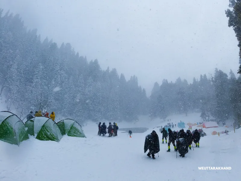
Heavy or prolonged rainfall makes the trails slippery and can make stream crossings risky – especially the Neel Ganga section on the Kotgaon route.
Emergency Exits
If you are on the Sankri route and have not passed Juda Ka Talab – descend back to Sankri.
If you are between Juda Ka Talab and the summit – descend towards Sankri or take the alternate descent towards Bhatwadi village.
If you are on the Kotgaon or Gaichawan routes – the safest exit is always to retrace your route back to the respective base village and drive to Dehradun.
The closest hospital with reasonable facilities is in Purola, about 2 to 3 hours from Sankri. For serious medical needs, Dehradun is the destination – about 10 hours by road.
Best Time to Do the Kedarkantha Trek
Kedarkantha is one of the few Himalayan treks that is genuinely good across four different seasons.
Winter (December to February)
The iconic version of this trek. Snow on the trails, frozen Juda Ka Talab, snow-draped forests, a winter summit unlike anything else in Indian trekking. The daytime weather is often bright and sunny. Nights are cold and clear. The summit views in winter are the sharpest and most dramatic.
This is the season that gave Kedarkantha its title. Highly recommended for anyone who can handle the cold.
Spring (March to April)
The snow begins to melt at higher altitudes. Rhododendrons bloom along the trail in bright reds and pinks. Juda Ka Talab is partially icy with a mirror-like surface that reflects the forest and sky. The forest fills with birdsong. The weather is mild.
A beautiful and underrated time to come.
Summer (May to June)
The meadows and clearings turn lush green. Wildflowers appear on the higher sections. The trail is at its easiest. Days are long. The forest sections are bright and alive.
Perfect for families with children or anyone trekking in Uttarakhand for the first time.
Autumn (October to November)
Post-monsoon clarity. The skies are washed clean. Mountain views are sharp and vivid. The forests turn golden – shades of yellow, brown, and orange fill the trail. The meadows near the summit are grassy instead of snowy.
A different but equally stunning experience.
Temperature Guide
| Season | Sankri / Base Village | Juda Ka Talab / Mid Camp | Summit | Night Temperature |
|---|---|---|---|---|
| Dec-Feb | 2-8°C | -5 to 2°C | -12 to -5°C | -15 to -8°C |
| March-April | 10-18°C | 4-10°C | -2 to 4°C | -3 to 3°C |
| May-June | 18-24°C | 12-18°C | 5-10°C | 4-8°C |
| Oct-Nov | 10-18°C | 2-8°C | -3 to 3°C | -5 to 2°C |
Temperatures at the higher campsites drop sharply after sunset regardless of the season. Layer up immediately when you stop moving.
How to Reach Sankri – Base Camp of the Kedarkantha Trek
Sankri is 220 km from Dehradun and takes about 10 hours by road.
The Route
Dehradun → Mussoorie → Yamuna Bridge → Naugaon → Purola → Mori → Naitwar → Sankri
You drive along the Yamuna and Tons rivers for much of the journey. The last 22 km passes through the Govind Wildlife Sanctuary – the most beautiful section of the drive.
By Air
Fly to Dehradun (Jolly Grant Airport), about 28 km from Dehradun city. Take a taxi to Dehradun and then hire a vehicle to Sankri. A direct taxi from Dehradun to Sankri is the most convenient option.
By Train
Take the Kota Express (Train No. 12401) from Hazrat Nizamuddin, Delhi to Haridwar. From Haridwar, take a bus or taxi to Dehradun (30 km). Then hire a vehicle to Sankri.
By Bus
Overnight Volvo buses from Delhi’s ISBT Kashmiri Gate to Dehradun are frequent and comfortable.
Tip: Arrive in Dehradun the evening before and start the drive to Sankri early in the morning. The 10-hour drive means a 6 am departure gets you to Sankri by 4 to 5 pm with some daylight left.
For Kotgaon and Gaichawan routes: The drive is 195 km from Dehradun. Follow the same route until the Naitwar or Netwar Barrier, then branch off as described in the respective route guides above.
Stay Options
At Sankri
Several guesthouses and homestays are available. Basic, clean, and comfortable. Plenty of options for all budgets.
At Kotgaon and Gaichawan
Small homestays run by local families. The experience is warm, personal, and a highlight of these routes in itself.
At Dehradun
Zostel Dehradun is a popular pre-trek option for solo trekkers and groups. Bunk beds from around Rs 400. Private rooms also available.
Frequently Asked Questions
How long is the Kedarkantha trek?
The Sankri route covers about 20 km over 4 trekking days. The Kotgaon and Gaichawan routes are about 24 km each over 4 trekking days. The summit is at 12,500 ft.
Which route is best for first-timers?
The Sankri route, without question. It is the most well-defined, most serviced, and most beginner-friendly route to the summit. Start here. You can explore the other routes on a return visit.
Is Kedarkantha good in summer?
Yes. It is a beautiful, easy, and refreshing trek in May and June. Great for families with children. The trail is fully accessible and the forests are at their greenest.
Do you need a permit?
Yes. The Kedarkantha trail passes through the Govind Wildlife Sanctuary. You need to register at the Sankri forest office and pay the entry fee. Carry a government-issued photo ID.
Can you rent gear at Sankri?
Basic gear like trekking poles, microspikes, and jackets can be rented from small shops in Sankri. Quality varies. For winter trekking especially, carry your own critical gear – good gloves, proper shoes, and warm layers.
What is Juda Ka Talab?
Juda Ka Talab is a high-altitude alpine lake at 9,100 ft on the Sankri route. In winter, it freezes completely. It is one of the most iconic campsites in Uttarakhand trekking and a major highlight of the Kedarkantha trek.
Is a guide necessary?
On the Sankri route in good weather, the trail is clear enough to follow without a guide. In winter, or if you are doing the Kotgaon or Gaichawan routes, a local guide is strongly recommended.
Final Thoughts
Kedarkantha is more than a summit. It is a complete Himalayan experience – forests, lakes, meadows, villages, and one of the finest mountain views in northern India.
Come in winter for the snow. Come in spring for the flowers. Come in summer for the green. Come in autumn for the clarity.
Whenever you come – come ready to be surprised.