
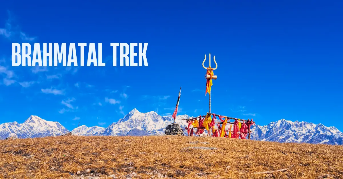
Two Lakes. One Ridge. The Most Beautiful Mountain Views in Uttarakhand.
Ask experienced trekkers which trail gives the finest mountain views in Uttarakhand and many of them will say Brahmatal.
Not Kedarkantha. Not Kuari Pass. Brahmatal.
The reason is simple. On this trek, Mt. Trishul and Mt. Nanda Ghunti are not distant shapes on the horizon. They are right in front of you. Close enough to feel real. Their full faces – glaciers, ridges, and all – towering above the meadows as you walk. It is the kind of mountain view that makes people stop mid-stride and just stare.
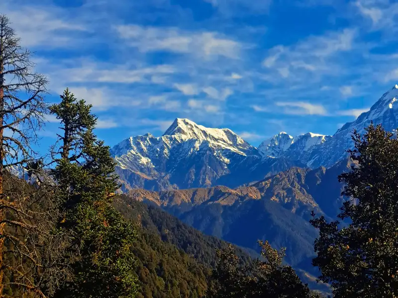
But Brahmatal gives you more than one great view. It gives you a ridge walk where 7 to 8 layers of mountain ranges stack up behind each other as far as you can see. From Jhandi Top, you can trace the entire Roopkund trail with your eyes – from the meadows of Ali and Bedni Bugyal all the way to the dip where the Roopkund tarn sits. And from Brahmatal Top at 12,250 ft, an entirely new set of peaks appears – Neelkanth, Hathi-Gauri, and on very clear days, Mt. Kamet – India’s third-highest peak – and peaks from Nepal.
And then there are the lakes. Two of them. Bekaltal on Day 2, surrounded by ancient oak forest with mysterious brown water. And Brahmatal itself – a high-altitude lake in an open, stark alpine setting at the foot of the big mountains. In winter, it freezes. At night, if it is not frozen, it reflects the entire night sky.
The Brahmatal trek is 22 km over 4 trekking days. It is easy to moderate. Lohajung, 270 km from Rishikesh, is the base camp.
This is a trek that gives back far more than it asks of you.
What Makes Brahmatal Special
1. Two High-Altitude Lakes – Completely Different From Each Other
Not many treks take you to even one high-altitude lake. Brahmatal gives you two – and they could not be more different.
Bekaltal sits surrounded by dense oak forest. Its waters are permanently brown – stained by dissolved organic matter from the thick forest around it, much like a tea bag in water. It has a quiet, almost mysterious quality. You reach it near the end of Day 2, up a short 10-minute climb from the Khopdalia clearing.
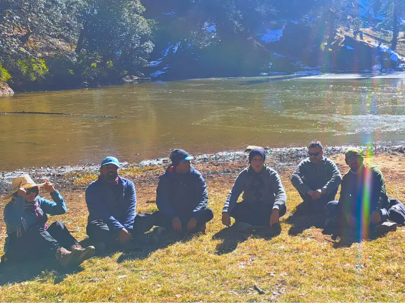
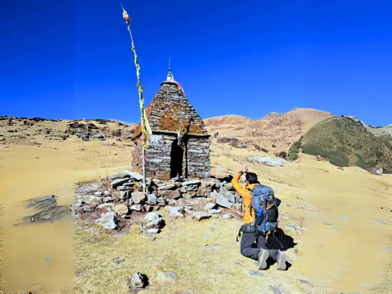
Brahmatal Lake is the opposite. It sits in a wide, open, alpine setting at 12,250 ft – bare and stark and beautiful. The big mountains loom directly above it. In winter it freezes completely. On clear nights when the water is open, it reflects the entire star-filled sky. There is a small Nag Devta temple beside it.
Two lakes. Two completely different worlds. Both unforgettable.
2. Mt. Trishul and Mt. Nanda Ghunti – Closer Than You Have Seen Them
The moment you step out of the treeline on Day 3 and enter the Tilandi meadow – the mountains hit you.
Trishul and Nanda Ghunti stand directly in front of you. Their full faces visible – ridges, glaciers, everything. This is not a distant view. It is an up-close, wall-of-white-mountains view that stops most trekkers in their tracks.
And then they stay with you. For the ridge walk. For the climb to Brahmatal Top. For the campsite. For almost two full days, these mountains are your constant companions.
3. The Ridge Walk – A View of the Entire Roopkund Trail
Day 4 is spent almost entirely on a long, open ridge. The treeline drops below you. The mountains spread across the horizon. Seven to eight layers of ranges stack up, one behind the other, as far as you can see.
From Jhandi Top – the highest point on the ridge before Brahmatal Top – you can see the entire Roopkund trek route. The meadows of Ali and Bedni Bugyal are visible across the valley. The trail that leads all the way to the Roopkund tarn is laid out in front of you like a map.
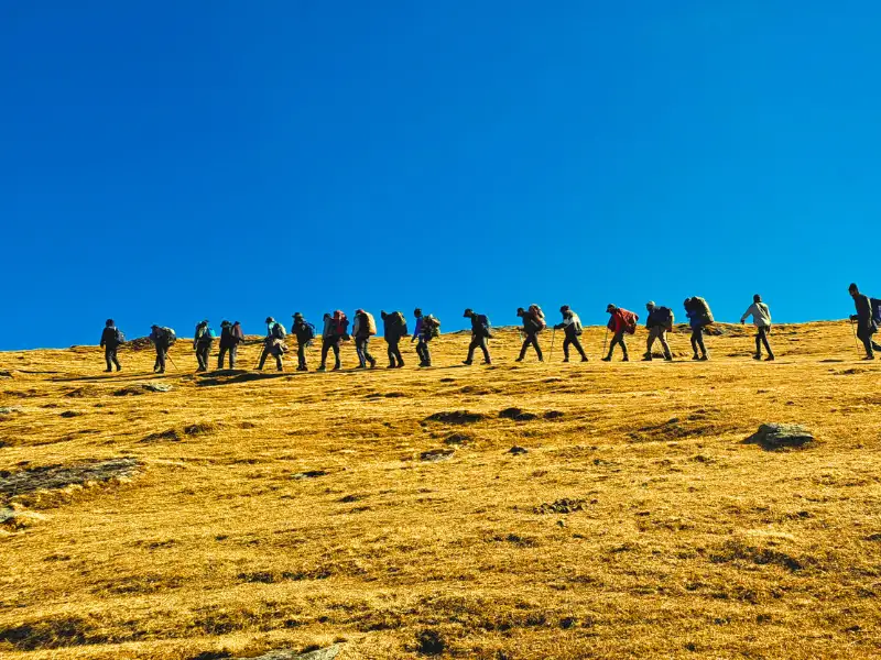
On very clear days, beyond Trishul and Nanda Ghunti, you can also spot Mt. Kamet – one of the highest peaks in India – and peaks from Nepal including Api Himal and Jethi Bahurani.
4. Ancient Rhododendron and Oak Forests
The forests between Lohajung and Bekaltal are centuries old. Dense, twisted, alive.
The rhododendron forest just beyond Bekaltal is unlike any other on this trail. The trees have grown into captivating shapes – bare trunks forming a smooth wooden maze, with the canopy closing over your head like a natural roof. In spring, this same canopy bursts into dark pink and crimson flowers.
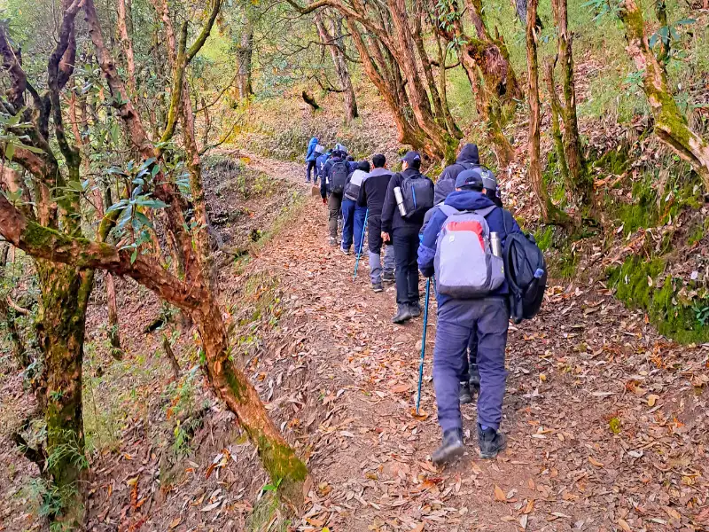
In winter, these same trees stoop under the weight of snow. Walking through them feels like stepping into another world entirely.
5. The Tilandi Campsite
Tilandi sits on the edge of a ridge at 10,495 ft. Below you on one side is the valley running from Lohajung to Wan. On the other side, the Ali and Bedni Bugyals of the Roopkund trail are visible across the open valley.
The sunsets from Tilandi are extraordinary. The sky turns crimson and the colours reflect onto the white mountains. In winter, those same colours reflect onto the snow at your feet.
And the sunrise the next morning is just as good. Wake up early. This campsite deserves both.
Quick Itinerary
| Day | Route | Distance | Duration | Altitude |
|---|---|---|---|---|
| Day 1 | Drive Rishikesh to Lohajung | 270 km | 10-11 hrs | 7,550 ft |
| Day 2 | Trek Lohajung to Gujreni | 4.6 km | 5 hrs | 7,550 ft to 9,180 ft |
| Day 3 | Trek Gujreni to Tilandi | 2.9 km | 4-5 hrs | 9,180 ft to 10,495 ft |
| Day 4 | Trek Tilandi to Brahmatal via Brahmatal Top | 5.5 km | 7-8 hrs | 10,495 ft to 10,190 ft via 12,250 ft |
| Day 5 | Trek Brahmatal to Lohajung | 8.45 km | 7-8 hrs | 10,190 ft to 7,550 ft |
| Day 6 | Drive Lohajung to Rishikesh | 270 km | 10-11 hrs | – |
Day by Day Trail Guide
Day 1: Drive from Rishikesh to Lohajung
Distance: 270 km | Duration: 10-11 hours | Altitude: 7,550 ft
The drive to Lohajung is long but genuinely beautiful. You leave Rishikesh and follow the Alaknanda river deep into the Garhwal mountains. The road passes through Devprayag – where the Bhagirathi and Alaknanda merge to form the Ganga. Then Rudraprayag, where the Mandakini joins. Then Karnaprayag, where the Pindari river meets the Alaknanda. Three sacred confluences in a single drive.
The mountain roads hug the hillside all the way. Forests and valleys drop away on either side. On clear days, the first glimpses of the Garhwal peaks appear above the ridgelines.
Lohajung sits at 7,550 ft in the Chamoli district. It is a small village at the centre of 12 to 15 nearby communities. The moment you step out of the vehicle, Nanda Ghunti peak appears above the village. If you arrive before sunset, the colours on the peak are extraordinary.
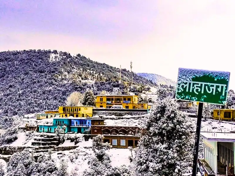
The name Lohajung comes from local legend. It is said that Goddess Parvati fought a battle here with the demon Lohasur. The name translates to “war with Lohasur.”
There are a few small shops in Lohajung where you can buy basic gear items – gloves, jackets, caps. But do not rely on them. Carry everything you need from home.
Rest well. The trek begins tomorrow.
Day 2: Trek from Lohajung to Gujreni
Distance: 4.6 km | Duration: 5 hours | Altitude Gain: 7,550 ft to 9,180 ft | Difficulty: Moderate
The trail begins from Lohajung market. Walk upward through the upper part of the village and then into the forest trail. After a short stretch, Mandoli village appears on your left. As you gain height, the Kali Valley opens up to your left – the Kali and Pindari rivers joining far below.
Follow the water pipes that supply Lohajung – they run alongside the trail and serve as a useful guide. After crossing a small cluster of homes called Budla, the rhododendron trees begin. From February to March, this section blazes with colour.
At around 8,500 ft, you cross a 10-metre bridge over a stream – locally called Link-gaad. This is a good water refill point. About two hours into the walk, you reach Begum – a resting spot with good views of Navali Bugyal and Bagdi Bugyal in the distance.
From Begum, another hour of walking brings you to the Gujreni stream and campsite.
Gujreni sits in a forest clearing surrounded by green oak, brown oak, and rhododendrons. The sun reaches this campsite early and stays late – which makes it noticeably warmer than the higher camps. A stream runs close by. The birdlife here is excellent – Himalayan woodpeckers, Asian barred owlets, blue-fronted redstarts, and solitary snipe have all been spotted here. Listen for barking deer in the forest at night.
This campsite has a quiet seclusion to it. The forest on all sides, the sound of water nearby, the occasional bird call. It is one of the most peaceful nights on any Himalayan trek.
After Gujreni, the trail continues through thick oak forest. At sections where the mountain is on your left and the valley drops away to your right, Mt. Trishul appears on the horizon for the first time – distant but unmistakable.
About an hour and a half further through the forest, the trail flattens into a small plateau with a crater-like depression at its centre. This is Khopdalia – a dried-up lake. The valley of Deval is visible at one end.
Bekaltal is a 10-minute climb above Khopdalia. The lake sits in a thick cluster of oak trees. Its water is permanently brown – stained by dissolved organic matter from the dense surrounding forest, much the way tea stains water. This is a natural phenomenon common in forest-surrounded lakes. The brown colour tells you the forest here is old and healthy.
Camp at Khopdalia for the night. Bekaltal is worth a short evening visit before the light fades.
Day 3: Trek from Gujreni to Tilandi
Distance: 2.9 km | Duration: 4-5 hours | Altitude Gain: 9,180 ft to 10,495 ft | Difficulty: Moderate
Water note: There are no water sources on today’s trail. Fill at least 2 litres before you leave camp.
Short in distance. Big in reward.
The trail starts heading south-west from camp. Within a few metres, you cross a stream. After that, the climb begins – steep, into the oak and rhododendron forest.
For the first half of the climb, rhododendrons dominate. Their twisted trunks and smooth bark create a canopy overhead. In spring, this section turns into a tunnel of dark pink and crimson flowers. In winter, the same branches bend under snow.
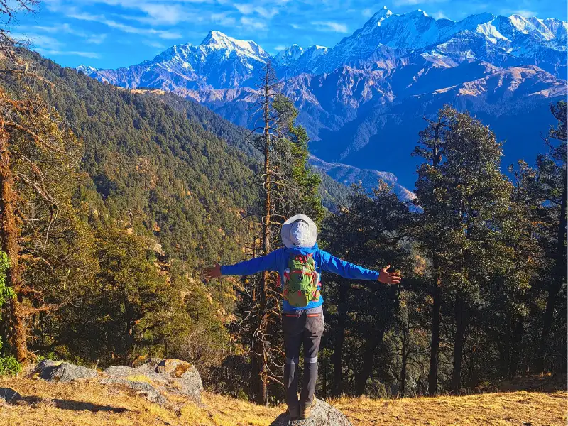
Midway up, the oak trees take over. The forest changes character – darker, older, quieter. After about an hour of climbing, the treeline ends abruptly.
And then Trishul and Nanda Ghunti are in front of you.
No warning. No gradual reveal. The forest stops and the mountains fill the sky. The Trishul massif stands like a wall of white. Nanda Ghunti rises beside it. Their full faces – ridges, glaciers, snowfields – all visible at once.
Most people stop walking here. Some for a long time.
The meadow ahead leads to the ridge. That is Tilandi campsite – right on the edge of the ridge at 10,495 ft.
Below you on one side is the full valley running from Lohajung to Wan. On the other side, directly across the open air, are the meadows of Ali and Bedni Bugyal – the heart of the Roopkund trail – spread out as if someone unrolled a map just for you.
Watch the sunset from Tilandi tonight. The sky turns crimson. The colours fall on the mountains and the snow. It is one of the finest sunsets on any Himalayan trek.
And set your alarm for sunrise. The golden light from the east hits the peaks while the valley still sits in shadow. Worth being awake for.
Day 4: Trek from Tilandi to Brahmatal via Brahmatal Top
Distance: 5.5 km | Duration: 7-8 hours | Altitude: 10,495 ft to 12,250 ft to 10,190 ft | Difficulty: Moderate
The longest day of the trek. And the most rewarding.
The trail today runs almost entirely along the ridge. The treeline appears sometimes below you, sometimes beside you as you gain and lose height. The mountains stay with you throughout – always visible, always close.
Note: The Tilandi campsite is known for strong, fast winds. Even without snowfall, wind at this altitude can cut through you quickly. Keep your wind layer within easy reach from the moment you leave camp.
The first major objective is Jhandi Top – the highest point on the ridge before Brahmatal Top. As you walk, the mountain panorama keeps expanding. Trishul and Nanda Ghunti are now joined by Chaukhamba, Neelkanth, and the Hathi-Gauri peaks on clear days.
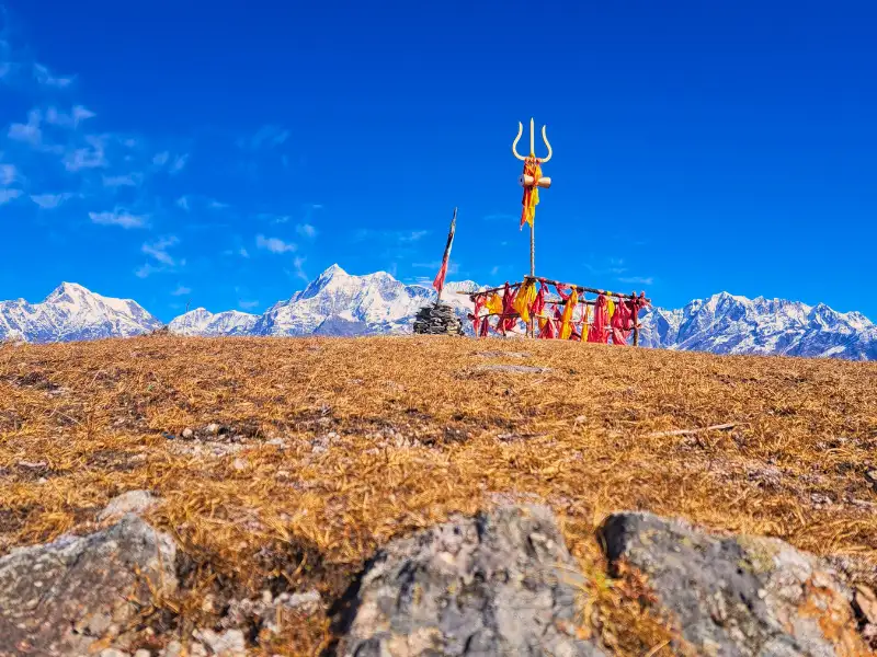
From Jhandi Top, the view is extraordinary. Seven to eight layers of mountain ranges stretch across the horizon, each one slightly lower than the one in front. In the valley below, you can trace the entire Roopkund route – from Wan village, across the Ali and Bedni meadows, all the way to the dip in the ridge where the Roopkund tarn sits.
Spend at least 20 minutes here. It takes time for the scale of what you are seeing to properly register.
From Jhandi Top, take the right trail. It continues along a ridge that climbs gradually to Brahmatal Top at 12,250 ft – the highest point on the entire trek.
From Brahmatal Top, the mountain views reach their fullest extent. Kamet – India’s third-highest peak – appears on very clear days. And beyond it, peaks from Nepal including Api Himal and Jethi Bahurani.
After the top, the trail descends gradually to Brahmatal Lake.
The first view of Brahmatal Lake stops you. It sits in a wide, open, alpine bowl – completely exposed to the sky. No trees. No shelter. Just the lake and the mountains above it. A small Nag Devta temple stands at its edge.
In winter, the lake freezes over. In the warmer months, on a still clear night, it reflects the entire sky – stars and all.
The campsite is 500 metres from the lake on the left side of the slope. Do not miss the sunset from here tonight.
Day 5: Trek from Brahmatal to Lohajung
Distance: 8.45 km | Duration: 7-8 hours | Altitude Loss: 10,190 ft to 7,550 ft | Difficulty: Moderate
The longest trekking day. Mostly downhill – but 8.45 km of descent is still a full, demanding day on your legs.
Start right after breakfast. The trail from Brahmatal lake climbs back briefly towards Jhandi Top. The vegetation here is sparse and open – the mountains play hide and seek as you move through open terrain.
From Jhandi Top, take the left trail this time. The descent begins. Initially it is open ground with the mountain views gradually falling behind you. About 1 km down, you re-enter the treeline – all oak trees now.
Soon you reach a clearing called Khorurai. Khoru means oak in the local language. This is a good rest stop. It could also serve as a campsite if you want to add an extra day to the trek.
After Khorurai, another 1.3 km of descent joins the main trail. The route then passes through rhododendron forest. The trail is well-made and clear throughout. Two streams cross the path on the way down.
About an hour from the lake, you reach shepherd huts – called Chawni in the local language. These are the shelters that villagers and shepherds use when moving livestock through these forests. The trail connecting these mountain communities runs right through here.
Continue on the well-made trail. The forest thins gradually. The sounds of the village begin returning. And then Lohajung appears below.
You are back.
Day 6: Drive from Lohajung to Rishikesh
Distance: 270 km | Duration: 10-11 hours
Start early. The drive back follows the same beautiful road – Karnaprayag, Rudraprayag, Devprayag. The same confluences, the same river, the same mountains in the distance.
You reach Rishikesh by evening.
How Difficult Is the Brahmatal Trek?
This is an easy to moderate trek. Suitable for beginners who are fit and reasonably trained.
Total trekking distance is 22 km over 4 days. The highest point is 12,250 ft. The altitude gain is gradual – the itinerary is well-paced for acclimatization.
The steepest challenge is the climb on Day 3 from the treeline to the Tilandi meadow. The most demanding day physically is Day 5 – 8.45 km of continuous descent that puts real stress on the knees.
In winter, the terrain above the treeline becomes significantly harder. The snow freezes overnight and the early morning approach to Brahmatal Top can be icy and steep. Microspikes are essential. In January and February, Brahmatal Top itself may be inaccessible – but the ridge walk and Tilandi campsite are completely fulfilling on their own.
Suitable for trekkers aged 8 and above. Fitness benchmark: 5 km in 40 minutes.
Is the Brahmatal Trek Safe?
Yes – with the right preparation.
Terrain Safety
The trails are well-defined and well-maintained throughout. The main hazard in winter is frozen snow – especially above the treeline from Day 3 onwards. Early morning trekking on frozen snow near Brahmatal Top requires microspikes. Do not attempt this section in winter without proper traction.
Tilandi campsite is exposed to fast, strong winds. Layer up before the wind picks up – not after you are already cold.
Altitude Safety
At 12,250 ft, Brahmatal Top reaches an altitude where Acute Mountain Sickness is possible. The gradual altitude gain over the itinerary helps – but AMS can still affect anyone, regardless of fitness or experience.
Watch for these symptoms: persistent headache, nausea, dizziness, loss of appetite, weakness, disturbed sleep. If any appear, descend immediately.
Hydration is especially important on this trek. There are no water sources on Day 3. Fill at least 2 litres before leaving camp that morning. Drink consistently through the day.
Take half a tablet of Diamox (125 mg) every 12 hours from Rishikesh as a preventive measure.
Weather Safety
Heavy or sustained rain makes the forest trails slippery and can flood stream crossings. Snowfall above the treeline can cover the trail entirely. If visibility drops or snowfall is continuous and heavy – do not push towards Brahmatal Top. The Tilandi ridge is already a complete and deeply rewarding experience.
Emergency Exits
From anywhere on the trail, the safest exit is to retrace back to Lohajung. This is the base camp and the closest point with road access.
The nearest Primary Health Centre is in Dewal, about 30 km from Lohajung – basic facilities only. For more serious emergencies, Gopeshwar is about 120 km away, roughly 4 hours by road. Rudraprayag is faster to reach as the road is mostly downhill in that direction.
Best Time to Do the Brahmatal Trek
Winter (December to February)
The most dramatic version of this trek. Snow covers the trail from Lohajung itself by late December. The oak and rhododendron forests stoop under heavy snow – silent, white, and beautiful. Bekaltal freezes over. Tilandi becomes a snowfield. Sunrises and sunsets here in winter are the most vivid on any Himalayan trail.
Note – Brahmatal Top and the lake may be inaccessible in deep winter. The ridge walk and campsite views are completely fulfilling on their own. Requires 5 warm layers. Microspikes are mandatory.
Spring (March to April)
Highly recommended. Lower sections still carry winter snow while rhododendrons begin blooming in dark pink and crimson. In March, you can walk on snow and see flowers simultaneously – a combination that is rare and beautiful. By mid-April the snow has mostly retreated to the upper reaches near the lake. Requires 3 warm layers.
Autumn (September to November)
Post-monsoon skies are the clearest of the year. Mountain views are at their sharpest. The forests turn dark with falling leaves – a dry crunch under every step. The ridge at Tilandi and the view from Jhandi Top are especially vivid under a deep blue autumn sky. Sunrises and sunsets from Tilandi in autumn are the most colourful of any season. Trail is least crowded after Diwali. Requires 4 warm layers.
Summer (May to June)
Accessible but not the ideal season. Views are good on clear mornings before afternoon clouds build. The forests are green but the trail loses much of its drama without snow or flowers.
Note: Brahmatal becomes inaccessible during July and August due to heavy monsoon rain. Avoid this window entirely.
Temperature Guide
| Season | Lohajung | Gujreni | Tilandi | Brahmatal Lake | Night Temp |
|---|---|---|---|---|---|
| Dec–Feb | 2–8°C | -3 to 3°C | -8 to -2°C | -12 to -6°C | -8 to 0°C |
| March–April | 10–18°C | 5–12°C | 0–7°C | -3 to 3°C | 0–5°C |
| Sept–Nov | 10–15°C | 5–12°C | 0–8°C | -2 to 4°C | -5 to 0°C |
| May–June | 18–24°C | 12–18°C | 6–12°C | 3–8°C | 3–7°C |
The Tilandi campsite is on an exposed ridge and is consistently windier and colder than temperatures suggest. Layer up before sunset regardless of how warm the afternoon felt.
How to Reach Lohajung – Base Camp of the Brahmatal Trek
Lohajung is 270 km from Rishikesh and takes 10 to 11 hours by road.
Option 1: Direct Bus from Rishikesh One direct bus runs from Rishikesh to Lohajung. It leaves at 5 am and reaches Lohajung by around 5 pm. This is the simplest and most economical option.
Option 2: Rishikesh to Karnaprayag and Onwards Take a bus or shared cab from Rishikesh to Karnaprayag – about 6 to 7 hours. From Karnaprayag, shared jeeps go to Debal. From Debal, shared transport takes you to Lohajung.
Option 3: Via Kathgodam From Kathgodam, shared jeeps go to Debal via Almora and Gwaldam. From Debal, shared jeeps continue to Lohajung. This works well if you are coming from the Kumaon direction.
By Air: Fly to Dehradun (Jolly Grant Airport) and take a taxi to Rishikesh – about 1 hour. From Rishikesh, use the bus options above.
By Train: The Kota Express (Train No. 12401) from Hazrat Nizamuddin, Delhi reaches Haridwar early morning. From Haridwar, take a bus to Rishikesh (30 km) and then onwards to Lohajung.
Tip: Arrive in Rishikesh the evening before Day 1. A 5 am departure gets you to Lohajung by evening with time to rest before the trek starts.
Stay Options
At Lohajung: Small guesthouses and homestays run by local families. Basic, clean, and welcoming. Good food and a warm atmosphere before and after the trek.
At Rishikesh: Zostel is a popular pre-trek option for solo trekkers and groups. Clean, well-located, bunk beds from around Rs 400.
Frequently Asked Questions
How long is the Brahmatal trek? The total trek distance is 22 km over 4 trekking days. The highest point is Brahmatal Top at 12,250 ft.
Is it suitable for beginners? Yes. Easy to moderate grade with a gradual altitude gain. Suitable for ages 8 and above. Fitness benchmark is 5 km in 40 minutes.
Can you do this trek in winter? Yes – and winter is one of the best seasons for it. The trail stays open from December to February when most Himalayan treks are closed. Carry 5 warm layers and microspikes. Brahmatal Top may not be accessible in January and February due to deep snow – but the ridge and Tilandi campsite are completely worth the trek regardless.
What is special about Bekaltal? Bekaltal is a forest lake with permanently brown water – caused by dissolved organic matter from the ancient oak forest surrounding it. It has a quiet, unusual beauty unlike most Himalayan lakes. It is also the only brown-water lake you will encounter on this trail.
Can you see the Roopkund trail from this trek? Yes. From Jhandi Top on Day 4, the entire Roopkund route is visible – from Wan village and the Ali-Bedni meadows all the way to the dip in the ridge where the Roopkund tarn sits. It is one of the most extraordinary bird’s-eye views in Himalayan trekking.
Why is Tilandi campsite so windy? Tilandi sits directly on an exposed ridge at 10,495 ft. Wind channels along the ridge from both sides. Even in clear weather, the wind here can be strong and very cold. Layer up well before sunset every time.
What other treks use Lohajung as base camp? The Ali Bedni Bugyal trek also starts from Lohajung and shares a similar approach route. Both treks share the same base village and the same beautiful drive from Rishikesh.
Brahmatal earns its reputation honestly.
The forests are old and beautiful. The lakes are unlike anything else in Uttarakhand. The ridge walk is one of the finest single days of trekking you will have. And the mountains – Trishul and Nanda Ghunti standing right in front of you – are closer and more powerful than you expect.
Come in winter for the snow. Come in spring for the flowers. Come in autumn for the clarity.
Just come.