
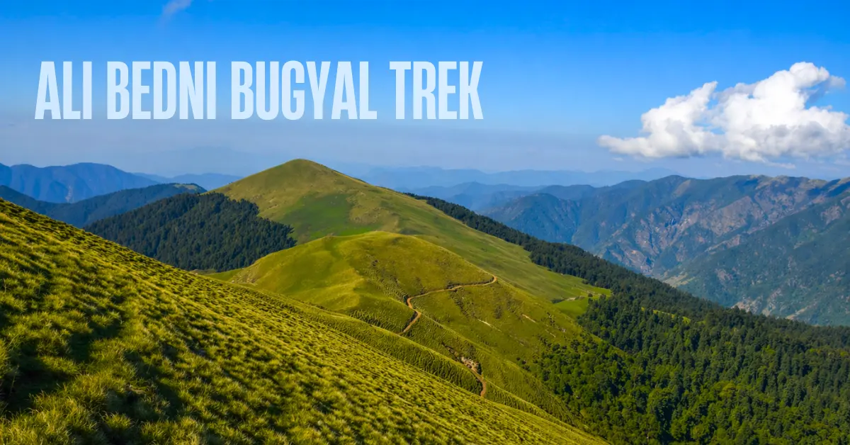
There are meadows. And then there is Ali Bedni Bugyal.
Two days. Two massive alpine meadows. Snow-capped peaks walking beside you the entire way. Soft grass under your feet. A sky so big it feels like it was made just for this place.
If you have ever wondered what it feels like to stand in the middle of the Himalayas with nothing between you and the mountains – this trek is your answer.
The Ali Bedni Bugyal trek, often pronounced as Aai Bedni by locals, is not just about meadows (bugyal). It takes you through dense forests with trees so wide it takes five people to wrap their arms around one. You cross the Neel Ganga stream, cold and crystal clear, on your very first day. You climb to Bedni Top at 12,550 ft – and that is where Mt. Trishul and Mt. Nanda Ghunti reveal themselves in full, rising 6,000 to 7,000 feet right in front of you.
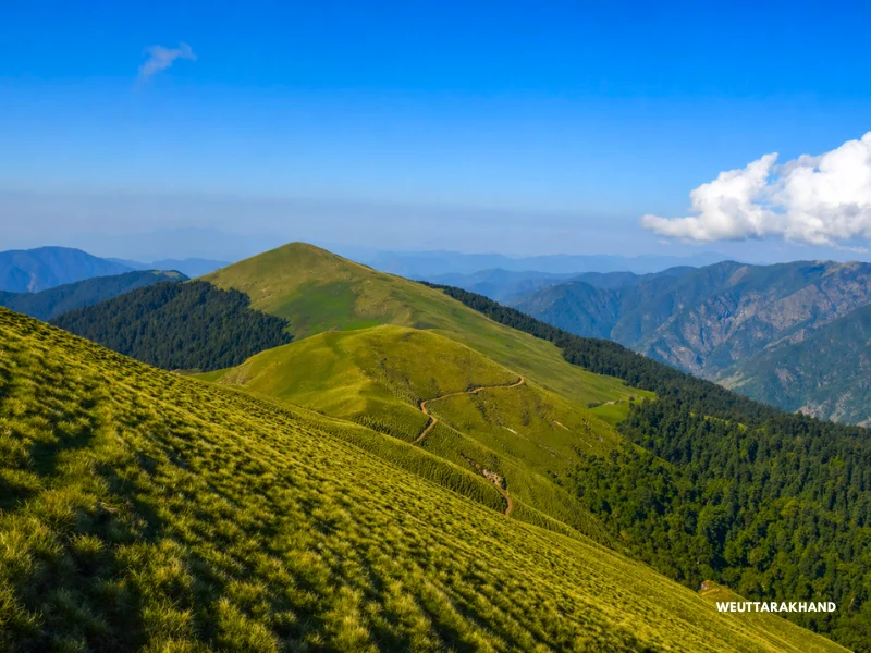
People have been known to stop walking and simply stare. Some with tears in their eyes.
The trek is 27.2 km over 4 trekking days. It starts from Wan village and the base camp is Lohajung, about 270 km from Rishikesh.
What most people also do not know is that this trail is part of the legendary Roopkund route. While Roopkund itself is no longer accessible, Ali Bedni Bugyal is the closest you can get to that iconic trail.
This is one of the finest meadow treks in the country. And one of the best introductions to Himalayan trekking for a beginner.
What Makes Ali Bedni Bugyal Special
1. Two Meadows, Two Days, One Unforgettable Experience
Most treks give you a meadow for an hour or two. Ali Bedni gives you two full days in two of the most stunning bugyals in Uttarakhand.
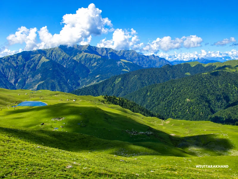
Day 3 is Bedni Bugyal. Vast, open, rolling grasslands above the treeline. Bedni Kund – a sacred lake – sits quietly in the middle of it. And just beyond the lake, at Bedni Top, the full face of Mt. Trishul and Mt. Nanda Ghunti appears in front of you.
Day 4 is Ali Bugyal. A straight, level walk along a wide meadowy ridge. The grass is so soft you will want to take off your shoes and walk barefoot. And the mountains – Trishul, Nanda Ghunti, Mrigthuni, Maiktoli – stay beside you the whole way.
Back-to-back days in the meadows, with the Himalayas for company. This is the kind of experience that stays with you for years.
2. Mt. Trishul and Mt. Nanda Ghunti Up Close
You get your first glimpse of Mt. Trishul from the clearing at Gehroli Patal on Day 2. It is a distant view, but it holds you.
Then on Day 3, as you approach Bedni Kund, the mountains grow. By the time you reach Bedni Top, they are right in front of you. Their entire face – 6,000 to 7,000 feet of sheer ice and rock – towers over the meadows. There is nothing between you and them.
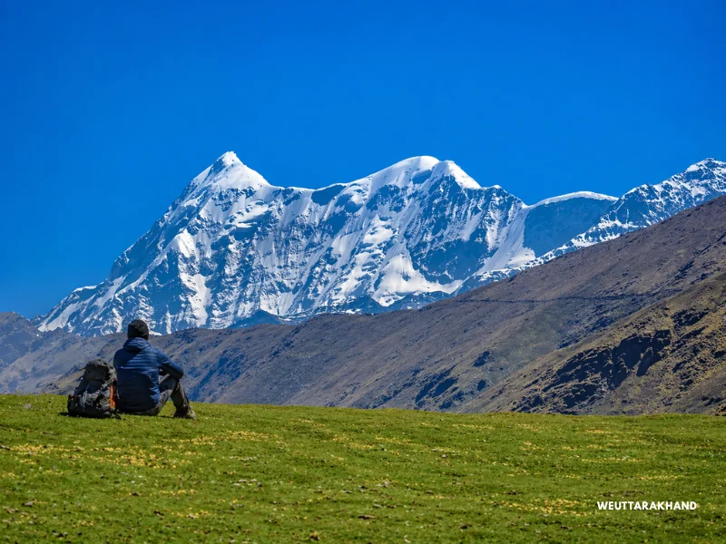
Watching the sunset on Mt. Trishul from the meadow is one of the most beautiful things you will ever see on a trek.
3. The Neel Ganga Stream
On your first day of trekking, the trail takes you down to the Neel Ganga. The bridge here is one of those quiet, perfect spots on any trek. Trees hang over the water. The stream tumbles over boulders in the shade. The water is icy cold and crystal clear.
Stop here. Wash your face. Drink the silence.
You will cross the Neel Ganga again on your way back. And both times, it leaves an impression.
4. Ancient Forests That Feel Like Another World
The forests on this trek are among the oldest and densest in Uttarakhand.
Near the Latu Devta temple, just 15 minutes into the trek, you will see cypress trees so wide it takes five to six people holding hands to wrap around one.
The Gehroli Patal section has a beautifully spaced oak forest – as if someone planted the trees deliberately, each one perfectly placed.
The forest on the return trail through Tithak is the complete opposite. Dense, raw, wild. Streams crisscross the path in every direction. Light filters through the canopy at angles that make photographers stop in their tracks.
Both forests are unforgettable. Just in very different ways.
5. The Abin Kharak Campsite
Not all campsites are created equal. Abin Kharak is special.
Tucked just off the edge of Ali Bugyal in a slight depression in the meadow, this campsite lets you step directly into the open grasslands.
The sunrises here – with the meadows turning golden and the peaks catching the first light – are something you will remember long after the trek ends. And the sunsets are equally breathtaking.
Very few campsites in the Himalayas offer views like this.
Quick Itinerary of Ali Bedni Bugyal Trek
| Day | Route | Distance | Duration | Altitude |
|---|---|---|---|---|
| Day 1 | Drive Rishikesh to Lohajung | 270 km | 10-11 hrs | — |
| Day 2 | Drive Lohajung to Wan + Trek to Gehroli Patal | 6.3 km | 6 hrs | 7,550 ft to 10,350 ft |
| Day 3 | Trek Gehroli Patal to Abin Kharak via Bedni Top | 5.6 km | 5-6 hrs | 10,350 ft to 11,145 ft via 12,550 ft |
| Day 4 | Trek Abin Kharak to Tithak via Ali Top | 5.7 km | 5 hrs | 11,145 ft to 10,515 ft via 11,600 ft |
| Day 5 | Trek Tithak to Wan + Drive to Lohajung | 7 km trek + 6 km drive | 6 hrs + 35 mins | 10,515 ft to 7,550 ft |
| Day 6 | Drive Lohajung to Rishikesh | 270 km | 10-11 hrs | — |
Day by Day Trail Guide
Day 1: Drive from Rishikesh to Lohajung
Drive Distance: 270 km
Drive Duration: 10-11 hours
The drive to Lohajung is long but beautiful. You pass through Devprayag, Rudraprayag, and Karnaprayag – each one a confluence where two rivers meet to form something greater. The road hugs the mountainside for most of the journey, with forests on one side and river gorges on the other.
Lohajung sits at 7,550 ft. It is a small village in the Chamoli district of the Garhwal Himalayas. The moment you step out of the vehicle, Nanda Ghunti peak greets you. If you arrive before sunset, the colours on the peak will stop you in your tracks.
The name Lohajung comes from a local legend. It is said that Goddess Parvati fought a battle (Jung) here with the demon Lohasur. The name translates to “war with Lohasur.”
There are a few small shops in Lohajung where you can buy basic items – jackets, gloves, caps. But do not rely on them for your trekking gear. Carry everything you need from home.
Rest well tonight. Tomorrow is a long climbing day.
Day 2: Drive from Lohajung to Wan. Trek to Gehroli Patal
Distance: 6.3 km
Duration: 6 hours
Altitude Gain: 7,550 ft to 10,350 ft
Difficulty: Easy to Moderate
Start the day with a short 45-minute drive from Lohajung to Wan village. This is where the trek begins.
The trail starts on a cemented path through a cluster of houses. Just 15 minutes in, you reach something remarkable – a grove of ancient cypress trees. These trees are hundreds of years old. One of them is so wide it takes four people to wrap their arms around it. Try it.
Just ahead, the trail forks. One path goes straight up to the ridge. The other takes a short detour to the Latu Devta temple.
Latu Devta is the local deity who is believed to protect the area. The mountain communities pay their respects here before going higher on the Nanda Devi Jat Yatra. Ring the temple bell. It is a small ritual but it means a lot to the people of this valley.
After the temple, rejoin the main trail and climb to Ranaka Dhar – the ridge above Wan. It takes 30 to 45 minutes. From the top of the ridge, you get a clear view of Lohajung, Wan village, and the valley stretching out below. A good spot to catch your breath.
From Ranaka Dhar, the trail descends to the Neel Ganga. The bridge here is a quiet, beautiful spot. Trees lean over the water. The stream rushes over boulders in the cool shade. The water is icy cold.
Stop here, fill your bottles, wash your face.
After the Neel Ganga crossing, the real climb begins. The trail winds up through dense oak and rhododendron forests. Dry leaves crunch under your feet. Walnut trees, pear trees, and wild Himalayan roses line the path. Watch for flycatchers and magpies darting through the branches.
This forest climb takes about 3 hours. It is steady and continuous but never brutal.
And then the forest opens into a clearing. A small green hut stands in the middle of it. And in the distance – Mt. Trishul, commanding and clear.
This is Gehroli Patal. Your camp for the night.
On a clear evening, the views from here are stunning. Set up camp, rest, and let the mountains settle into your mind.
Day 3: Trek from Gehroli Patal to Abin Kharak via Bedni Top
Distance: 5.6 km
Duration: 5-6 hours
Altitude Gain: 10,350 ft to 11,145 ft via 12,550 ft
Difficulty: Easy to Moderate
Today is the day that makes every effort worthwhile.
Start with a climb through oak and rhododendron forest. The trail ascends steadily.
And then, without warning, the trees end.
The treeline breaks. And you walk straight into Bedni Bugyal.
Nothing prepares you for this moment. You step out of the dark, dense forest and suddenly you are standing in the middle of a vast, open landscape. The sky is enormous. The grass stretches in every direction. And far across the bugyal, Bedni Kund – the sacred lake – sits quietly in the morning light.
Take a moment here. Just breathe.
From Bedni Kund, Bedni Top is just 800 metres away. This is the highest point of the trek at 12,550 ft. The final climb is short but steep.
And then you are at the top.
Mt. Trishul and Mt. Nanda Ghunti stand directly in front of you. Not as distant shapes. As full, towering mountains. Their entire faces – 6,000 to 7,000 feet of rock and ice – rise from the meadow below.
There is no other word for it. It is breathtaking.
Weather on the bugyal can shift quickly. One minute, blazing sunshine. The next, anxious clouds rolling in.
Keep your rain jacket accessible. Sometimes it rains for just a few minutes. Sometimes for a few hours.
From Bedni Top, descend back to the main trail. This is the historic Roopkund route. Follow it ahead.
The trail now heads towards Ali Bugyal, about 2 km away. The descent is gradual. A sharp ledge hugs the mountainside for a stretch. And then the meadows of Ali Bugyal open up.
Horses graze here in large numbers. Foals run freely across the grass. Clouds drift in from below, glide over the ridge, and slide down either side in slow, sweeping motions.
From Ali Bugyal, your campsite – Abin Kharak – is on the left side of the ridge. It sits in a gentle depression just off the bugyal.
Watch the sunset tonight. The sky here turns into something extraordinary.
Day 4: Trek from Abin Kharak to Tithak via Ali Top
Distance: 5.7 km
Duration: 5 hours
Altitude: 11,145 ft to 10,515 ft via 11,600 ft
Difficulty: Easy to Moderate
Take your time this morning.
Sit at the edge of the bugyal before you start packing. Let the meadows settle in. If you want to take off your shoes and feel the soft grass under your feet – do it. You may not be at 11,000 ft again for a while.
Climb about 200 metres from your campsite and you will come across some old stone shepherd huts. Just ahead is a small mound. Climb it.
From the top of that mound, Mt. Chaukhamba appears in the distance. Its shape is unmistakable – a massive, broad massif that stands apart from every other peak around it. You cannot miss it.
Turn left and keep walking on the bugyal. For the next 2 km, it is just you and these wide-open grasslands. Thick forest lines both sides, layer after layer of trees. But the meadow keeps going. It almost feels like it has no end.
When you reach Ali Top at 11,600 ft, you are at the highest point of the day.
Look around.
Mt. Trishul and Mt. Nanda Ghunti stand right in front of you now. This is one of the most beautiful stretches of trail in all of Uttarakhand. If the sky is clear, every photograph you take here will look like a painting.
From Ali Top, the trail retraces the route back to the shepherd’s hut. Turn left onto the ledge trail. In about 400 metres, you enter the forest.
This forest section is completely different from what you walked through on Day 2.
It is raw and wild. The trees are dense and untouched. Small streams crisscross the path every few minutes. Light filters through the canopy at unexpected angles – long beams of gold cutting through the green. It is a photographer’s paradise.
Walk through this forest for about 2 km until you reach Tithak. A small clearing in the middle of the trees.
This is your campsite for the night.
Quiet, hidden, and completely peaceful.
Day 5: Trek from Tithak to Wan. Drive to Lohajung
Distance: 7 km trek + 6 km drive
Duration: 6 hours trek + 35 mins drive
Altitude Loss: 10,515 ft to 7,550 ft
Difficulty: Easy to Moderate
The last trekking day begins with a steep zig-zag descent from Tithak. Your legs will know about it.
Trek about 700 metres from your campsite to reach Gehroli Patal again. From here, you retrace the same trail back to Wan.
The forest looks different on the way down. You notice things you missed on the climb – a hidden stream, a flowering shrub, a bird you did not catch before.
You lose more than 3,000 ft of altitude today. That puts real strain on your knees.
Use your trekking poles. Take your time on the steep sections.
The Neel Ganga will greet you again on the way down. Stop once more. It deserves a second visit.
From Wan, a short drive takes you back to Lohajung. You should reach by early afternoon.
Day 6: Drive from Lohajung to Rishikesh
Drive Distance: 270 km
Drive Duration: 10-11 hours
The drive back passes through the same beautiful mountain roads.
But this time, it feels different.
You have been to the meadows. You have stood in front of Trishul. You are carrying the mountains inside you now.
You reach Rishikesh by evening.
How Difficult Is the Ali Bedni Bugyal Trek?
This is an easy to moderate trek. It is one of the best introductions to Himalayan trekking for beginners who are reasonably fit.
Total trek distance is 27.2 km over 4 days. Total altitude gain is about 5,000 ft (from 7,550 ft to 12,550 ft). Every day has a combination of ascent and descent. No day is flat.
The hardest day is Day 2 – you gain nearly 3,000 ft in just 6 km. This is a continuous climb and it will test your fitness. Start early and go at a steady pace.
Day 3 involves a steep ascent just before the treeline breaks into Bedni Bugyal. It is short but sharp.
Overall, if you are reasonably fit and have trained consistently before the trek, you will manage this trail well.
Is the Ali Bedni Bugyal Trek Safe?
Yes – but come prepared.
Terrain Safety
The steep ascent on Day 2 from Wan to Gehroli Patal is the most demanding section. Take your time. Do not rush.
Use trekking poles on the way down – Day 5 has a steep descent that puts significant stress on the knees.
The Neel Ganga crossing is easy in normal conditions. But after heavy rainfall, the water level can rise quickly. If it has been raining continuously, cross with caution.
Altitude Safety
Bedni Top at 12,550 ft is above the altitude where Acute Mountain Sickness (AMS) becomes a real possibility.
AMS does not care if you are fit or experienced. It can affect anyone.
Watch for these warning signs:
- Persistent headache
- Nausea
- Dizziness
- Loss of appetite
- Weakness
- Poor sleep
If any of these appear – even mildly – do not push on. Descend and rest.
Stay well hydrated throughout the trek. Drink at least 3 litres of water daily.
Take half a tablet of Diamox (125 mg) every 12 hours starting from Rishikesh as a preventive measure.
Weather Safety
The weather above 10,000 ft can change fast. A clear morning can turn into heavy rain or even snowfall by afternoon – especially near Bedni Top.
Always carry your rain jacket where you can reach it quickly.
Continuous rainfall of 4 hours or more can make sections of the trail slippery and risky. Snowfall can cover the trail entirely and require fresh paths to be made.
If the weather turns bad, be ready to turn back or wait at the campsite.
Always start early on Day 3. You want to be at Bedni Top and back on the main trail before afternoon clouds set in.
Emergency Exits
Know your way out before you need it.
From anywhere on the trail, the safest exit is to retrace your route back to Wan village and then drive to Lohajung.
Alternatively, you can descend to Didna village for rest and recovery. But note – you will need to trek back to Lohajung from there.
The nearest Primary Health Center is in Dewal, about 30 km from Lohajung. It has basic facilities.
For more serious concerns, the hospitals in Gopeshwar (Chamoli district headquarters) are about 120 km away by road – a 4-hour drive. Rudraprayag is also an option and is faster to reach since it is mostly downhill from Lohajung.
Best Time to Do the Ali Bedni Bugyal Trek
The trek is open across multiple seasons – each one with its own character.
Spring (March to April)
The last patches of snow are melting. Fresh green leaves are just appearing. Red rhododendrons bloom all along the trail to Gehroli Patal.
The air is crisp and the skies are clear. Mountain views of Trishul and Nanda Ghunti are sharp and stunning.
One of the best times to come.
Summer (May to June)
This is the most popular time.
The meadows are at their greenest. Wildflowers of every colour – pink, yellow, purple, white – carpet the bugyal. June is when you see the best of it.
The days are long and the views are excellent.
Post-Monsoon (September to November)
After the monsoon, the skies become exceptionally clear. The mountains look their sharpest.
If you want the best mountain photography, choose this season.
The meadows turn golden in October and November – a whole different kind of beautiful.
Winter (December to February)
A completely different experience.
Snow settles under the oaks and rhododendrons in the forest. On the west-facing slopes, the early morning sun hits the snow at magical angles as you climb.
The meadows are buried under a thick white cover.
If you have winter trekking experience and are well-equipped, this season offers something rare and quiet.
Temperature Guide
| Season | Lohajung / Wan | Gehroli Patal | Bedni Top | Night Temperature |
|---|---|---|---|---|
| March-April | 12-18°C | 6-12°C | 1-5°C | -2 to 3°C |
| May-June | 18-22°C | 10-15°C | 3-8°C | 2-6°C |
| Sept-Nov | 10-18°C | 4-10°C | 0-4°C | -3 to 2°C |
| Dec-Feb | 2-8°C | -5 to 2°C | -10 to -5°C | -15 to -8°C |
Temperature drops significantly after sunset at every campsite. Always carry warm layers even if the daytime feels mild.
How to Reach Lohajung – Base Camp of Ali Bedni Bugyal Trek
Lohajung is 270 km from Rishikesh and takes 10 to 11 hours by road.
By Air
Fly into Dehradun (Jolly Grant Airport), about 1 hour from Rishikesh.
Take a taxi or shared auto from the airport. Taxis charge around Rs 800–1,000 to Rishikesh. Shared autos just outside the airport complex charge around Rs 300.
By Train
The Kota Express (Train No. 12401) from Hazrat Nizamuddin station in Delhi reaches Haridwar at 3:50 am.
From Haridwar, take a bus or shared taxi to Rishikesh – about 30 km. Buses run every 15 minutes.
Rishikesh to Lohajung
From Rishikesh, you can hire a private taxi for the full journey to Lohajung.
Alternatively, take a bus towards Karnaprayag and change to a local vehicle headed to Lohajung.
Important: Arrive in Rishikesh one day before your trek begins. This gives you rest and a buffer in case of travel delays.
Stay Options
At Lohajung
Several small guesthouses and homestays are available. Basic but comfortable. The village is small and welcoming.
At Rishikesh
Zostel is a popular choice for trekkers and solo travellers. Clean, safe, and well-located.
Budget around Rs 400–800 per bed or Rs 1,200 for a room.
Frequently Asked Questions
How long is the Ali Bedni Bugyal trek?
Total trekking distance is 27.2 km over 4 days. The highest point is Bedni Top at 12,550 ft.
Where does the trek start?
The trek starts from Wan village. Lohajung, about 6 km from Wan, is the base camp and the point where you stay the first and last nights.
Is this good for beginners?
Yes. This is one of the best beginner treks in Uttarakhand. The distances are manageable, the altitude is moderate, and the rewards are extraordinary.
That said, you need to be fit. Train specifically for the steep ascent on Day 2.
What is the connection to Roopkund?
Ali Bedni Bugyal lies on the traditional Roopkund trail. The same path that pilgrims and trekkers used to take to Roopkund lake passes through these meadows.
Roopkund itself is no longer accessible, but this section of the route remains open and is one of the most beautiful parts of that legendary trail.
Do you need any permits?
A forest entry fee may be applicable at the start of the trek. Check with local authorities or your guide for the latest requirements.
What is the best season for mountain views?
Post-monsoon – September to November – gives the clearest skies and the sharpest mountain views.
Spring is also excellent.
What other treks are nearby?
The Brahmatal Trek also uses Lohajung as its base camp. It is a winter trek at higher altitude.
The Bedni Kund and Roopkund trail also pass through the same starting point.
Final Thoughts
Ali Bedni Bugyal is one of those rare places that delivers more than you expect.
The meadows are grander than you imagined. The mountains are closer than you thought possible. And the forests are older and quieter than anywhere you have walked before.
Train well. Pack right. Come ready to be moved.