
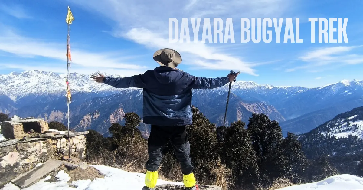
Uttarakhand’s Most Beautiful Meadow – Open Almost All Year
There is a moment on this trek that people talk about for years afterwards.
You have been walking through forest for a while. Dense oak and rhododendron. The trees are old and the canopy is thick. And then – without much warning – the trees end. The forest stops. And in front of you, rolling meadows stretch in every direction as far as you can see. Above them, the Gangotri range, Bandarpoonch, Kala Nag, Srikanth, Jaonli, Draupadi Ka Danda – all of them, right there.
That is Dayara Bugyal.
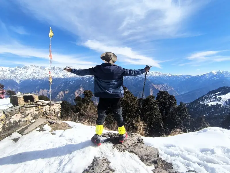
It is one of those places that makes you question why you do not do this more often.
Dayara Bugyal is a high-altitude meadow at 11,830 ft in the Uttarkashi district of Uttarakhand. The meadows are vast and rolling – they go over one hillock and continue beyond, and then beyond that. Trekkers regularly walk further and further into them, unable to stop, discovering more meadow at every turn.
What makes this trek even more special is its range. In winter, everything is white – the meadows, the trees, the trails. In spring, rhododendrons bloom and the last patches of snow melt into green grass. In summer, wildflowers cover every inch of the meadow. In autumn, the maples turn fiery red and the mountains appear in perfect clarity against a blue sky.
The trek is 21 km over 4 trekking days. Easy to moderate. Raithal village – 185 km from Dehradun – is the base camp. It is one of the finest treks for beginners and families in the entire Garhwal Himalayas.
What Makes Dayara Bugyal Special
1. Meadows That Feel Unreal
Most meadows have a size and a shape. Dayara Bugyal does not seem to have either.
The grasslands roll over hillocks in every direction, seamless and unending. There are no rocks or trees breaking the flow. The grass is soft underfoot. In spring and summer, wildflowers grow so densely that you have to deliberately step around them. In winter, the same landscape is buried under feet of soft, powdery snow.
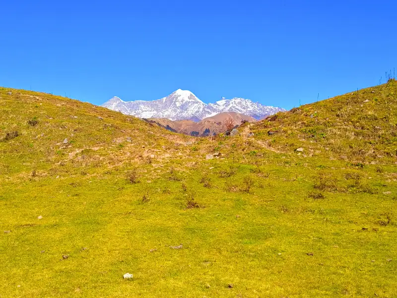
Trekkers who come here for the first time almost always walk further than they planned. The meadow keeps pulling you in, hillock after hillock, each one revealing more grassland beyond.
2. The Gangotri Range Up Close
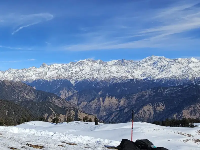
From the meadow of Dayara Bugyal, the Greater Himalayas appear without obstruction. Bandarpoonch is the dominant presence – its snow-covered slopes catching the light at every hour of the day. Kala Nag stands beside it. Srikanth, Jaonli, Draupadi Ka Danda, and the Gangotri peaks fill the rest of the panorama.
From Dayara Top at 11,830 ft, the view becomes a full sweep. The mountains are so close they seem like you could walk to their base in an hour.
This is the mountain view that defines the trek.
3. Ancient Forests Full of Character
The forest trails between Raithal and Gui are some of the most beautiful on any beginner trek in Uttarakhand.
Green oak, brown oak, rhododendron, maple, bamboo, and wild Himalayan cherry grow together in a rich, layered canopy. Giant roots hold the forest floor in place. Birdsong is constant. At night, the alarm calls of sambar deer carry through the silence. The Himalayan Monal is regularly spotted in these forests.
Unusually for this region, there are no pines in this section – which gives the forest a distinctive warmth and density.
The first pines only appear near a rain shelter close to Chilapada. And from there, the forest thins gradually until it opens completely into the treeless grasslands of Dayara.
Witnessing that transition – from dense ancient forest to open sky and mountains – is one of the finest moments on the trek.
4. Campsites That Deserve More Attention
Gui, Chilapada, and Nayata are all set in grassy clearings tucked inside the forest. Each one has a completely different character.
Gui has a small lake nearby. In summer, the lake reflects the sky. In winter, it freezes over. Village huts stand close to the campsite – used by locals in the summer months.
Chilapada sits right at the edge where forest meets meadow. The Himalayan peaks are visible from the camp. A short walk from Chilapada and you are already in Dayara Bugyal.
Nayata is surrounded by maple and rhododendron trees. Close to Barnala lake – a quiet, beautiful lake with a small Nag Devta temple beside it. In winter, the camp fills with snow and becomes a quiet, magical spot.
5. Good in Every Season
Very few Himalayan treks hold up across almost the entire calendar year. Dayara Bugyal is one of them.
The trail is open and worth doing in winter, spring, summer, and autumn. Each season looks and feels like a completely different trek. You could come back four times and have four entirely different experiences.
Only the monsoon months of July and August are best avoided.
Quick Itinerary
| Day | Route | Distance | Duration | Altitude |
|---|---|---|---|---|
| Day 1 | Drive Dehradun to Raithal | 185 km | 8-9 hrs | 7,142 ft |
| Day 2 | Trek Raithal to Gui | 4.5 km | 5 hrs | 7,142 ft to 9,630 ft |
| Day 3 | Trek Gui to Chilapada | 2.5 km | 3 hrs | 9,630 ft to 10,515 ft |
| Day 4 | Trek Chilapada to Nayata via Dayara Top | 9.5 km | 6-7 hrs | 10,515 ft to 9,186 ft via 11,830 ft |
| Day 5 | Trek Nayata to Raithal | 4 km | 4-5 hrs | 9,186 ft to 7,142 ft |
| Day 6 | Drive Raithal to Dehradun | 185 km | 8-9 hrs | – |
Day by Day Trail Guide
Day 1: Drive from Dehradun to Raithal
Distance: 185 km | Duration: 8-9 hours | Altitude: 7,142 ft
The drive from Dehradun to Raithal passes through some of the finest mountain scenery in Uttarakhand.
You leave Dehradun and within an hour you are passing through Mussoorie. The road continues beyond the hill station into the quieter mountain zones. Between Mussoorie and Uttarkashi, watch for a viewpoint commonly called Tingling Point. On a very clear day, this single stop gives you views of the entire Garhwal Himalayan range – from the Swargarohini massif near the Himachal border, across Bandarpoonch, the Gangotri peaks, Chaukhamba, all the way to Nanda Devi in the far east.
From Uttarkashi, the road continues to Bhatwari and then turns towards Raithal.
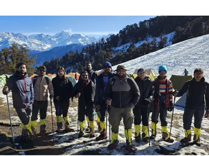
As you approach Raithal in the late afternoon, watch the peaks above the village. Bandarpoonch, Srikanth, Jaonli, and Draupadi Ka Danda catch the sunset light in brilliant shades of orange and gold.
Raithal sits at 7,142 ft – a small, traditional village with mountain views on every side. Walk around the village in the evening. Mt. Srikanth and the Gangotri peaks are visible directly from here. The forested hillside above the village leads all the way to Dayara Bugyal.
Rest well. The trek begins tomorrow.
Day 2: Trek from Raithal to Gui
Distance: 4.5 km | Duration: 5 hours | Altitude Gain: 7,142 ft to 9,630 ft | Difficulty: Easy to Moderate
The trail starts directly from Raithal village. The first section goes through the village fields before climbing into the forest. In about an hour, you reach a flat grassy clearing with a hand pump. This is a good water stop – fill your bottles here.
After the clearing, the forest takes over. Green oak and brown oak mix with rhododendrons to form a dense, layered canopy. There are no pines in this section – which gives these forests a richness and warmth that is unusual for this altitude. Giant roots hold the forest floor. The trail is well-defined throughout.
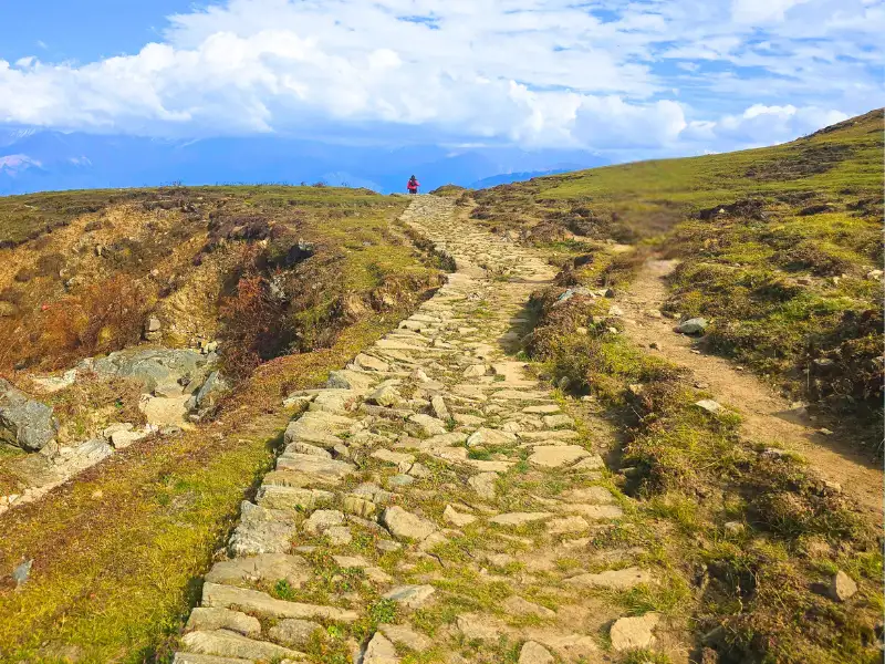
As you gain height, keep looking left where the mountain side drops away. The first views of Mt. Trishul appear on the horizon. And if the morning is clear, Srikanth and the Gangotri peaks begin to reveal themselves through gaps in the trees.
Water note: The first point to refill your water bottles is about 3 hours into the walk. The second is at lunch. Carry enough to cover the gap.
After a couple of small forest clearings, Gui campsite appears.
Gui sits in a clearing inside the forest. Village huts stand nearby – used by local families in summer. A small lake is close to the campsite. In winter the lake freezes. In summer it reflects the sky and the surrounding trees.
The forest around Gui is alive with birds. Walk slowly and quietly in the evening. Himalayan woodpeckers, flycatchers, and many other species are active here at dusk.
Day 3: Trek from Gui to Chilapada
Distance: 2.5 km | Duration: 3 hours | Altitude Gain: 9,630 ft to 10,515 ft | Difficulty: Easy
A short, gentle day. The trail is mostly flat with gradual ascent sections.
From Gui, join the main trail climbing towards Dayara. Within a short distance, you reach Gui Thatch – a small meadow in the forest with 5 to 6 shepherd huts on one side and a compact pond in front of them. Just beside the pond is a small mound.
The views from Gui Thatch are the best you have had so far. The entire Gangotri range is visible – Srikanth, Gangotri I, II, and III spread across the horizon. Look straight ahead for Jaonli peak. Look left and you can catch the top of Bandarpoonch just peeking above the ridge.
After Gui Thatch, the trail enters a beautiful section of rhododendron forest. The gradient is gentle here. The trees form a canopy above. In spring, the canopy turns dark pink and crimson with blooming flowers. In winter, the same branches bend under snow. This is a section worth walking slowly.
A couple of streams cross the trail – flowing, dried, or frozen depending on the season. Fill your bottles if they are running.
About 5 minutes after the streams, an umbrella-shaped rain shelter marks a rest point. Chilapada is 20 minutes from here.
Just 5 minutes past the rain shelter, watch for a smaller broken trail branching left from the main path. Take this turn. It leads directly to Chilapada – a small opening at the edge of the meadows.
From Chilapada, you can already see the start of Dayara Bugyal above you. The Chania huts of Chilapada Top are visible on the hill ahead. The mountains are now closer and more defined. Jaonli is directly visible from camp.
Short day. Beautiful camp. Rest well – tomorrow is the big day.
Day 4: Trek from Chilapada to Nayata via Dayara Top
Distance: 9.5 km | Duration: 6-7 hours | Altitude: 10,515 ft to 11,830 ft to 9,186 ft | Difficulty: Moderate
The day you have been building towards.
From Chilapada, climb through the last of the forest. Half an hour of walking and the treeline ends completely. The meadows of Dayara Bugyal open up.
This is the moment.
From the edge of the treeline, the meadows stretch ahead and in every direction – rolling, wide, unbroken. Bandarpoonch and Kala Nag rise directly above the far edge. All the peaks that have been with you since Raithal are now larger, closer, and more commanding.
In early summer, thousands of yellow, violet, and white wildflowers cover the meadow – sometimes so densely that you have to deliberately step around them. In winter, the same rolling hills are buried under feet of soft, powdery snow.
Walk into the meadows. Explore. The Chania huts are visible ahead – use them as your landmark but do not rush to them. Take at least a couple of hours wandering the meadows before you start the ascent to Dayara Top.
The climb to Dayara Top at 11,830 ft is the steepest section of the trek. In winter, the snow here can be several feet deep and the ascent becomes significantly more demanding. Take your time. Go steadily.
From Dayara Top, the view completes itself. The full Gangotri range, Bandarpoonch, Kala Nag, Srikanth, Jaonli, Draupadi Ka Danda – all of them in a single, unobstructed sweep. The rolling meadows below you, the mountains above. It is one of those views that makes the entire effort feel completely worthwhile.
After the top, retrace to the Chania huts. The trail to Nayata goes below the huts and immediately enters the forest. It is a well-laid descending trail. About 45 minutes of descent through the forest brings you to Nayata campsite.
Nayata is surrounded by maple and rhododendron trees. Barnala lake is a short walk away – a quiet, beautiful lake with a small Nag Devta temple beside it. In winter, the lake is frozen and the camp fills with snow. Evenings here are still and peaceful.
You have earned this rest.
Day 5: Trek from Nayata to Raithal
Distance: 4 km | Duration: 4-5 hours | Altitude Loss: 9,186 ft to 7,142 ft | Difficulty: Easy
The final trekking day. Mostly descent, through forest all the way.
From Nayata, continue on the main trail. The forest canopy is heavy and the light comes through in patches. The descent is gradual at first, then steeper in the lower sections. About 15 minutes down, you pass the rain shelter where the trail to Barnala lake branches off – continue on the main path.
About an hour into the descent, the grassy clearing with the water source appears. Stop here for a rest. It is a good place to sit for a while before the final stretch.
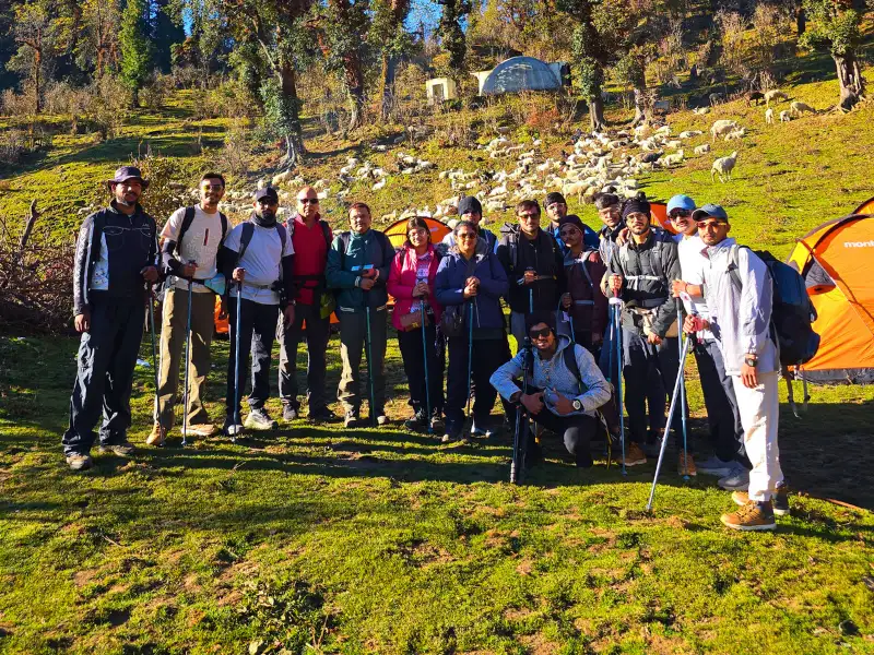
The last section descends more steeply to Raithal. The arch at the entrance of Raithal marks the end of the trek.
Walk through the village one more time. The mountain views that seemed so large and close from the meadows now frame the village from a distance. That shift in perspective – how different a mountain looks from its base versus from 11,000 ft above – is its own kind of memory.
Day 6: Drive from Raithal to Dehradun
Distance: 185 km | Duration: 8-9 hours
Start after breakfast. The same beautiful road takes you back through Uttarkashi, past Mussoorie, and down to Dehradun. Watch for Tingling Point on the return if the day is clear – the mountain views from there on the way back look different now that you have been up among them.
You reach Dehradun by early evening.
How Difficult Is the Dayara Bugyal Trek?
This is an easy to moderate trek. It is one of the best treks for beginners and families in Uttarakhand.
Total trekking distance is 21 km over 4 days. The highest point is Dayara Top at 11,830 ft. Total altitude gain is about 4,688 ft from Raithal.
The most demanding section is the Day 2 climb from Raithal to Gui – 2,488 ft gained in 4.5 km. This is a sustained ascent and will test your fitness early in the trek.
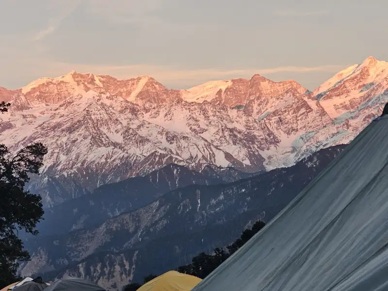
The final climb to Dayara Top on Day 4 is also steep. In winter, when snow covers the meadows several feet deep, this section becomes significantly harder.
Otherwise the trail is gradual, well-defined, and enjoyable throughout. Suitable for children and families in the summer months.
Is the Dayara Bugyal Trek Safe?
Yes – one of the safer high-altitude trails in the region.
Terrain Safety
The trail is well-made and clearly defined throughout. The main challenges are the steep climb to Gui on Day 2 and the summit approach to Dayara Top on Day 4.
In winter, snow on the meadow section can be several feet deep. The ascent to Dayara Top on deep snow is steeper and more demanding than the same trail without snow. Microspikes or crampons are strongly recommended for winter trekkers.
Altitude Safety
Dayara Top at 11,830 ft is above the altitude where Acute Mountain Sickness becomes a real possibility. The climb from Raithal to Gui on Day 2 gains 2,478 ft in 4.5 km – watch for AMS symptoms on this initial ascent.
AMS does not discriminate by fitness or experience. Watch for persistent headache, nausea, dizziness, loss of appetite, weakness, or disturbed sleep. If any of these appear, descend immediately.
Stay hydrated throughout. Drink at least 3 litres on trekking days. Take half a tablet of Diamox (125 mg) every 12 hours from Dehradun as prevention.
Weather Safety
Rain makes the forest trails slippery. Heavy or sustained rainfall can make stream crossings risky and campsites muddy and difficult.
Snowfall on the meadows above the treeline can cover the trail entirely. In peak winter, the snow on Dayara can be deep enough to make the summit climb very demanding. Start early on Day 4 to have maximum time on the meadow before afternoon weather changes.
Emergency Exits
If you have not yet passed Chilapada – retrace to Raithal.
If you are near Dayara Top or beyond – descend towards Barsu village. Note that evacuation from the farthest point on this trek can take 7 to 8 hours. Know your exit before you need it.
The nearest district hospital is in Uttarkashi – about 1 hour by road from Raithal. For more serious emergencies, Mussoorie or Dehradun are 8 to 9 hours away.
Best Time to Do the Dayara Bugyal Trek
Dayara Bugyal is one of the rare Himalayan treks that is genuinely excellent in four different seasons. Only the monsoon months are best avoided.
Winter (December to February)
Snow covers everything – the forests, the meadows, the campsites. The pine trees near Chilapada bend under the weight of snowfall. The meadow of Dayara is buried in soft, powdery snow and the undulating hills look completely different under white. Bandarpoonch and the Gangotri peaks appear crisp and sharp against cold, clear winter skies.
The camping experience in winter – sleeping on snow, watching sunrises over white mountains – is one of the finest available on any beginner trek in India.
Difficulty increases in winter. Microspikes required above the treeline. 5 warm layers needed.
Spring (March to April)
Snow melts slowly from the lower sections while the upper meadows still carry a winter cover. Rhododendrons bloom in the forest sections from mid-March. In the meadows, tiny wildflowers push through the receding snow. The colour contrast – white snow, green grass, pink flowers – makes spring a spectacular time for photography.
By mid-April the upper reaches still hold snow near Dayara Top while the lower campsites are fully green.
3 to 4 warm layers. A mix of snow and flowers – ideal for those who want both.
Summer (May to June)
The meadow is at its most vivid green. Thousands of wildflowers – yellow, violet, white – cover the bugyal so densely that you have to step carefully to avoid them. The air is warm and clear in the mornings.
The easiest and most family-friendly season. Views are good in the morning; afternoon haze is common. Nights are comfortable.
This is the best time to bring children for their first Himalayan experience. 3 warm layers.
Autumn (September to November)
Post-monsoon clarity. The skies are deep blue and the mountains are at their sharpest. Maple leaves turn fiery red in the forest sections – a signature Himalayan autumn sight against the backdrop of golden meadows. The views of Bandarpoonch and the Gangotri range from Dayara Top in autumn are the clearest of any season.
Trails are dry. Campsites are uncrowded after Diwali. The crisp, pine-scented air is invigorating.
4 warm layers. Highly recommended for photographers.
Monsoon (July to August): Avoid. Heavy rain makes trails slippery and difficult. The trek experience is significantly diminished.
Temperature Guide
| Season | Raithal | Gui | Chilapada | Dayara Top | Night Temp |
|---|---|---|---|---|---|
| Dec–Feb | 2–8°C | -3 to 3°C | -6 to 0°C | -10 to -5°C | -10 to -5°C |
| March–April | 13–17°C | 6–12°C | 2–8°C | -2 to 4°C | 0–5°C |
| May–June | 18–20°C | 12–16°C | 8–12°C | 4–8°C | 5–8°C |
| Sept–Nov | 12–15°C | 6–12°C | 2–8°C | 0–5°C | 2–5°C |
Temperatures drop sharply after sunset at all campsites. At Gui and above, nights are consistently cold regardless of season. Layer up before the sun goes down.
How to Reach Raithal – Base Camp of the Dayara Bugyal Trek
Raithal is 185 km from Dehradun and takes 8 to 9 hours by road.
The Route: Dehradun → Mussoorie → Uttarkashi → Bhatwari → Raithal
By Air: Fly to Dehradun (Jolly Grant Airport), about 28 km from the city. Take a taxi to Dehradun and then hire a vehicle to Raithal. A private taxi from Dehradun to Raithal is the most convenient option.
By Train: The Kota Express (Train No. 12401) from Hazrat Nizamuddin, Delhi reaches Haridwar early morning. From Haridwar, take a bus or taxi to Dehradun (30 km). Then hire a vehicle to Raithal via Uttarkashi.
By Bus: Buses from Rishikesh to Uttarkashi run regularly. From Uttarkashi, take a local bus or shared taxi towards Bhatwari and then to Raithal.
Tip: Arrive in Dehradun the evening before Day 1. A 6 to 7 am departure from Dehradun gets you to Raithal by evening with daylight to settle in.
Stay Options
At Raithal: Small guesthouses and homestays in the village. Simple, clean, and welcoming. Several families here have been hosting trekkers for years and know the trail well.
At Uttarkashi: A larger town with more hotel options at various budgets. Good if you want a more comfortable overnight before the drive to Raithal.
At Dehradun: Wide range of options. Zostel Dehradun is a popular pre-trek choice. Bunk beds from around Rs 400.
Frequently Asked Questions
How long is the Dayara Bugyal trek? The total trekking distance is 21 km over 4 days. The highest point is Dayara Top at 11,830 ft.
Is it suitable for beginners? Yes – it is one of the best beginner treks in Uttarakhand. The trail is gradual, well-defined, and the altitude gain is manageable. Train for the Day 2 ascent specifically.
Can families with children do this trek? Yes. Summer is the ideal family season – May and June. Children above 8 to 10 years who can walk 5 to 6 km comfortably manage this trek well.
Is it good in winter? Very good. Snow covers the trail from Raithal by late December. The meadow in winter is one of the finest snow experiences on any beginner trek in India. Carry microspikes, 5 warm layers, and waterproof shoes. Be prepared for a more demanding version of the trail.
What peaks can you see from Dayara Top? Bandarpoonch, Kala Nag, Srikanth, Jaonli, Draupadi Ka Danda, and the full Gangotri range. On very clear days, peaks from the Chaukhamba massif are also visible.
Is there water on the trail? Yes – streams cross the trail at several points. The first reliable water point on Day 2 is about 3 hours from Raithal. Always carry at least 2 litres from camp.
What is Barnala lake? Barnala lake is near the Nayata campsite. It is a quiet, peaceful high-altitude lake with a small Nag Devta temple beside it. Worth a short walk on the evening you arrive at Nayata.
Dayara Bugyal is the kind of place that makes you wonder why you do not do this more often.
The meadows are vast and beautiful. The forests are old and alive. The mountains are right there above you.
Come in any season. Come with family. Come alone. Just come once – and you will understand why people keep coming back.