
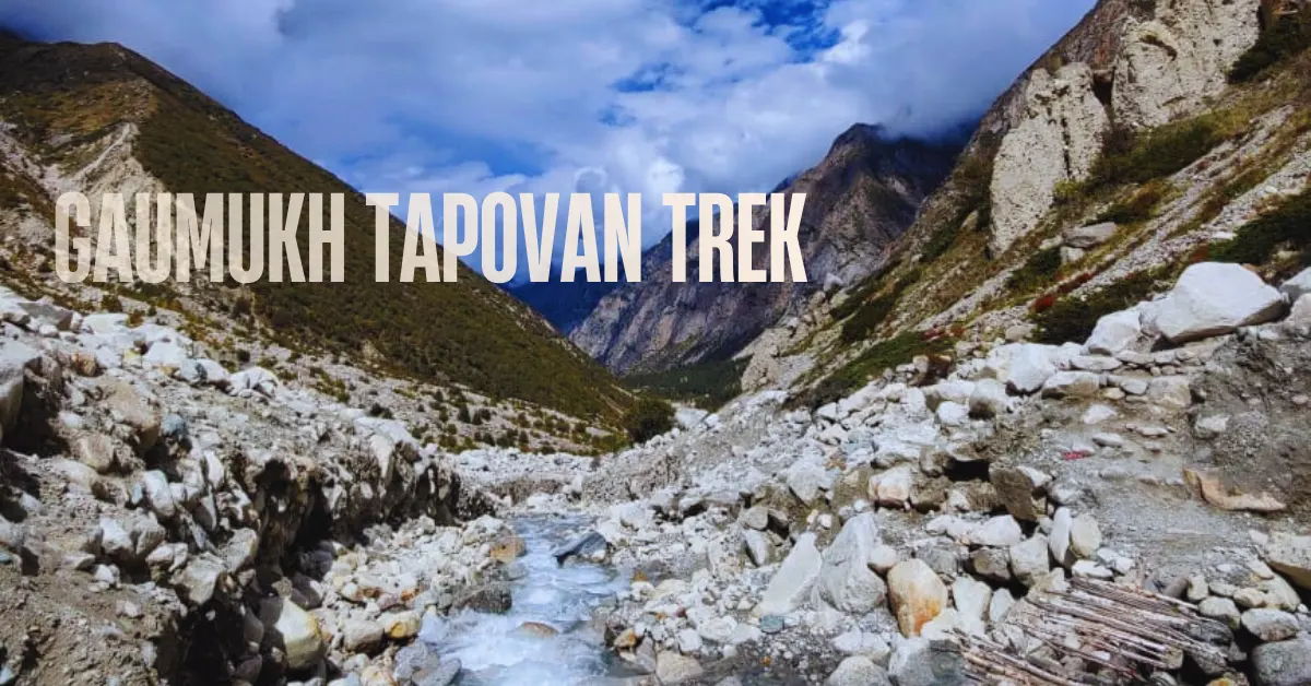
Some treks take you through beautiful landscapes. This one takes you to the beginning of a river.
The Gaumukh Tapovan trek is a journey to Gaumukh – the massive glacial snout where the Bhagirathi River emerges from the Gangotri Glacier and begins its journey to the plains. This is the origin of the Ganga. And standing here, watching a ten-storey wall of ancient ice crack and calve into roaring water, is one of the most powerful experiences you can have in the Indian Himalayas.
But this trek does not stop at Gaumukh. It climbs further – up the lateral moraines of the Gangotri Glacier, across rockfall zones, through a steep final push – all the way to Tapovan at 14,203 ft. And at Tapovan, something extraordinary waits. Mt. Shivling – arguably the most beautiful mountain in India – stands right in front of you. From base to summit. Its perfect pyramid shape rising out of the glacier below. At sunrise, when the first light touches its tip and the peak turns gold, trekkers have been known to cry.
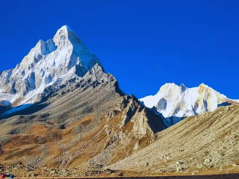
This is not a casual trek. The base camp at Gangotri sits at 10,050 ft – one of the highest starting points of any trail in Uttarakhand. You cross rockfall zones, navigate unstable terrain, and make a demanding final ascent to Tapovan. The total distance is 41 km over 6 trekking days. It is a moderate to difficult trek. Suitable for experienced trekkers who are well-prepared.
But for those who are ready – few treks anywhere in India deliver what Gaumukh Tapovan delivers.
What Makes Gaumukh Tapovan Special
1. Gaumukh – Where the Ganga is Born
Gaumukh means “cow’s mouth.” The name comes from the shape of the glacial snout from which the Bhagirathi pours out. And the sight is extraordinary.
A ten-storey wall of glacial ice stretches across the valley. Massive chunks break off and fall with a thunderous crack, sending tremors through the ground. The Bhagirathi rushes out from beneath in a powerful, roaring flow – cold, grey-blue, and overwhelming.
This is the source of one of the world’s great rivers. Standing here, watching it happen in real time, is humbling in a way that is difficult to describe.
The mythological story behind this place adds another layer. King Bhagirath is said to have prayed for the salvation of the souls of his 60,000 sons. Lord Shiva obliged and Goddess Ganga descended to earth – purifying the ashes of the king’s sons as she flowed. The river has carried this story for thousands of years.
2. Mt. Shivling at Tapovan – India’s Most Beautiful Peak
Opinions differ on which Himalayan peak is most beautiful. But Mt. Shivling – a sharp, elegant pyramid of rock and ice rising above the Gangotri Glacier – is consistently named among the finest shapes in the entire range.
At Tapovan, you see it from base to summit. No obstruction. No partial view. The full mountain, close and commanding.
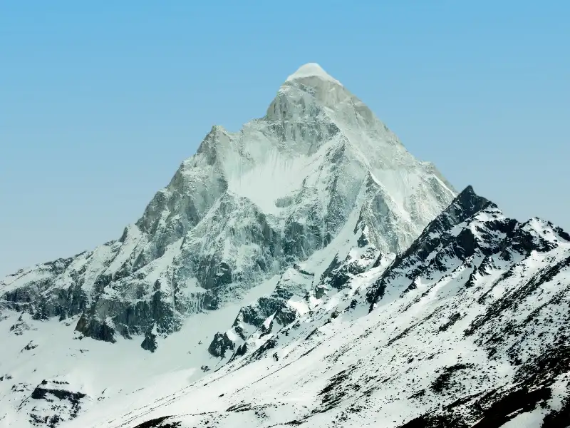
At sunrise, the first light touches the summit tip and slowly spreads downwards – gold, then orange, then the full warmth of morning across the entire face. Trekkers who have seen this rarely describe it without emotion.
3. The Bhagirathi Sisters – Alpenglow at Sunset
On the other side of Tapovan, the Bhagirathi massif rises in a grand, multi-peaked wall. At sunset, alpenglow sweeps across thousands of metres of rock and ice – turning orange, then gold, then deep purple as the last light of day fades.
Watching this from Tapovan campsite, with Mt. Shivling behind you and the Bhagirathi sisters in front, is one of the finest sunset experiences in Himalayan trekking.
4. The Trolley River Crossing
Between Bhojbasa and Gaumukh, you cross the Bhagirathi River on a trolley – a hand-pulled carrier strung on a rope across the water. The river rushes below you. The trolley sways. When the pullers pause, you hang mid-air over the flowing Bhagirathi.
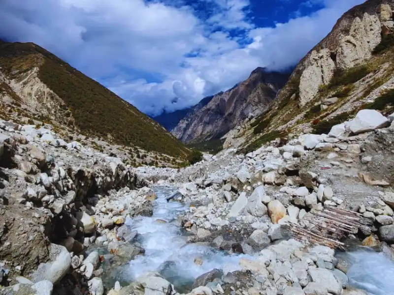
It is a controlled crossing. It is safe. But the thrill of being suspended over a roaring glacial river in the heart of the Himalayas is something entirely its own. Every trekker who has done this crossing talks about it afterwards.
5. Gangotri – A Spiritual Starting Point
The trek begins at Gangotri at 10,050 ft. The Bhagirathi flows past the town. The marble-white Gangotri temple stands at the edge of the water. Pilgrims from across India come here year-round.
Starting a trek from a place this sacred – with this much history, mythology, and natural beauty around you – sets the tone for everything that follows. There is a quality to Gangotri that stays with you as you walk.
Quick Itinerary
| Day | Route | Distance | Duration | Altitude |
|---|---|---|---|---|
| Day 1 | Drive Dehradun to Gangotri | 242 km | 8-10 hrs | 10,050 ft |
| Day 2 | Trek Gangotri to Chirbasa | 10 km | 6 hrs | 10,050 ft to 11,630 ft |
| Day 3 | Trek Chirbasa to Bhojbasa | 5 km | 3 hrs | 11,630 ft to 12,415 ft |
| Day 4 | Trek Bhojbasa to Tapovan | 6 km | 9 hrs | 12,415 ft to 14,203 ft |
| Day 5 | Trek Tapovan to Bhojbasa | 6 km | 5 hrs | 14,203 ft to 12,415 ft |
| Day 6 | Trek Bhojbasa to Gangotri | 14 km | 8 hrs | 12,415 ft to 10,050 ft |
| Day 7 | Drive Gangotri to Dehradun | 242 km | 8 hrs | – |
Day by Day Trail Guide
Day 1: Drive from Dehradun to Gangotri
Distance: 242 km | Duration: 8-10 hours | Altitude: 10,050 ft
The drive from Dehradun to Gangotri is a journey into the high Himalayas. You leave the city and within an hour you are in the mountains. The road passes through Mussoorie and then follows the Bhagirathi river all the way up to Gangotri.
The drive gets more dramatic as you approach Uttarkashi – a large town in the Uttarkashi district. After Uttarkashi, the road narrows and the mountains close in. The Bhagirathi runs deep and fast in the valley below. Beyond Harsil, the valley narrows further. The peaks above get taller and whiter. And then Gangotri appears.
Gangotri sits at 10,050 ft. The Bhagirathi flows past the town with real force. The Gangotri temple – white marble, traditional in its design – stands at the edge of the water. Pilgrims and trekkers mix in the small market. The air is cold and clean.
Important: You are already at 10,050 ft the moment you arrive. Give yourself time to rest and acclimatize. Do not overexert on the evening you arrive. Drink plenty of water. Eat a light dinner.
The mythology of this place runs deep. It is said that the sage-king Bhagirath performed penance here for thousands of years to bring the Ganga down from the heavens. The river that flows past the temple carries his name – Bhagirathi – until it reaches Devprayag, where it meets the Alaknanda and becomes the Ganga.
The trek begins tomorrow morning.
Day 2: Trek from Gangotri to Chirbasa
Distance: 10 km | Duration: 6 hours | Altitude Gain: 10,050 ft to 11,630 ft | Difficulty: Moderate
Start early from Gangotri.
The trail begins from the market area, heading left along the mountain ridge. About 2 km from the Gangotri bus stand, you reach the Forest Check Post where you register your permits. Carry your ID proof – it is checked here.
After the check post, a striking white peak appears in the distance. That is Sudarshan Parbat at 21,345 ft – part of a cluster of major peaks that will follow you for the rest of the trek.
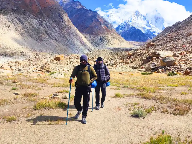
The trail stays on the left side of the mountain ridge throughout the day. The Bhagirathi runs below to your right, loud and fast. The first of several waterfalls and streams appears within 15 minutes of the check post. Small makeshift bridges cross some of them. Others you boulder-hop.
The gradient is mostly gradual with occasional level stretches. Blue pine and silver birch trees line the valley. The vegetation here is a surprise – taller and denser than most expect at this altitude.
After the third major stream crossing, the trail curves right and the valley opens up. Snow-capped peaks fill the horizon. Sudarshan Parbat disappears from view. The trail continues steadily for another 45 minutes.
A boulder zone marks the snout of a smaller glacier coming down from Sudarshan Parbat. Cross carefully. After the boulders, a short climb brings you to a series of small dhabas – a good rest stop.
Chirbasa is 15 minutes further, under forest cover. The name comes from the Chir pine trees that surround it. The campsite sits on level ground next to the Bhagirathi River. A GMVN hut is nearby. From Chirbasa, you get clear views of the Bhagirathi peaks – and in the distance, you can already see the mouth of the Gaumukh glacier.
Camp here for the night. The sound of the Bhagirathi running alongside the campsite is constant.
Day 3: Trek from Chirbasa to Bhojbasa
Distance: 5 km | Duration: 3 hours | Altitude Gain: 11,630 ft to 12,415 ft | Difficulty: Moderate
Water note: There are no water sources between Chirbasa and Bhojbasa. Carry 2 litres from camp.
A shorter day. But attention is needed on several sections.
Start from the trail behind the GMVN hut at Chirbasa. It reconnects with the main Gaumukh trail coming from the forest check post. Once on the main trail, you can see the Chirbasa campsite below you.
Within 10 minutes, the first potentially unstable section appears – “Kachha Dhaang” in local terminology. These are sections prone to landslides. Move through them without stopping. Do not rest here. Keep moving steadily.
After the first unstable section, the terrain is broken but manageable. The first ridge takes about 30 to 45 minutes to reach. The Bhagirathi peaks begin to loom larger as you cross it.
After another 20 minutes of gradual ascent, a stream appears on your left. Keep going. Another 45 minutes of similar terrain leads to the second unstable area – boulders and a stream crossing. Climb through carefully.
There are 8 to 9 landslide-prone bends on this section. They take 20 to 30 minutes total to traverse. The rule here is simple: keep your eyes up, keep moving, do not stop.
After crossing this section, a bridge over a stream appears ahead. Bhojbasa is 1.5 km from this bridge – a level, scenic walk.
About 300 metres before Bhojbasa, a natural vantage point opens up. The entire valley ahead is visible from here – wide, treeless, stark. The Gaumukh glacier is visible in the distance. It is a striking view after the enclosed forest sections of the previous day.
And then – for the first time – Mt. Shivling appears.
It rises above the far end of the valley in a clean, sharp pyramid. Just the tip at first. And then more of it as you descend to Bhojbasa.
Bhojbasa is the last campsite before Gaumukh and Tapovan. It is completely above the treeline – open, exposed, and beautiful. The Bhagirathi runs right beside the campsite. An SDRF camp and Forest Department office are located here – in case of any emergency, these are your first points of contact.
Tomorrow is the biggest day of the trek. Rest well.
Day 4: Trek from Bhojbasa to Tapovan
Distance: 6 km | Duration: 9 hours | Altitude Gain: 12,415 ft to 14,203 ft | Difficulty: Difficult
Start before dawn. This day takes 9 hours. Every hour of daylight matters.
From Bhojbasa, walk about half a kilometre to the Bhagirathi River. Here, the crossing begins.
A trolley – a hand-pulled carrier strung on a rope – carries you across. The river rushes and roars below. The trolley sways as it moves. When the pullers pause mid-crossing, you hang stationary above the water.
Forest officials have also installed a government trolley at this crossing point for self-guided trekkers. Use it carefully. Follow the instructions of whoever is managing the crossing.
The crossing takes about an hour for a full group. After everyone is across, the walk begins – about 2 km on a visible path through rocks and boulders on both sides.
Then comes the glacial approach. The trail climbs up the lateral moraines of the Gangotri Glacier. This is rough, broken terrain – boulders, loose gravel, uneven footing throughout. Walk steadily and carefully.
And then – Gaumukh.
The glacial snout rises in front of you. Ten stories of ancient ice, grey-blue and fractured. Massive chunks calve off the face with deep, cracking sounds that echo through the valley. The Bhagirathi pours out from beneath in a powerful, muddy-grey torrent.
This is the source of the Ganga.
Take your time here. Look at the scale of what you are seeing. The glacier stretches back kilometres into the mountains. The river that flows from under your feet will eventually reach Haridwar, Varanasi, and the Bay of Bengal.
After Gaumukh, the trail turns and begins the climb to Tapovan. You hit a rock face – the base of the final ascent. This is adjacent to Akash Ganga, a stream that falls vertically down the rock face.
Critical: Climb this section before noon. In the afternoon, rockfalls increase and the volume of Akash Ganga rises significantly. Start early enough to clear this section by 12 to 12:30 pm.
The ascent is steep – loose gravel on a sharp incline. About 100 metres up, cross Akash Ganga. If the water level is high, you may need to remove your shoes to cross. Otherwise, careful boulder hopping works. Take a rest and eat lunch after the crossing.
From here, the final 1.5-hour climb to Tapovan begins. It is steep and demanding. But the end is close.
And then Tapovan opens up.
A wide, relatively flat alpine meadow at 14,203 ft. Mt. Shivling rises to the right – from base to summit, close and perfect. Meru is behind Shivling. Sumeru to its left. The Bhagirathi peaks, Thenu, and Sudarshan Parbat fill the far left.
Find a suitable camping spot on the dry, solid ground – avoid areas close to Shivling that may be wet from glacial melt, especially in early summer.
Watch the sunset from Tapovan this evening. The alpenglow on the Bhagirathi sisters opposite is extraordinary. Orange, then gold, then deep purple as the light fades.
And in the morning – set your alarm for before dawn. The sunrise on Mt. Shivling is the reason people do this trek.
Day 5: Trek from Tapovan to Bhojbasa
Distance: 6 km | Duration: 5 hours | Altitude Loss: 14,203 ft to 12,415 ft | Difficulty: Moderate to Difficult
Before you leave Tapovan, take a short morning walk.
A 1.5 km walk from Tapovan towards the ridge connecting to Neelatal gives you exceptional views of Mt. Meru – a spectacular peak that is not fully visible from the main Tapovan campsite. If you walk to the small ashram visible from camp, Mt. Shivling appears even closer.
Manage your time to be back at camp by early afternoon.
Then the descent begins. The same route you came up – steep, loose, careful. The Akash Ganga crossing again. The rocky lateral moraine descent. The boulder sections.
Rockfall caution: The Akash Ganga section and the rock face below Tapovan are prone to rockfall, especially in the afternoon. Do not stop or rest in exposed sections. Move steadily and keep looking up.
After crossing the Bhagirathi by trolley, the trail continues back to Bhojbasa. The campsite is familiar now. The Bhagirathi beside it. The mountains behind you.
Rest here for the night. Tomorrow is a long final day of walking.
Day 6: Trek from Bhojbasa to Gangotri
Distance: 14 km | Duration: 8 hours | Altitude Loss: 12,415 ft to 10,050 ft | Difficulty: Moderate
The longest trekking day of the trek. But it is mostly descent and level walking – and the familiar trail moves faster on the way down.
From Bhojbasa, follow the same route back through the unstable boulder sections. Move through them without stopping, eyes up. After these sections, the terrain opens and the descent becomes more relaxed.
The Bhagirathi peaks stay visible behind you for much of the morning. The vegetation returns – first sparse, then the blue pine and silver birch of the Chirbasa section. The forest feels welcoming after the stark terrain above.
Through the waterfalls and stream crossings. Back past the Forest Check Post. And then the Gangotri market appears ahead.
14 km is a long distance to cover in a day. The trail is gradual and well-defined throughout, but pace yourself. There is no shortcut from Bhojbasa to Gangotri.
Day 7: Drive from Gangotri to Dehradun
Distance: 242 km | Duration: 8 hours
Start early. The drive back follows the Bhagirathi downstream – the same river whose source you stood at two days ago. The water looks different now. You know where it comes from.
You reach Dehradun by evening.
How Difficult Is the Gaumukh Tapovan Trek?
This is a moderate to difficult trek. It is suitable for experienced trekkers with prior high-altitude trekking experience.
Total trekking distance is 41 km over 6 days. The highest point is Tapovan at 14,203 ft. The base camp at Gangotri is already at 10,050 ft – meaning you are above 10,000 ft from the moment the trek begins.
The most demanding day is Day 4 – a 9-hour day that includes the trolley crossing, glacier approach, Gaumukh, the Akash Ganga rock face climb, and the steep final push to Tapovan. This day requires physical strength, mental endurance, and careful attention to timing.
Other serious challenges include multiple rockfall-prone sections between Chirbasa and Bhojbasa, the unstable boulder terrain on the glacier approach, and the sheer length of Day 6’s return – 14 km in a single day.
This is not a first Himalayan trek. Come with prior experience of multi-day high-altitude trekking. Come fit. Come prepared.
Is the Gaumukh Tapovan Trek Safe?
This is one of the more serious treks in Uttarakhand from a safety perspective. Knowing the risks before you go is essential.
Terrain Safety
Between Gangotri and Chirbasa: One large boulder section near the river has a sheer drop on one side. Guard rails are in place but extra caution is needed, especially in rain. Never rush this section.
Between Chirbasa and Bhojbasa: Multiple “Kachha Dhaang” sections – unstable landslide-prone terrain. Move through without stopping. Do not rest on exposed sections. Keep your eyes on the slope above.
Bhagirathi River Crossing: The trolley is the only way across after Bhojbasa. Follow the crossing procedure carefully. Handle the pulley mechanism as directed. Forest officials manage the government trolley – defer to their instructions.
The Akash Ganga Rock Face (Day 4): This is the most dangerous section on the trek. Rockfalls are common, especially in the afternoon. Climb this section before noon without exception. Do not rest on the rock face. If water level is high, take shoes off to cross – do not attempt a dry crossing when the stream is in full flow.
Tapovan to Bhojbasa Descent: The same rockfall risks apply on the descent. Keep moving through exposed sections.
Altitude Safety
Gangotri at 10,050 ft is one of the highest starting points of any trek in Uttarakhand. You are already above the AMS threshold from Day 1.
Tapovan at 14,203 ft is a serious altitude. AMS, HAPE, and HACE are all possible at this elevation. The itinerary’s gradual ascent helps – but acclimatization is not guaranteed.
Watch for all AMS symptoms throughout this trek: persistent headache, nausea, dizziness, loss of appetite, weakness, breathlessness at rest, dry cough, disorientation. If any appear – descend immediately. Do not wait.
Take half a tablet of Diamox (125 mg) every 12 hours from Dehradun as prevention. Drink at least 4 litres of water daily on trekking days.
The one-in-one-out rule applies strongly here: if you are not feeling right, turn back. There is only one exit point on this trek – Gangotri. Evacuation from Tapovan is extremely difficult given the terrain between it and the valley.
Weather Safety
Summer brings pre-monsoon rains that make rockfall sections significantly more dangerous. Avoid the trek from July onwards.
Autumn brings pre-winter snow at higher elevations, especially at Bhojbasa and Tapovan. By mid-October, the weather can become untenable above 12,000 ft.
Afternoon weather changes fast above the glacier. Always start early. Clear the Akash Ganga section and the rock face before noon regardless of conditions.
Emergency Information
The SDRF camp and Forest Department office at Bhojbasa can be contacted in emergencies. Mules and horses can be arranged from Bhojbasa to Gangotri for evacuation to the valley.
Beyond Bhojbasa, evacuation from Tapovan is extremely difficult due to terrain. This is not a trek where rescue is easy. Prevention is the only reliable safety strategy.
The nearest Primary Health Centre is at Harsil, about 25 km from Gangotri – basic facilities only. The District Hospital in Uttarkashi is about 100 km from Gangotri by road. For any advanced treatment, Dehradun is the destination.
Best Time to Do the Gaumukh Tapovan Trek
The trek is open in two seasons only – summer and autumn. Both are distinct and excellent in different ways.
Summer (Mid-May to End of June)
The most popular time. In early summer, snow still covers sections of the trail and natural snow bridges may still be in place over the Bhagirathi. The vegetation on the way to Chirbasa is turning green. The Bhagirathi runs at full strength from the melting glaciers – the river at Gangotri and along the trail is powerful and loud.
By late May and early June, the snow has mostly retreated and the trail is clear. This is when the trek is at its most accessible.
Avoid from July – the monsoon brings constant downpours that make the rockfall sections genuinely dangerous. The pilgrimage season means significant crowds on the trail to Gaumukh in summer, though the trail to Tapovan is quieter.
Requires 3 warm layers. Day temperatures 15 to 20°C. Nights near 0°C.
Autumn (Mid-September to Mid-October)
A shorter but exceptional window. Skies are clear and stable after the monsoon. The Bhagirathi runs a gentler, deeper blue – glaciers slow down as temperatures drop. The vegetation on the Chirbasa section turns yellow, brown, and maroon. The mountain views are at their sharpest and most vivid of the year.
The trail is significantly less crowded in autumn. Fewer pilgrims, fewer trekkers. The experience of Gaumukh and Tapovan in autumn solitude is deeply different from the summer.
By mid-October, pre-winter snows arrive at the higher elevations. The season closes quickly. Do not plan for late October.
Requires 4 to 5 warm layers. Temperatures at Tapovan can drop to minus 3 to minus 5°C at night.
Temperature Guide
| Season | Gangotri | Chirbasa | Bhojbasa | Tapovan | Night at Tapovan |
|---|---|---|---|---|---|
| May–June | 15–20°C | 10–15°C | 6–12°C | 4–8°C | -2 to 2°C |
| Sept–Oct | 12–15°C | 8–12°C | 4–8°C | 2–6°C | -5 to -3°C |
Temperature drops significantly with every camp gained. Tapovan at 14,203 ft is cold and exposed. Even in summer, nights at Tapovan require serious warm layers.
What to Pack for the Gaumukh Tapovan Trek
This is a serious high-altitude trek. Your gear needs to be right. Do not cut corners.
Footwear
Sturdy trekking shoes with ankle support and excellent grip are essential. Waterproof shoes are strongly recommended – the Akash Ganga crossing may require wading through water and the glacier approach is wet.
Gaiters are recommended for the boulder and moraine sections.
Tip: The Trek series and MH series by Decathlon are reliable. For this trek specifically, waterproof options are worth the extra cost.
Backpack
A 55–60 litre backpack with good hip and shoulder support. This is a 6-day trekking trip at altitude. You carry everything yourself – pack thoughtfully but completely.
Clothing
Base Layer: 3 full-sleeve dry-fit T-shirts. Synthetic only.
Mid Layers: 2 light fleece jackets and 1 warm full-sleeve sweater.
Outer Layer: 1 padded jacket with a hood. Wind-blocking is essential above the treeline.
Bottoms: 2 pairs of quick-dry trek pants.
Summer: 3 warm layers minimum. Autumn: 4 to 5 warm layers. Thermal inners are mandatory for autumn trekkers.
Accessories
- Sunglasses with UV protection – absolutely mandatory above the glacier and at Tapovan. Glacier glare causes snow blindness quickly
- Sun cap – for open sections in summer
- Woollen cap or balaclava – covers ears and neck; essential at Bhojbasa and Tapovan in all seasons
- Warm waterproof gloves – mandatory; fingers are exposed on boulder sections and at the river crossing
- 3 pairs of socks – two synthetic, one wool pair for Tapovan nights
- Headlamp – Day 4 starts before dawn; a headlamp is essential
- Trekking poles (a pair) – the boulder and moraine sections are much safer with poles. The Day 6 descent of 14 km is kinder on the knees with poles
- Gaiters – for the glacier moraine sections
- Rainwear – poncho or rain jacket; summer pre-monsoon rain is common
Personal Medical Kit
- Diamox (2 strips) – half tablet every 12 hours from Dehradun. Continue through Tapovan. Do not stop early
- Dolo 650 (10 tablets) – for fever or mild pain; carry more on this trek than others
- Combiflam (5 tablets) – for muscle strain
- Avomine (4 tablets) – motion sickness on the long drive
- Digene (6 tablets) – indigestion; common at altitude
- ORS (8 packs) – one pack every trekking day; hydration is critical at this altitude
- Cough drops – the dry altitude air and glacier exposure commonly trigger coughs
- Knee brace – the Day 6 descent of 14 km makes this worthwhile if you have any knee history
How to Get Fit for the Gaumukh Tapovan Trek
Start training 6 to 8 weeks before the trek. This is not a trek to approach under-prepared.
Running: Target 5 km in under 35 minutes. Run 5 times a week. Build distance and pace progressively.
Stair climbing: Climb 20 floors without stopping. The Akash Ganga rock face and the final push to Tapovan both require serious sustained uphill strength.
Walking: Walk 12 to 15 km continuously at a brisk pace. Day 6 is 14 km – your body needs to be ready for this distance at the end of a 6-day trek.
Strength training: Squats, lunges, and core work will help significantly on the boulder and moraine sections, which require balance and leg strength, not just endurance.
This is not a beginner trek. Prior experience of at least two or three high-altitude multi-day treks is strongly recommended before attempting Gaumukh Tapovan.
How to Reach Gangotri – Starting Point of the Trek
Gangotri is 242 km from Dehradun and takes 8 to 10 hours by road.
The Route: Dehradun → Mussoorie → Uttarkashi → Harsil → Gangotri
By Air: Fly to Dehradun (Jolly Grant Airport), about 28 km from the city. Take a taxi to Dehradun and then hire a vehicle to Gangotri. A private taxi from Dehradun to Gangotri is the most practical option given the remote location.
By Train: The Kota Express (Train No. 12401) from Hazrat Nizamuddin, Delhi reaches Haridwar early morning. From Haridwar, take a bus or taxi to Dehradun (30 km). From Dehradun, hire a vehicle to Gangotri via Uttarkashi.
By Bus: Buses run from Rishikesh and Haridwar to Uttarkashi. From Uttarkashi, local buses and shared taxis go to Gangotri in summer and autumn. However, for the start of a demanding trek, a private vehicle is worth the additional cost.
Tip: Gangotri temple is closed in winter and opens in May for the summer season. Confirm the temple opening dates if you are planning a May trek – the road access and services at Gangotri are linked to the pilgrimage season.
Permits: You need to register at the Forest Check Post about 2 km from the Gangotri bus stand. Carry a government-issued photo ID. This is mandatory and checked.
Stay Options
At Gangotri: Guesthouses and dharamshalas are available throughout the town. Basic to moderate comfort. The pilgrim infrastructure means there are enough options even in peak season. Arrive the evening before and rest at altitude before starting the trek.
At Harsil: A beautiful village about 25 km before Gangotri. Several guesthouses available. An option if you want a more peaceful overnight before the Gangotri arrival.
At Uttarkashi: The largest town on the route. Multiple hotel options at all budgets. A good overnight if you are arriving late from Dehradun.
Frequently Asked Questions
How long is the Gaumukh Tapovan trek? Total trekking distance is 41 km over 6 days. The highest point is Tapovan at 14,203 ft. The base camp at Gangotri starts at 10,050 ft.
Is this suitable for beginners? Not recommended for first-time trekkers. Prior experience of at least 2 to 3 high-altitude Himalayan treks is needed. The altitude from Day 1, the rockfall zones, the glacier terrain, and the demanding Day 4 all require experience and fitness.
What is Gaumukh? Gaumukh – meaning “cow’s mouth” – is the snout of the Gangotri Glacier from which the Bhagirathi River emerges. It is the source of the Ganga. A massive wall of glacial ice from which huge chunks regularly calve off into the river below.
What is Tapovan? Tapovan is a high-altitude alpine meadow at 14,203 ft, directly below Mt. Shivling. It has been a place of meditation for sages for centuries. Several holy men live here permanently. The views of Mt. Shivling and the Bhagirathi massif from Tapovan are among the finest in the entire Himalayas.
What is the trolley crossing? Between Bhojbasa and Gaumukh, a government-operated trolley carries trekkers across the Bhagirathi River where no bridge exists. It is a rope-and-pulley hand-pulled carrier. Safe, but genuinely thrilling mid-crossing.
What time should you start Day 4? Before dawn – ideally 4 to 5 am. The Akash Ganga rock face and the section above it must be cleared before noon to avoid afternoon rockfalls and rising water levels. Starting late on Day 4 is one of the most common and serious mistakes on this trek.
When does Gangotri open and close? Gangotri temple opens in May (exact date varies each year – usually around Akshaya Tritiya) and closes in November. The trek is only done in summer (mid-May to end June) and autumn (mid-September to mid-October). Do not attempt outside these windows.
Gaumukh Tapovan is not the easiest trek in Uttarakhand. It demands fitness, experience, and respect for the terrain.
But it gives back something that most treks cannot. You stand at the source of a river that has defined a civilization for thousands of years. You watch ice become water become river. And above you, Mt. Shivling rises in the first light of dawn – and you understand why people have been coming to this place for centuries.
Come prepared. Come ready. And come with the understanding that some places need to be earned.