
Uttarakhand’s Trek of the Year – And One of Its Best Kept Secrets
Not every beautiful trek in Uttarakhand is famous. Some are quietly waiting for the right people to discover them.
Gulabi Kantha is one of those treks.
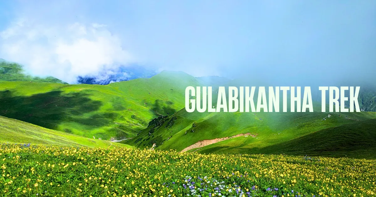
Named Trek of the Year 2025-26 by the Uttarakhand government, Gulabi Kantha Trek sits in the Yamuna Valley – close to Yamunotri, close to Dodital, yet completely off the radar of most trekkers. While thousands crowd the popular trails every season, Gulabi Kantha remains quiet, uncrowded, and absolutely stunning.
The name itself tells you something. Gulabi means pink. Kantha means mountain or hill. In spring, the entire mountain turns pink and red with blooming rhododendrons – and the locals named it exactly what they saw.
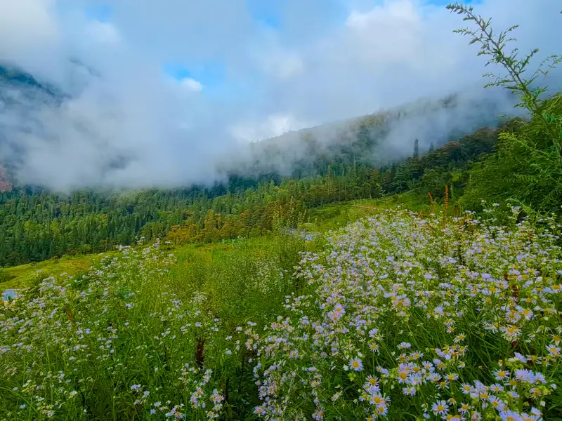
Gulabi Kantha is one of the rare Himalayan trails that is genuinely good in every season. In summer, lush green meadows and Himalayan wildflowers. In monsoon, waterfalls everywhere and a deep, almost electric green landscape. In winter, a thick blanket of snow over wide open meadows that have serious potential as a ski destination. In spring, the rhododendrons.
The summit at 12,000 ft gives you a 360-degree view of Bandarpoonch, Black Peak, Swargarohini, Chaukhamba, Kalindi Sirkala, and the Gangotri range. On the other side of the summit, the Darba Pass leads towards Dodital – the sacred lake that is the abode of Lord Ganesha.
The total trek distance is 26 km over 4 trekking days. It is easy to moderate. Suitable for beginners with reasonable fitness.
This is a trek that deserves far more attention than it gets. And that is exactly why you should do it now – before everyone else finds out.
What Makes Gulabi Kantha Special
1. Trek of the Year 2025-26
The Uttarakhand government named Gulabi Kantha one of its Treks of the Year 2025-26. It is a recognition that was a long time coming.
This is a trail with everything – mountain views, meadows, forests, wildlife, cultural villages, and a summit worth reaching. The award simply put a name to what those who have been here already knew.
2. A 360-Degree Summit View – Including Peaks You Rarely See
The summit of Gulabi Kantha at 12,000 ft is not a narrow viewpoint. It is a wide, open top with the entire Garhwal Himalayan range spread out around you.
Bandarpoonch and Black Peak to the northwest. Swargarohini, unmistakable in its shape. Chaukhamba in the distance. The Gangotri range stretching across the horizon. Srikanth, Kalindi Sirkala – peaks that most trekkers never see this close.
And on the far side, the route towards Dodital through Darba Pass.
This is a summit that rewards you with one of the most complete Himalayan panoramas in Uttarakhand.
3. Seema Thatch – A Meadow That Could Become a Ski Destination
Seema Thatch is the campsite before the summit. And it is extraordinary.
Wide, open meadows stretching for kilometres in every direction. In summer, they are covered in Himalayan wildflowers – Blue Poppy, Rain Lily, Paper Cup Flower, Himalayan Fleabane. In winter, the same meadows fill with deep snow. The gradient and the snowfall here are ideal for skiing. There is genuine potential for Seema Thatch to become a ski destination in the future.
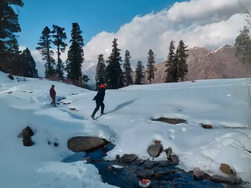
Very few trekking meadows in Uttarakhand have this quality – beautiful in summer and equally stunning under winter snow.
4. Nishni Village – A Living Piece of Yamuna Valley Culture
You pass through Nishni Village on Day 2. It is the first and last village on the trek.
The houses here are built using an ancient interlocking system of rock and wood – no cement, no modern material. They stay cool in summer and warm in winter. They have withstood earthquakes. This way of building is rare and almost forgotten in most parts of the Himalayas.
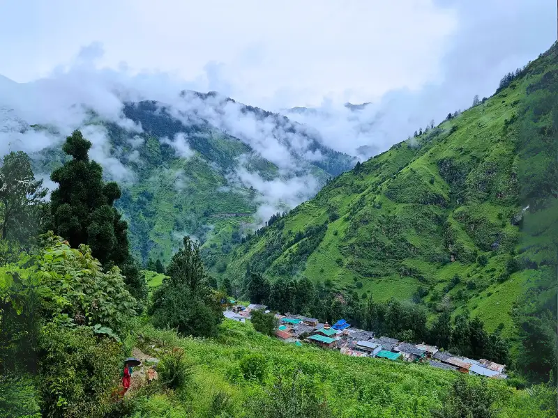
Walking through Nishni is not just a rest stop. It is a window into a way of life that has stayed largely unchanged for centuries.
5. Truly Uncrowded
This is one of the least-visited treks in the Uttarkashi region – despite being close to one of Uttarakhand’s most important pilgrimage sites, Yamunotri.
Most trekkers rush past Hanuman Chatti on their way to the temple. Very few turn up the trail towards Gulabi Kantha. The forests, meadows, and campsites here see a fraction of the footfall that nearby popular treks receive.
That solitude is itself a highlight.
Quick Itinerary for Gulabi Kantha Trek
| Day | Route | Distance | Duration | Altitude |
|---|---|---|---|---|
| Day 1 | Drive Dehradun to Barkot | ~180 km | 6-7 hrs | – |
| Day 2 | Drive Barkot to Hanuman Chatti + Trek to Kandola Chhani | 5 km | 4-5 hrs | Gradual to Moderate |
| Day 3 | Trek Kandola Chhani to Seema Thatch | 6 km | 4 hrs | Gradual to Moderate |
| Day 4 | Summit Push to Gulabi Kantha + Descend to Kandola Camp | 8 km | 6-7 hrs | Up to 12,000 ft |
| Day 5 | Trek Kandola Camp to Hanuman Chatti + Drive to Dehradun | 5 km trek | 2 hrs | Descent |
Day by Day Trail Guide
Day 1: Drive from Dehradun to Barkot
Drive Distance: ~180 km | Duration: 6-7 hours
The drive to Barkot is the first reward of this trek. You leave Dehradun and head up through Mussoorie – the road winds through the hill station and out the other side. Kempty Falls is the first major stop. The falls tumble down a rocky face surrounded by green hills. A good place to stretch your legs and have breakfast before the longer drive ahead.
After Kempty Falls, the road crosses the Yamuna Bridge. From here, the entire journey follows the Yamuna river. The water runs deep and clear in the valley far below the road. You pass through Nainbagh – the gateway to the Nag Tibba weekend trail. Then through Damta and Barnigad. At Barnigad, a cold water stream called Gangnani runs alongside the road – local folklore calls it a tributary of the Ganga.
At Naugaon, the road forks. The left road goes to Purola Valley and Sankri – the base camp for Kedarkantha and Har Ki Dun. Your road goes right, towards Barkot.
Just before Barkot, watch the left side of the road. Bandarpoonch Peak will appear suddenly above the treeline. That first glimpse of a 20,000 ft mountain stops people mid-conversation.
Barkot is a small town with a comfortable, unhurried pace. Check into your hotel. Take an evening walk through the town. The surrounding hills and the valley below look beautiful in the evening light.
Day 2: Drive from Barkot to Hanuman Chatti. Trek to Kandola Chhani.
Drive: 30 km | Trek Distance: 5 km | Duration: 4-5 hours | Difficulty: Gradual to Moderate
After breakfast, a 30-minute drive takes you from Barkot to Hanuman Chatti. This small settlement sits at the confluence of the Hanuman Ganga and the Yamuna rivers – about 13 km before the famous Yamunotri Dham.
The trek begins right here.
The trail starts alongside a water stream and passes through a forest trail. Within 3.5 km, you reach Nishni Village.
Stop here. Take your time.
Nishni is the only village on the entire Gulabi Kantha trail. The houses are built with an ancient interlocking system of flat stones and deodar wood beams – layered alternately without a drop of cement. The walls are thick. The construction is designed to flex in earthquakes rather than collapse. These houses have stood for generations.
Walk through the lanes. The wooden facades, the stone pathways, the views of the surrounding mountains and valley – this village alone justifies the drive from Dehradun.
After Nishni, the trail climbs to the top of a small ridge above the village. From here, you get a sweeping view back down – the village, the valley, the mountains beyond it. A perfect photo stop.
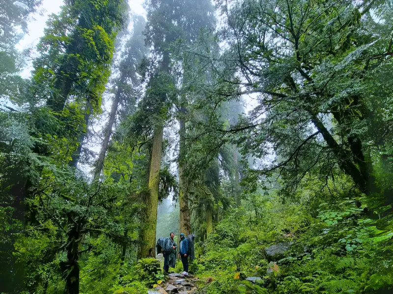
The trail then enters a forest of giant trees. It feels dense and ancient – the kind of forest that makes you walk slower and quieter. You cross several water streams on the way. Each one is clean and cold.
Kandola Chhani appears after the forest – a wide grassland ringed by deodar trees on all sides. The treeline forms a perfect natural border around the meadow. Shepherd huts stand in the clearing. Small apple orchards dot the edges.
This is your campsite for the night. In the evening, walk around the meadow. The light at this altitude in the late afternoon is warm and golden. The mountains show themselves above the treeline.
Day 3: Trek from Kandola Chhani to Seema Thatch
Distance: 6 km | Duration: 4 hours | Difficulty: Gradual to Moderate
A beautiful day of walking through forest and meadow.
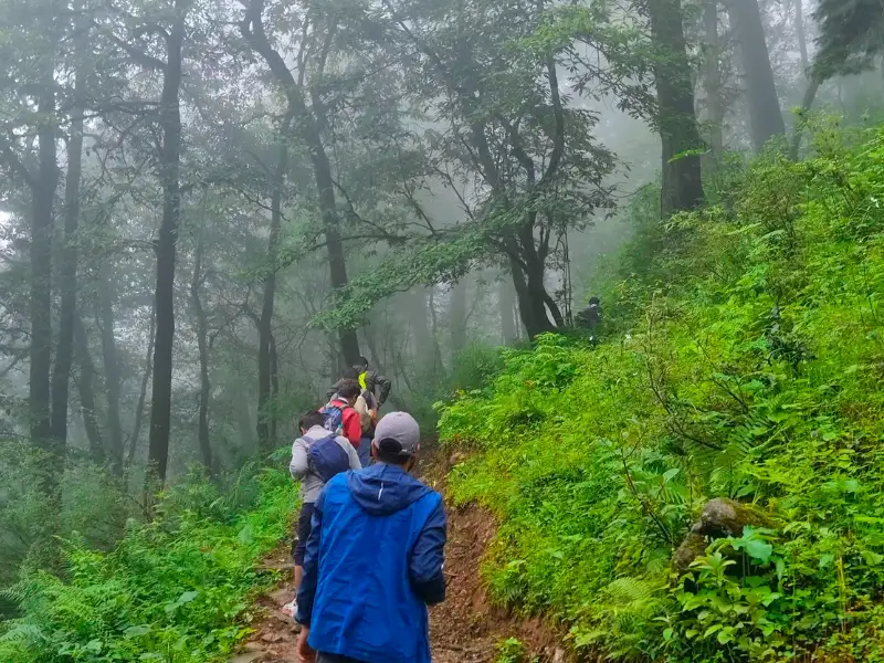
The trail climbs through dense forest from Kandola. The trees are tall and the canopy is thick. The forest floor is covered in moss and fallen leaves. You move in and out of small clearings as you gain altitude.
And then the forest opens completely.
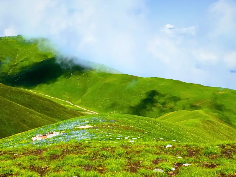
Seema Thatch appears ahead – vast, rolling meadows stretching for kilometres in every direction. The treeline drops away behind you and suddenly the sky is enormous.
In summer, these meadows are covered in wild Himalayan flowers. Blue Poppy, Rain Lily, Paper Cup Flower, Himalayan Fleabane – a carpet of colour that makes this trail a genuine alternative to the Valley of Flowers in terms of wildflower variety and density.
In winter, the entire meadow fills with deep, clean snow. The gradient and the snowfall pattern here make Seema Thatch ideal for skiing. There is genuine talk of developing it as a ski destination in the future – and when you stand here in winter, you understand exactly why.
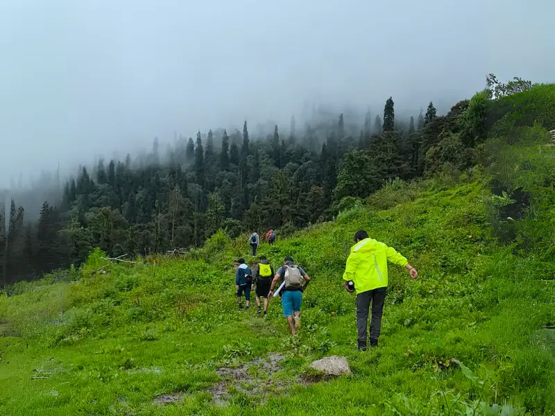
You arrive at camp before lunch. After eating, take an evening walk across the meadow. The Himalayan peaks visible from the campsite edge include Bandarpoonch and Swargarohini – appearing large and close above the far end of the meadow.
Tonight you sleep in a tent at high altitude with the peaks above you and the meadow all around. The night sky here, away from any town or road, is full of stars.
Tomorrow is summit day.
Day 4: Summit Push to Gulabi Kantha. Descend to Kandola Camp.
Distance: ~8 km | Duration: 6-7 hours | Altitude: Up to 12,000 ft
Start early. The air at this altitude in the early morning is cold and sharp. That first breath outside the tent wakes you up completely.
The summit push begins with a steep 1 km climb from Seema Thatch to the top of Gulabi Kantha at 12,000 ft. It is short but demanding. The gradient is steep. Take it one step at a time.
And then you are at the top.
The 360-degree view from Gulabi Kantha is everything this trek promises. Bandarpoonch and Black Peak stand to the northwest – massive and white. Swargarohini appears in its distinctive profile. The Gangotri range stretches across the far horizon. Chaukhamba is visible in the distance. Srikanth and Kalindi Sirkala complete the panorama.
On the other side of the summit, look for the route that leads towards Darba Pass and eventually Dodital – the high-altitude freshwater lake that is the sacred home of Lord Ganesha. Standing at the summit of Gulabi Kantha, you are at a crossroads of two entirely different Himalayan trails.
Take your time at the top. Sit down. Eat your packed breakfast or lunch. Let the view settle into you.
After the summit, the descent begins. The trail takes you down through the meadows and back into the forest, past Seema Thatch and further down towards Kandola Chhani. The descent is long – about 7 km back to camp. Pace yourself. Your knees will appreciate the trekking poles.
You arrive at Kandola Chhani by late afternoon. Dinner at camp. One last night under the deodar trees.
Day 5: Trek from Kandola Camp to Hanuman Chatti. Drive to Dehradun.
Trek Distance: 5 km | Duration: 2 hours | Then Drive: ~180 km to Dehradun
The final morning. Pack up camp. Take one last look at the meadow and the treeline.
The descent from Kandola to Hanuman Chatti retraces the Day 2 trail – through the forest, back through Nishni Village, and down to the river confluence. Going downhill, the forest looks different. You notice things you walked past on the way up.
Back at Hanuman Chatti, the trek ends where it began – at the meeting of two rivers.
From Hanuman Chatti, the drive back to Dehradun follows the Yamuna river all the way down. The same mountain views that appeared on the way up now feel like familiar faces. You reach Dehradun by evening.
How Difficult Is the Gulabi Kantha Trek?
This is an easy to moderate trek. It is suitable for first-time trekkers who are reasonably fit.
Total trek distance is 26 km over 4 trekking days. The summit is at 12,000 ft. The highest single-day challenge is the steep 1 km summit push on Day 4.
The trail has no technically difficult sections. No river crossings that are dangerous. No exposed ridges that require special care. The gradients are manageable throughout.
That said – the summit day is a full 8 km day with a steep ascent and a long descent. Your fitness going in will determine how comfortable or difficult that day feels.
Train for 3 to 4 weeks before the trek. Focus on sustained walking and stair climbing.
Is the Gulabi Kantha Trek Safe?
Yes – it is one of the safer trails in the region.
Terrain Safety
The trail is well-defined throughout. The forest sections have clear paths. The meadow sections above the treeline are open and easy to navigate.
The summit push is steep for 1 km. Take it slowly and use your trekking poles on the descent.
In winter, snow can cover the trail above the treeline. A local guide who knows the route is strongly recommended for winter treks.
Altitude Safety
At 12,000 ft, Gulabi Kantha reaches an altitude where Acute Mountain Sickness (AMS) is possible. It is less likely than on higher treks but still worth taking seriously.
Watch for persistent headache, nausea, dizziness, or loss of appetite. If any of these appear, descend immediately.
Stay hydrated. Drink at least 3 litres of water on trekking days. The itinerary’s gradual ascent profile helps your body acclimatize naturally.
Weather Safety
The Yamuna Valley gets significant snowfall in winter. Above the treeline, conditions can change quickly. If it starts snowing heavily, do not push for the summit. Turn back to Seema Thatch and wait.
In monsoon, the trail can be slippery in forest sections. Stream crossings may have higher water flow. Start early on trekking days to avoid afternoon rain.
Emergency Exits
If you have not crossed Nishni Village – descend to Hanuman Chatti and drive to Barkot.
If you are at or beyond Kandola Chhani – retrace the trail to Hanuman Chatti. It is the closest point with road access.
The nearest hospital with reasonable facilities is at Barkot. For more serious emergencies, Uttarkashi is about 2 to 3 hours by road.
Best Time to Do the Gulabi Kantha Trek
This is one of the few Himalayan treks that is genuinely good in every season.
Spring (March to May)
The iconic version of this trek. Rhododendrons cover the trail in red and pink from the lower forest sections all the way to the higher meadows. This is exactly why the mountain was named Gulabi Kantha. The views are clear, the weather is mild, and the trail is alive with colour and birdsong. Highly recommended.
Summer (June)
The meadows of Seema Thatch are at their most spectacular. Himalayan wildflowers of every variety – Blue Poppy, Rain Lily, Paper Cup Flower, Himalayan Fleabane – cover the meadows in a carpet of colour. The streams are full and the forest is deep green. For wildflower enthusiasts, this is the best time.
Monsoon (July to August)
An unusual but beautiful time to do this trek. Waterfalls appear everywhere along the trail. The entire landscape turns an intense, saturated green. The trail is less crowded than almost any other time. There will be rain – plan for it and dress accordingly.
Autumn (September to November)
Clear skies after the monsoon. Sharp mountain views. The meadows turn golden. The air is crisp and the trail is dry. A classic post-monsoon trekking window that offers some of the best photography conditions.
Winter (December to February)
Seema Thatch fills with deep snow. The forests are draped in white. The trail above the treeline becomes a snowfield. For those with proper winter gear and experience, this is a magical and completely solitary version of the trek. Strongly recommended for confident winter trekkers.
Temperature Guide
| Season | Barkot / Hanuman Chatti | Kandola Chhani | Seema Thatch | Summit | Night Temp |
|---|---|---|---|---|---|
| March–May | 12–20°C | 8–15°C | 4–10°C | 1–6°C | 0–5°C |
| June | 18–24°C | 14–20°C | 8–14°C | 5–10°C | 5–8°C |
| July–Aug | 16–22°C | 12–18°C | 6–12°C | 3–8°C | 4–7°C |
| Sept–Nov | 10–20°C | 6–14°C | 2–8°C | -1 to 5°C | -2 to 4°C |
| Dec–Feb | 2–10°C | -4 to 3°C | -10 to -3°C | -15 to -8°C | -12 to -6°C |
Temperature drops quickly after sunset at all campsites. Carry warm layers even if the daytime feels comfortable.
What to Pack for the Gulabi Kantha Trek
Footwear
Good trekking shoes with ankle support and grip. The forest sections have uneven, rooty terrain. In winter, waterproof shoes are essential above the treeline.
Tip: The Trek series and MH series by Decathlon are reliable options at a reasonable price.
Backpack
A 40–50 litre backpack is sufficient for this trek. Keep it light – you carry it on a steep summit push on Day 4.
Clothing
Base Layer: 2 to 3 full-sleeve dry-fit T-shirts. Synthetic only. No cotton.
Mid Layer: 1 to 2 light fleece jackets. One full-sleeve sweater for camp evenings.
Outer Layer: 1 padded jacket with a hood. Essential for early mornings and evenings at camp.
Bottoms: 2 pairs of quick-dry trek pants.
Winter addition: Thermal inners – top and bottom – are mandatory from December through February.
Accessories
- Sunglasses with UV protection – important on the open meadows and summit
- Sun cap – for meadow and open trail sections
- Woollen cap – covers ears; essential at camp in the evenings
- Light gloves – evenings and early mornings at higher camps
- 2 to 3 pairs of socks – at least one wool pair for nights
- Headlamp – always a headlamp, not a handheld torch
- Trekking poles (a pair) – the steep summit descent and long Day 4 return are much easier with poles
- Rainwear – a poncho or rain jacket; essential especially in monsoon season
- Rain cover for backpack – keep your dry clothes and warm gear protected
Personal Medical Kit
- Diamox (1 strip) – half tablet every 12 hours from Dehradun onwards as AMS prevention
- Dolo 650 (5 tablets) – for fever or mild pain
- Combiflam (5 tablets) – for muscle strain or sudden pain
- Avomine (4 tablets) – for motion sickness during the long drive
- Digene (4 tablets) – for indigestion
- ORS (4 packs) – one pack per trekking day to replenish lost salts
- Knee brace – optional but useful on the long descent on Day 4
How to Get Fit for the Gulabi Kantha Trek
Start training 3 to 4 weeks before the trek.
Running: Target 5 km in under 42 minutes. Run 4 times a week.
Stair climbing: Climb 10 to 15 floors without stopping. Excellent preparation for the steep summit push.
Walking: Walk 8 to 10 km continuously in under 90 minutes.
The longest challenge is Day 4 – a full summit and descent day of about 8 km with a steep ascent and a long return. Build your endurance specifically for sustained effort over several hours.
How to Reach Hanuman Chatti – Starting Point of the Trek
The trek starts from Hanuman Chatti, about 13 km before Yamunotri Dham.
The Route from Dehradun: Dehradun → Mussoorie → Kempty Falls → Yamuna Bridge → Nainbagh → Naugaon → Barkot → Hanuman Chatti
By Air: Fly to Dehradun (Jolly Grant Airport), 28 km from the city. From the airport, take a taxi or shared vehicle to Dehradun and then hire a vehicle to Barkot. Barkot is about 6 to 7 hours from Dehradun by road.
By Train: The Kota Express (Train No. 12401) from Hazrat Nizamuddin, Delhi reaches Haridwar early morning. From Haridwar, take a bus or taxi to Dehradun (30 km). From Dehradun, hire a vehicle to Barkot.
By Bus: Volvo AC buses from Delhi’s ISBT Kashmiri Gate to Dehradun run regularly through the night. From Dehradun, local buses go towards Barkot via Mussoorie – though a private vehicle is more convenient for the full route.
Tip: Arrive in Dehradun the evening before Day 1. The drive to Barkot is long and starting early makes Day 1 more relaxed.
Stay Options
At Barkot: Several small hotels and guesthouses are available, offering basic yet comfortable accommodation. Barkot is a small town with a few shops and local dhabas, making it a convenient place to rest before the trek.
(Our Recommendation: Hotel Shiva, Barkot – a comfortable and convenient stay option for trekkers looking to relax and prepare before the trek)
At Hanuman Chatti: Small tea shops and basic rest facilities. Not a major overnight option but fine for a short break before or after the trek.
At Dehradun: Wide range of options. Zostel Dehradun is a popular pre-trek choice for solo trekkers and groups. Bunk beds from around Rs 400.
A Few Things Worth Knowing
The Dodital Connection: From the Gulabi Kantha summit, the route towards Darba Pass leads to Dodital – one of Uttarakhand’s most beautiful high-altitude lakes and the legendary birthplace of Lord Ganesha. Experienced trekkers can plan an extended route combining both trails. This is an uncommon and extraordinary combination.
Seema Thatch as a Future Ski Destination: The meadows at Seema Thatch get consistent, deep snowfall in winter and have a good gradient for skiing. There is active discussion about developing this area for ski sports in the future. If that happens, it will put Gulabi Kantha firmly on the national trekking and adventure map.
Why It Is Still Uncrowded: Hanuman Chatti sees large numbers of pilgrims heading to Yamunotri. But almost none of them turn up the trail to Gulabi Kantha. The trek is not yet on the standard packaged-tour circuit. That means the trail, the campsites, and the summit are yours almost entirely to yourself – especially on weekdays.
A Better Alternative To Crowded Winter Treks Like Kedarkantha
Kedarkantha is one of India’s most loved winter treks. The views are beautiful, the snow trail is exciting, and the summit is famous for a reason.
But on peak winter dates, Kedarkantha can feel very crowded. During summit hours, the trail often feels less like a Himalayan escape and more like a busy tourist spot.
This does not take away Kedarkantha’s beauty. But it does change the experience.
Gulabi Kantha offers a quieter alternative for trekkers who want snow, open meadows, forest trails, and big Himalayan views without the heavy rush.
The trail remains peaceful even during the winter season. Group sizes are usually smaller. Campsites feel more open. The summit gives you space to sit, breathe, and actually enjoy the mountains.
In many winters, Gulabi Kantha also holds good snow across its meadow sections, especially around Seema Thatch. This makes the trek feel raw, natural, and deeply connected to the landscape.
So, if you are looking for a winter trek that is beautiful but not overcrowded, Gulabi Kantha is one of the best alternatives to Kedarkantha in Uttarakhand.
Frequently Asked Questions
How long is the Gulabi Kantha trek?
The total trek distance is 26 km over 4 trekking days. The summit is at 12,000 ft.
Where does the trek start?
The trek starts from Hanuman Chatti, at the confluence of the Hanuman Ganga and Yamuna rivers, about 13 km before Yamunotri Dham.
Is this good for beginners?
Yes. The trail is easy to moderate. No technical sections. The gradients are manageable. A reasonably fit person with basic fitness preparation can complete this trek comfortably.
Can you do this trek in monsoon? Yes – and it is beautiful. The wildflowers, the waterfalls, and the intensity of the green landscape make monsoon a unique time for this trek. Be prepared for rain and slippery sections in the forest. Start each day early to avoid afternoon showers.
Why is it called Gulabi Kantha? Gulabi means pink and Kantha means mountain in Hindi. In spring, the entire hillside turns pink and red with blooming rhododendrons. The local communities named it exactly what they saw every year.
What is the connection to Dodital? The Darba Pass, visible from the Gulabi Kantha summit, is a high-altitude crossing that connects the Yamuna Valley to Dodital – the freshwater lake sacred to Lord Ganesha. Combining both treks is possible for experienced trekkers with more time.
Is a guide necessary? The trail is relatively straightforward in clear weather. But for the winter version of this trek, a local guide who knows the snow-covered trail is strongly recommended. A guide also adds depth to the experience – the local knowledge about Nishni Village, the meadows, and the summit area is genuinely interesting.
Gulabi Kantha is the kind of trek you tell people about after you come back – and they have never heard of it.
The views are there. The meadows are there. The summit is there. The solitude is there.
Go before the crowds find it.